City of London in Greater London, England, United Kingdom — Northwestern Europe (the British Isles)
Trinity House
Photographed by Ian Lefkowitz, September 11, 2026
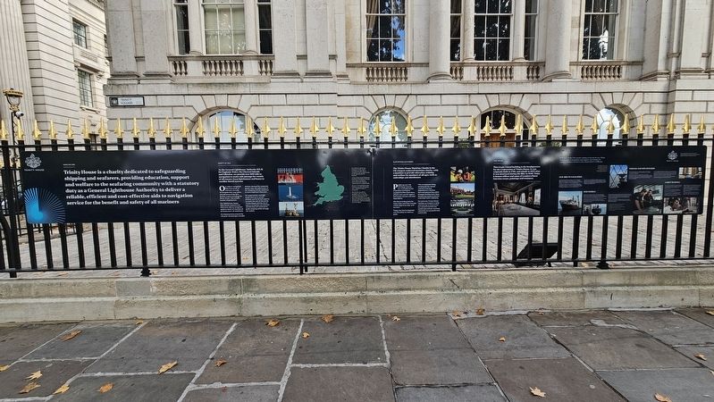
1. Trinity House Marker
Trinity House is a charity dedicated to safeguarding shipping and seafarers, providing education, support and welfare to the seafaring community with a statutory duty as a General Lighthouse Authority to deliver a reliable, efficient and cost-effective aids to navigation service for the benefit and safety of all mariners
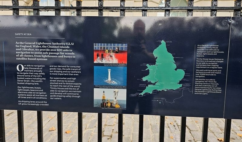
Safety at Sea
As the General Lighthouse Authority (GLA) for England, Wales, the Channel Islands and Gibraltar, we provide over 600 aids to navigation to assist safe passage for vessels of all classes, from lighthouses and buoys to satellite-based systems
Our aids to navigation help thousands of mariners annually to navigate their way safely around some of the UK’s busiest waters including the Dover Strait—the world’s busiest shipping lane.
Our lighthouses, buoys, lightvessels, beacons and electronic aids to navigation systems assist all mariners at all times and in all conditions.
As shipping lanes around the UK grow increasingly crowded and our demand for consumer goods rises, the safe transit of our shipping and our seafarers is more important than ever.
For supermarket and high street shelves
this page online
(Captions)
One of the highly distinctive lightvessels we operate as major floating aids to navigation.
Bishop Rock Lighthouse was built by Trinity House in 1858 to mark a rock ledge four miles west of the Isles of Scilly.
Type 1 buoy maintenance on board THV Galatea.
As a General Lighthouse Authority, Trinity House provides over 600 aids to navigation such as lighthouses, buoys, lightvessels and beacons.
Trinity House issues Notices to Mariners to broadcast changes to our aids to navigation and reviews their ongoing requirement on a regular basis.
We work with local ports and harbours to audit and inspect over 11,000 local aids to navigation.
We monitor our aids to navigation 24/7 from the Planning Centre in Harwich, and also undertake out-of-hours monitoring for our sister General Lighthouse Authorities the Northern Lighthouse Board and Irish Lights.
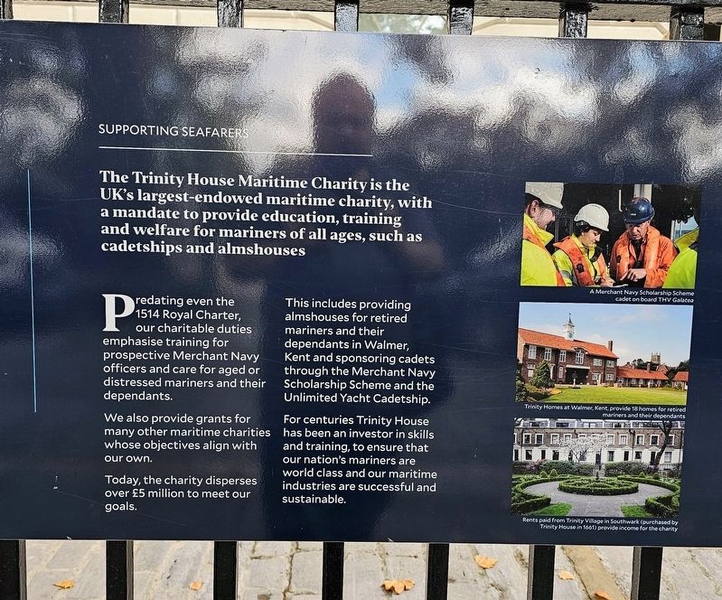
Supporting Seafarers
The Trinity House Maritime Charity is the UK’s largest-endowed maritime
Photographed by Ian Lefkowitz, September 11, 2026
2. Trinity House Marker
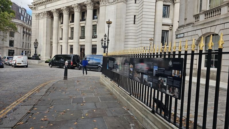
The marker is located at the end of Trinity Square.
Predating even the 1514 Royal Charter, our charitable duties emphasise training for prospective Merchant Navy officers and care for aged or distressed mariners and their dependants. We also provide grants for many other maritime charities whose objectives align with our own. Today, the charity disperses over £5 million to meet our goals.
This includes providing almshouses for retired mariners and their dependants in Walmer, Kent and sponsoring cadets through the Merchant Navy Scholarship Scheme and the Unlimited Yacht Cadetship. For centuries Trinity House has been an investor in skills and training, to ensure that our nation’s mariners are world class and our maritime industries are successful and sustainable.
(Captions)
A Merchant Navy Scholarship Scheme cadet on board THV Galatea
Trinity Homes at Walmer, Kent, provide 18 homes for retired mariners and their dependants
Rents paid from Trinity Village in Southwark (purchased by Trinity House in 1661) provide income for the charity
The House
This Grade I listed
Photographed by Ian Lefkowitz, September 11, 2026
3. Trinity House Marker
A close-up of a section of the marker.
(Captions)
The Court Room, inside Trinity House
With 95% of the UK’s goods coming or leaving by sea, Trinity House’s aids to navigation and support and training for seafarers make it integral to this island nation’s wellbeing.
As shipping lanes around the UK grow increasingly crowded and our demand for consumer goods rises, the safe transit of our shipping and our seafarers is more important than ever.
Our Aids to Navigation
As the General Lighthouse Authority (GLA) for England, Wales, the Channel Islands and Gibraltar, we provide over 600 aids to navigation to assist safe passage for vessels of all classes, such as lighthouses, buoys and lightvessels. Trinity House maintains over 60 lighthouses; these highly visual aids to navigation range from isolated offshore towers exposed to the open sea—such as the Eddystone, Bishop Rock or Longstone lighthouses—to shore-based stations.
Our
Photographed by Ian Lefkowitz, September 11, 2026
4. Trinity House Marker
A close-up of a section of the marker.
Our Vessels
We have been operating in the waters around England, Wales and the Channel Islands since 1741, using purpose-built tonnage equipped to the highest technical standard and manned by professionally qualified officers and crew. Coordinated and monitored around the clock by our Planning Centre, typical vessel activities include wreck location and marking, aid to navigation maintenance, towing, buoy handling and surveying.
Working at sea is unpredictable and inherently hazardous. To preserve the safety of the mariner we take measures to make sure we can respond effectively should an incident occur, working closely with our partners at the Department for Transport and the MCA. We have a vessel ready to respond within six hours of the Dover Strait, carrying our instantly recognisable Emergency Wreck Marking Buoys.
Trinity House operates a fleet of custom tenders for our extensive
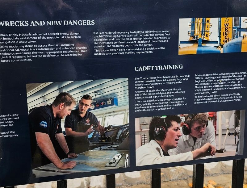
Photographed by Ian Lefkowitz, September 11, 2026
5. Trinity House Marker
A close-up of a section of the marker.
Wrecks and New Dangers
When Trinity House is advised of a wreck or new danger, an immediate assessment of the possible risks to surface navigation is undertaken. Using modern systems to assess the risk—including historical AIS vessel track information and enhanced charting technology—ensures the most appropriate reaction and that the full reasoning behind the decision can be recorded for future consideration.
If it is considered necessary to deploy a Trinity House vessel the 24/7 Planning Centre team will consider the current fleet disposition and task the most appropriate ship to proceed to the location to confirm the exact location of the wreck and ascertain the clearance depth over the danger. This data will then be risk assessed and a decision will be made as to appropriate marking requirements.
Cadet Training
The Trinity House Merchant Navy Scholarship Scheme provides financial support for young people seeking careers as officers in the Merchant Navy. A career at sea in the Merchant Navy is one of the most satisfying and worthwhile occupations it is possible to have. There are excellent career opportunities for young people who can meet the minimum academic requirements and have a practical and enthusiastic approach to life.
Major opportunities include Navigation (Deck) Officer—putting you in control of the ship—or Engineer Officer—operating the mechanical and electrical equipment on the ship—or Electro-Technical Officer—ensuring that a ship’s electronic and electrical equipment is in good working order. To find out more about joining the Trinity House Merchant Navy Scholarship Scheme please visit www.trinityhouse.co.uk/mnss.
Erected 2023 by Trinity House.
Topics. This historical marker is listed in this topic list: Waterways & Vessels. A significant historical year for this entry is 1858.
Location. 51° 30.614′ N, 0° 4.647′ W. Marker is in City of London, England, in Greater London. It is at the intersection of Trinity Square and Savage Gardens, on the right when traveling west on Trinity Square. Touch for map. Marker is at or near this postal address: 6 Trinity Square, City of London, England EC3N 4AA, United Kingdom. Touch for directions.

Regionally, this marker is in the Greater South East. Globally, it is on the Atlantic Ocean, in the North Atlantic Region, in Europe, in Atlantic Europe, on one of the British Isles, in the Western World, and in the Anglosphere. Historically, it finds itself in what was once the Roman Empire.
Other nearby markers. At least 8 other markers are within walking distance of this marker: The Corporation of Trinity House London (a few steps from this marker); a different marker also named The Trinity House (within shouting distance of this marker); a different marker also named Trinity House (within shouting distance of this marker); The Tower Hill Memorial (within shouting distance of this marker); The Tower Liberty (within shouting distance of this marker); Tower Hill Execution Site (within shouting distance of this marker); a different marker also named The Tower Hill Memorial (within shouting distance of this marker); a different marker also named The Tower Hill Memorial (within shouting distance of this marker). Touch for a list and map of all markers in City of London.
Credits. This page was last revised on September 23, 2026. It was originally submitted on September 23, 2026, by Ian Lefkowitz of New York, New York. This page has been viewed 5 times since then. Photos: 1, 2, 3, 4, 5. submitted on September 23, 2026, by Ian Lefkowitz of New York, New York. • Andrew Ruppenstein was the editor who published this page.
