Near Lucerne in Fraser-Fort George, British Columbia — Canada’s West Coast (North America)
Crossing the Great Divide/Traverser la ligne de partage des eaux
Photographed by Cosmos Mariner, July 6, 2022
1. Crossing the Great Divide/Traverser la ligne de partage des eaux Marker

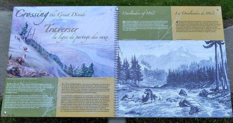
Aboriginal and non-Aboriginal traders, including the French-Canadian Voyageurs, carried goods of various kinds back and forth across the pass, just as trucks, trains and the pipeline do today. For a brief period in the mid-1800s, the pass was known as “Leather Pass”, because of the flow of leather going into New Caledonia. The Hudson's Bay Company started using the pass around 1825 to keep information flowing between its administrative headquarters and the trading districts of New Caledonia and the upper Fraser River. Yellowhead Pass was abandoned as a route by the fur trade in 1855.
Overlanders of 1862
Searching for a better life, 115 men and one woman left their Ontario homes to strike it rich in British Colombia’s gold fields. Crossing the mountains
this page online
[background image caption] M472 | Painting | The Leather Pass, Rocky Mountains © McCord Museum
Les commerçants autochtones et non autochtones, y compris les Voyageurs canadiens-français, transportaient des marchandises de toutes sortes de part et d'autre du col, tout comme le font aujourd'hui les camions, les trains et le pipeline. Pendant une courte période au milieu
Photographed by Cosmos Mariner, July 6, 2022
2. Crossing the Great Divide/Traverser la ligne de partage des eaux Marker
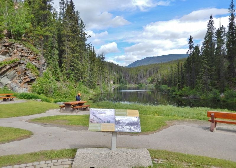
Looking north from the rest area. Portal Lake is in the background.
Les Overlanders de 1862
Attirés par la promesse d'une vie meilleure, 115 hommes et une femme quittèrent leur domicile, en Ontario, pour aller faire fortune dans les champs aurifères de la Colombie-Britannique. En 1862, pendant la traversée des montagnes, le groupe dût affronter des forêts vierges et faire face à la famine et à l'hypothermie. Certains périrent même noyés dans les eaux turbulentes du Fraser et de la Thompson Nord. La plupart survécurent, mais bien peu devinrent riches. Leurs difficultés font de ce périple l'un des événements les plus marquants de l'histoire du voyage au Canada.
[légende de l'image de fond]
M472 | Peinture | The Leather Pass, Rocky Mountains (Le col du Cuir, montagnes Rocheuses) © Musée McCord
Erected by Parks Canada/Parcs Canada.
Topics. This historical marker is listed in these topic lists: Exploration • Indigenous Peoples and Communities • Industry & Commerce. A significant historical year for this entry is 1862.
Location. 52° 52.929′ N, 118° 27.078′ W. Marker is near Lucerne, British Columbia, in Fraser-Fort George. It is on Yellowhead Highway (Provincial Highway 16) 24.8 kilometers west of Icefields Parkway (Provincial Highway 93), on the right when traveling west. The marker is at the Yellowhead Pass National Historic Site in Mount Robson Provincial Park, just west of the British Columbia-Alberta boundary line. Touch for map. Marker is in this post office area: Lucerne BC V0E 2Z0, Canada. Touch for directions.

Regionally, this marker is in the BC Interior and in Cariboo Chilcotin Coast. Globally, it is in North America, on the Ring of Fire, on the Pacific Rim, in the Western Hemisphere, in the Western World, and in the Anglosphere. Historically, it finds itself in what was once a British colony.
Other nearby markers. At least 8 other markers are within walking distance of this marker: Welcome to Yellowhead Pass National Historic Site (here, next to this marker); Travelling a Traditional Route/Parcourir une route traditionnelle (here, next to this marker); Rails Through the Rockies/Des rails à travers les Rocheuses (here, next to this marker); The Yellowhead Pass / Le col Tête-Jaune (a few steps from this marker); Modern Travel/Les voyages des temps modernes (a few steps from this marker); Connecting Canada/D'un océan à l'autre (a few steps from this marker); Yellowhead Pass (a few steps from this marker); Historic Yellowhead Pass (a few steps from this marker). Touch for a list and map of all markers in Lucerne.
Related markers. Click here for a list of markers that are related to this marker.
Also see . . . Overlanders of 1862 (Canadian Encyclopedia).
(by Barry M. Gough & Tabitha Marshall) Excerpt: In 1862, groups of men from Canada West, Canada East, the United States, the United Kingdom and Australia travelled by ship and American railway to Fort Garry (Winnipeg). Lured by news of rich gold finds in the Cariboo (see Cariboo Gold Rush), they planned to travel overland to British Columbia. In Fort Garry, they formed a single party of approximately 150 people and chose Thomas McMicking as their leader. The group included Augustus and Catherine Schubert and their three children. The party left Fort Garry in early June 1862, equipped with Red River carts and a few horses.(Submitted on September 25, 2026, by Cosmos Mariner of Cape Canaveral, Florida.)
The party split on 1 September 1862. A small group, including the Schubert family, decided to raft down the Thomson River to Kamloops. McMicking and the rest of the party rafted down the Fraser River to Fort George (Prince George). All but six of the original group survived. Some went on to the Cariboo goldfields, but found that the gold deposits were nearly exhausted. Many, including Thomas McMicking and his brother Robert, had successful careers in British Columbia.
Credits. This page was last revised on September 25, 2026. It was originally submitted on September 23, 2026, by Cosmos Mariner of Cape Canaveral, Florida. This page has been viewed 7 times since then. Photos: 1, 2. submitted on September 25, 2026, by Cosmos Mariner of Cape Canaveral, Florida.
