St. Robert in Pulaski County, Missouri — The American Midwest (Upper Plains)
George M. Reed
Photographed by Jason Voigt, September 23, 2026
1. George M. Reed Marker
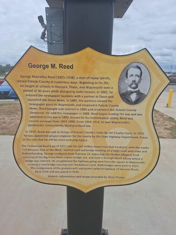
George Marcellus Reed (1855-1938), a man of many talents, served Pulaski County in numerous ways. Beginning in his 20s, he taught at schools in Hancock, Dixon, and Waynesville over a period of 30 years while also giving violin lessons. In 1882, he entered the newspaper business with a partner in Dixon and launched the Dixon News. In 1885, the partners moved the newspaper plant to Waynesville and renamed it Pulaski County News. Reed bought sole interest in 1886 and renamed it the Pulaski County Democrat. He sold the newspaper in 1888. Reed began reading the law and was admitted to the bar in 1892. Known for his mathematical ability, Reed was county surveyor from 1893-1896. From 1904-1914, he was Waynesville's postmaster. Concurrently, Reed practiced law.
In 1919, Reed was put in charge of Pulaski County's roads by the County Court. In 1921, he was appointed project engineer for the county by the State Highway Department. It was in this role that he left his most enduring legacy.
The Centennial Road Law of 1921 and the $60 million bond issue that funded it, with the motto "Lift Missouri Out of the Mud," started road
this page online
Historic information and image provided by Terry Primas
Erected 2025.
Topics and series. This historical marker is listed in these topic lists: Bridges & Viaducts • Communications • Roads & Vehicles. In addition, it is included in the U.S. Route 66 series list. A significant historical year for this entry is 1882.
Location. 37° 49.267′ N, 92° 8.907′ W. Marker is in St. Robert, Missouri, in Pulaski County. It is at the intersection of W.H. Williamson Drive and Business Interstate 44, on the right when traveling north on W.H. Williamson Drive. Marker is located at Neon Sign Park. Touch for map. Marker is
Photographed by Jason Voigt, September 23, 2026
2. George M. Reed Marker
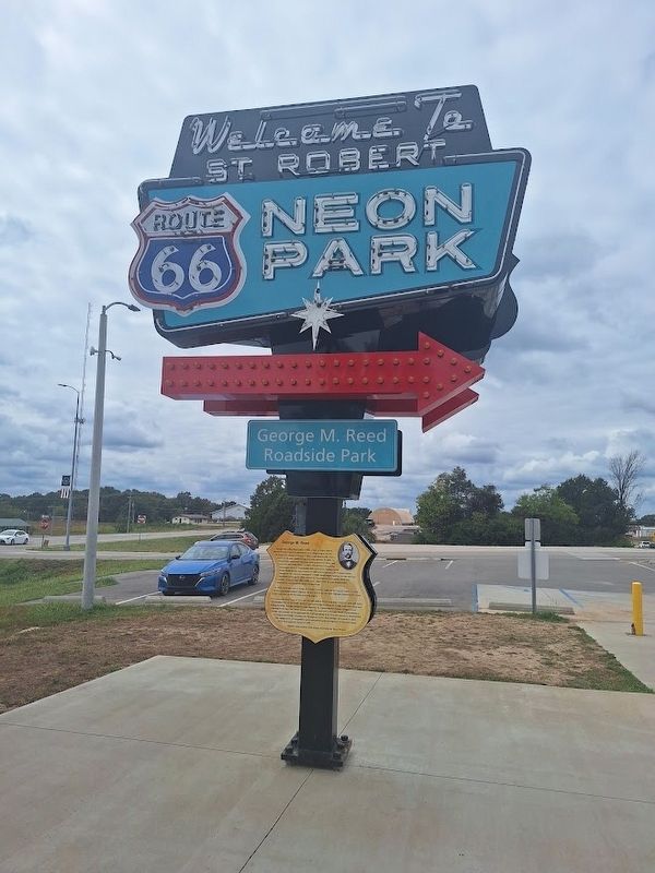
This is on the other side of the "How It All Began" marker

Regionally, this marker is in South-Central Missouri. It is also in the American Ozarks, in the Lewis & Clark Corridor, and in the Corn Belt. Globally, it is in North America, the Western Hemisphere, the Western World, and the Anglosphere. Historically, it finds itself in what was once the territory of the Mississippian Culture, the Louisiana Purchase, and the Antebellum South.
Other nearby markers. At least 8 other markers are within walking distance of this marker: How It All Began (here, next to this marker); Modern Cabins (a few steps from this marker); Skyline Garage Auto Service (a few steps from this marker); Motel St. Louis (within shouting distance of this marker); Stanley Cour-Tel (within shouting distance of this marker); D & G Package Store (within shouting distance of this marker); Alura Motel (within shouting distance of this marker); Tri-State Bonding (within shouting distance of this marker). Touch for a list and map of all markers in St. Robert.
Photographed by Jason Voigt, September 23, 2026
3. George M. Reed Marker
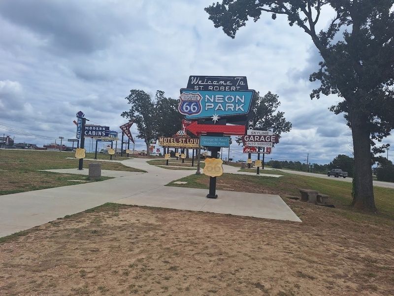
Located at Route 66 Neon Park, which is also George M. Reed Roadside Park.
Credits. This page was last revised on September 23, 2026. It was originally submitted on September 23, 2026, by Jason Voigt of Glen Carbon, Illinois. This page has been viewed 4 times since then. Photos: 1, 2, 3. submitted on September 23, 2026, by Jason Voigt of Glen Carbon, Illinois.
