Mount Laurel Township in Burlington County, New Jersey — The American Northeast (Mid-Atlantic)
Marne Highway
Photographed by John Ben Urban, October 17, 2012
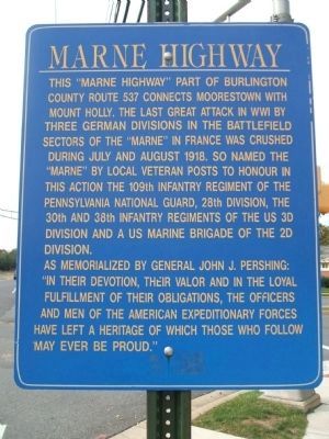
1. Marne Highway Marker
The "Marne Highway" part of Burlington County route 537 connects Moorestown with Mount Holly. The last great attack in WWI by three German divisions in the battlefield sectors of the "Marne" in France was crushed during July and August 1918. So named the "Marne" by local veteran posts to honour in this action the 109th infantry regiments of the US 3d division and a US marine brigade of the 2d division.
As memorialized by General John J. Pershing: "In their devotion, their valor and in the loyal fulfillment of their obligations, the officers and men of the American Expeditionary have left a heritage of which those who follow may ever be proud"
Topics. This memorial is listed in these topic lists: Roads & Vehicles • War, World I. A significant historical year for this entry is 1918.
Location. 39° 58.671′ N, 74° 52.706′ W. Memorial is in Mount Laurel Township, New Jersey, in Burlington County. It is at the intersection of Marne Highway (County Road 537 at milepost 13.8) and Larchmont Blvd, on the right when traveling west on Marne Highway. Touch for map. Memorial is at or near this postal address: 3163 Marne Hwy,
this page online

Regionally, this memorial is in South Jersey and in Greater Philadelphia. It is also in the American Northeast, in the Mid-Atlantic, and on the Eastern Seaboard. Globally, it is in the North Atlantic Region, North America, the Western Hemisphere, the Western World, and the Anglosphere. Historically, it finds itself in what was once New Netherland and also one of the original Thirteen Colonies.
Other nearby markers. At least 8 other markers are within 4 miles of this marker, measured as the crow flies: 1778 (approx. one mile away); Site of Governor William Franklin’s Home (approx. 2.7 miles away); Evesham Friends Meeting House (approx. 3 miles away); Lutheran Home (approx. 3.1 miles away); Paulsdale (approx. 3.1 miles away); a different marker also named Paulsdale (approx. 3.1 miles away); Alice Stokes Paul (approx. 3.2 miles away); “Hessian House” (approx. 3.4 miles away).
Photographed by John Ben Urban, October 17, 2012
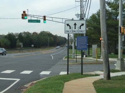
2. Marne Highway Marker
The marker as approaching.
Credits. This page was last revised on September 25, 2026. It was originally submitted on October 17, 2012, by John Ben Urban of Middletown, Delaware. This page has been viewed 2,846 times since then and 196 times this year. Last updated on September 24, 2026, by Kevin Vincent of Arlington, Virginia. Photos: 1, 2. submitted on October 19, 2012, by John Ben Urban of Middletown, Delaware. • Devry Becker Jones was the editor who published this page.
