Chesterfield in Chesterfield County, Virginia — The American South (Mid-Atlantic)
Chesterfield Court House
Soldiers and Refugees
| — | Lee’s Retreat | — |
Photographed by Evan Dwyer, August 22, 2026
1. Chesterfield Court House Marker
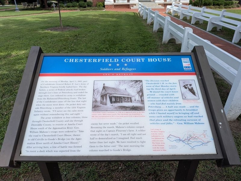
The army withdrew in four columns, three through Chesterfield County and one through Dinwiddie County, to reunite at Amelia Court House south of the Appomattox River. Gen. William Mahone's troops were ordered to "Take the road to Chesterfield Court House, thence to old Colville to Goode's Bridge [on the Appomattox River north of Amelia Court House]." After arriving here, a line of battle was formed "to resist a dash which was expected from the enemy but never made," the picket recalled.
Resuming the march, Mahone's column camped that night on Captain Flournoy's farm. A soldier
this page online
"The Division reached Chesterfield C.H. in the fore noon of that MOnday morning the third day of April. ... We found the court house ground ... crowded with all manner of vehicles and women with their children - who had fled mainly form Petersburg. ... A halt was made ... and the troops given an opportunity to breakfast while I busied myself in bringing off and away such military wagons as had reached that place and the retreating caravan of vehicles and folks." - Gen. William Mahone
Photo Captions:
Chesterfield County Courthouse, ca. 1750, as it appeared early in the 20th century with a 19th-century porch. The courthouse was demolished in 1916, then reconstructed in 1977, a few yards north of the original location.
Courtesy Chesterfield County Historical Society
Gen. William Mahone
Courtesy Library of Congress
Lee's Army of Northern Virginia took the routes indicated in red. Lee followed the solid red route. The Union Army of the Potomac took the roads indicated in blue.
Erected by Virginia
Photographed by Evan Dwyer, August 22, 2026
2. Chesterfield Court House Marker
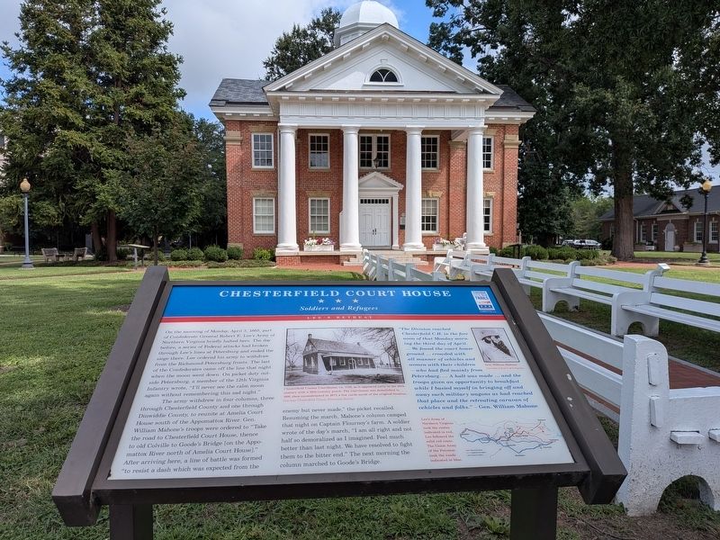
The courthouse in the background is on the site of the colonial courthouse that was present during the Civil War, but was built in 1917.
Topics and series. This historical marker is listed in this topic list: War, US Civil. In addition, it is included in the Virginia Civil War Trails series list. A significant historical date for this entry is April 3, 1865.
Location. 37° 22.573′ N, 77° 30.418′ W. Marker is in Chesterfield, Virginia, in Chesterfield County. It can be reached from Iron Bridge Road (Virginia Route 10) 0.1 miles west of Wagners Way, on the right when traveling west. Marker is on the front (south-facing) lawn of the historic courthouse square. Touch for map. Marker is at or near this postal address: 10011 Iron Bridge Road, Chesterfield VA 23832, United States of America. Touch for directions.

Regionally, this marker is in the Piedmont, in Central Virginia, and in the Richmond Metropolitan Area. It is also in the American South, specifically in the Upper South, and on the Eastern Seaboard. Globally, it is in the North Atlantic Region, North America, the Western Hemisphere, the Western World, and the Anglosphere. Historically, it finds itself in what was once the territory of the Mississippian Culture, one of the original Thirteen Colonies,
Photographed by Bernard Fisher, May 31, 2009
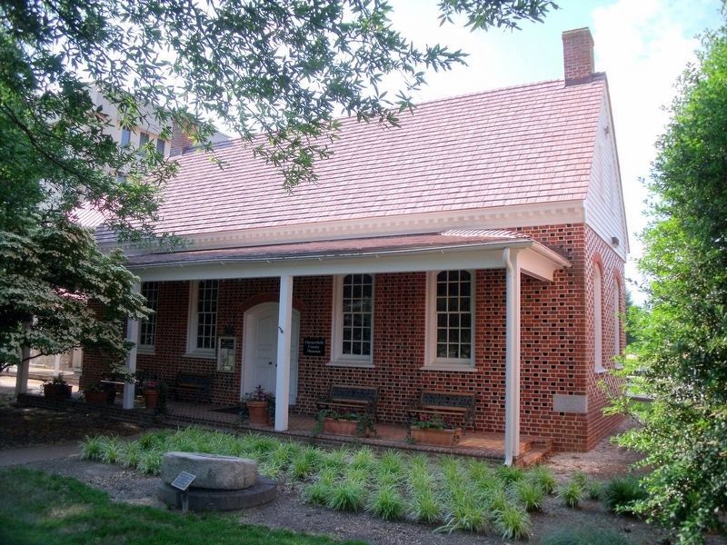
3. Chesterfield County Museum housed in a replica of the 1750 Courthouse.
Note the courthouse replica was built some 60 years after the original was demolished and does not contain original materials - nor is it on the same site (the old courthouse's footprint is encompassed by the 1917 courthouse's modern location), which makes it a replica rather than a reconstruction. A reconstruction would either be on the original site or include the original materials. The county museum's replica meets neither criteria.
Other nearby markers. At least 8 other markers are within walking distance of this marker: Veterans Memorial Wall (a few steps from this marker); Employee Service Recognition (a few steps from this marker); 1917 Courthouse (within shouting distance of this marker); World War I in Chesterfield County (within shouting distance of this marker); Apostles of Religious Liberty (within shouting distance of this marker); Chesterfield County Courthouse (within shouting distance of this marker); Confederate Memorial (within shouting distance of this marker); Magnolia Grange (within shouting distance of this marker). Touch for a list and map of all markers in Chesterfield.
Another marker is no longer nearby. Chesterfield Court House (has been replaced with this marker).
Related marker. Click here for another marker that is related to this marker. The linked marker preceded the present marker in the same location.
Photographed by Evan Dwyer, August 22, 2026
4. 1828 Chesterfield County Clerk's Office
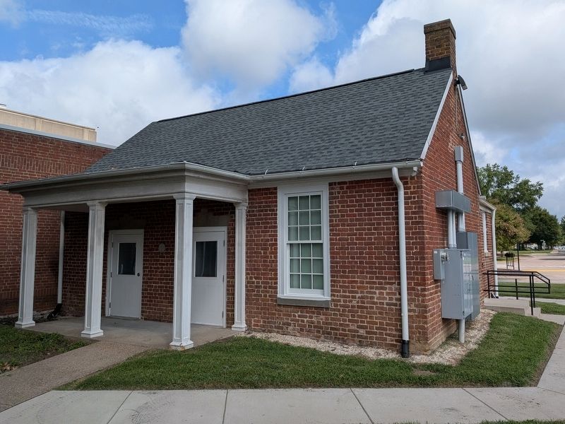
While the courthouse that graced the center of the square during the events described on the marker no longer stands, the clerk's office that accompanied it still does. Built in 1828, this is the oldest structure remaining in the courthouse square. It has been added onto (at the rear) and the porch is modern. Clerk offices were separate from the courthouse in the 19th century for both fire protection and physical security reasons.
Photographed by Evan Dwyer, August 22, 2026
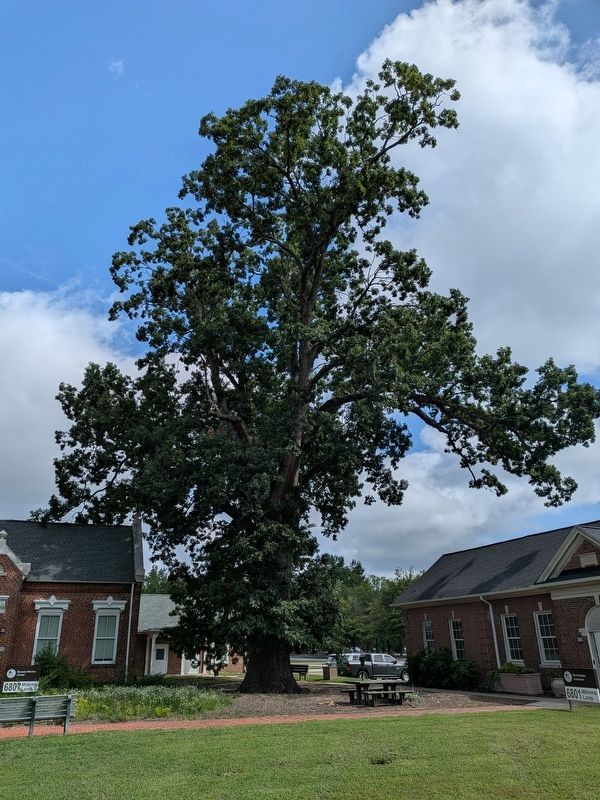
5. 1814 White Oak Tree
The oldest landmark on the square is not manmade at all - it is actually this White Oak, which has stood in this position directly south of the Clerk's Office (which had not even been constructed when the tree was planted) since 1814. It stood here during Lee's retreat.

May 30, 2009
6. Chesterfield and Manchester Confederate Memorial
Just east of the marker is this Confederate memorial. It reads: (front) 1861 In memory of the Confederate soldiers of Chesterfield and Manchester 1865; (rear) Dulce et decorum est pro patria mori [Translation: it is sweet and seemly to die for one's country]. The tree behind the memorial in this photograph no longer stands.
Photographed by Evan Dwyer, August 22, 2026
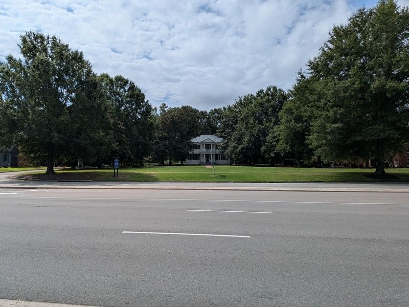
7. Magnolia Grange
Just across the road from the courthouse square is the house "Magnolia Grange," which was standing in the same location in 1865 as it occupies today. Though the marker does not mention Magnolia Grange, it was an integral and unavoidable piece of the otherwise very rural Chesterfield Courthouse area in the antebellum and Civil War period.
Photographed by Evan Dwyer, August 22, 2026
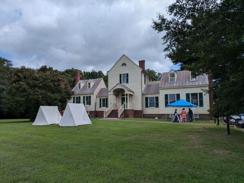
8. Castlewood
Aside from the Clerk's Office and Magnolia Grange, the only other structure in the vicinity of the courthouse that was present on 3 April 1865 is Castlewood, located just east on Iron Bridge Road. Like Magnolia Grange, a direct tie to Lee's Retreat is not established or mentioned in the marker, but its age and location in an area that has been heavily modernized is notable nonetheless. The west/north wing of the house is the original portion, constructed in the 1760s. The middle section was added in the 1790s (when the original was in-line with it, attached where the front door is now - the original was moved to its current location ca. 1816) and the south/east wing was constructed between 1816 and 1822 to coincide with, and balance, the relocation of the original cottage to the north.
Credits. This page was last revised on September 25, 2026. It was originally submitted on September 25, 2026, by Evan Dwyer of Richmond, Virginia. This page has been viewed 9 times since then. Photos: 1, 2. submitted on September 25, 2026, by Evan Dwyer of Richmond, Virginia. 3. submitted on June 1, 2009, by Bernard Fisher of Richmond, Virginia. 4, 5. submitted on September 25, 2026, by Evan Dwyer of Richmond, Virginia. 6. submitted on June 1, 2009. 7, 8. submitted on September 25, 2026, by Evan Dwyer of Richmond, Virginia.
