Near Niobrara in Knox County, Nebraska — The American Midwest (Upper Plains)
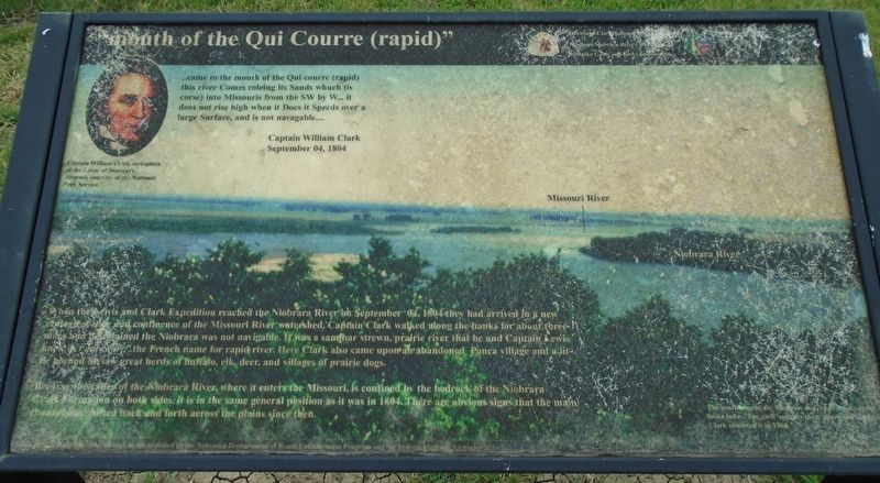
"mouth of the Qui Courre (rapid)"
Photographed by William Fischer, Jr., September 17, 2026
1. "mouth of the Qui Courre (rapid)" Marker
..came to the mouth of the Qui courre (rapid) this river Comes roleing its Sands whuch (is corse) into Missouris from the SW by W... it does not rise high when it Does it Spreds over a large Surface, and is not navagable....
Captain William Clark
September 04, 1804
[Portrait of] Captain William Clark, co-captain of the Corps of Discovery.
When the Lewis and Clark Expedition reached the Niobrara River on September 04, 1804 they had arrived in a new ecological zone and confluence of the Missouri River watershed. Captain Clark walked along the banks for about three miles and determined the Niobrara was not navigable. It was a sandbar strewn, prairie river that he and Captain Lewis knew as "qui courre," the French name for rapid river. Here Clark also came upon an abandoned Ponca village and a little beyond he saw great herds of buffalo, elk, deer, and villages of prairie dogs.
Because the valley of the Niobrara River, where it enters the Missouri, is confined by the bedrock of the Niobrara Chalk Formation on both sides, it is in the same general position as it was in 1804. There are obvious signs that the main channel
this page online
[Background photo caption reads]
The confluence of the Missouri and Niobrara Rivers as it looks today. The river appears today [much?] like Captain Clark observed it in 1804.
Erected by National Park Service and Nebraska State Parks.
Topics and series. This historical marker is listed in these topic lists: Exploration • Waterways & Vessels. In addition, it is included in the Lewis & Clark Expedition series list. A significant historical date for this entry is September 4, 1804.
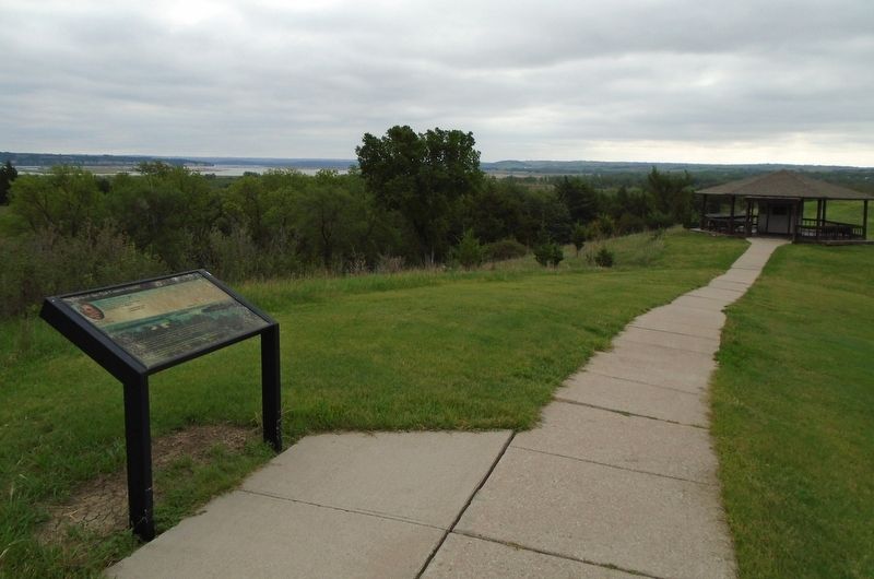
Location. 42° 45.97′ N, 98° 3.107′ W. Marker is near Niobrara, Nebraska, in Knox County. Marker is near the J. Alan Cramer Interpretive Shelter in Niobrara State Park. Touch for map. Marker is at or near this postal address: 89261 522 Avenue, Niobrara NE 68760, United States of America. Touch for directions.

Regionally, this marker is in Eastern Nebraska. It is also in the American Midwest, in the Corn Belt, and on the prairies. Globally, it is in North America, the Western Hemisphere, the Western World, and the Anglosphere. Historically, it finds itself in what was once the Louisiana Purchase.
Photographed by William Fischer, Jr., September 17, 2026
2. "mouth of the Qui Courre (rapid)" Marker
Other nearby markers. At least 8 other markers are within walking distance of this marker: J. Alan Cramer Interpretive Shelter (within shouting distance of this marker); Lewis and Clark Expedition (within shouting distance of this marker); They Opened The West (within shouting distance of this marker); 1846-47 Mormon Winter Camp (within shouting distance of this marker); The Peaceful Ponca (within shouting distance of this marker); The Forced Removal (within shouting distance of this marker); "We Proceeded On" (within shouting distance of this marker); Niobrara (within shouting distance of this marker). Touch for a list and map of all markers in Niobrara.
More about this marker. Marker is weathered and difficult to read. Nebraska State Parks entrance fee required.
Photographed by William Fischer, Jr., September 17, 2026
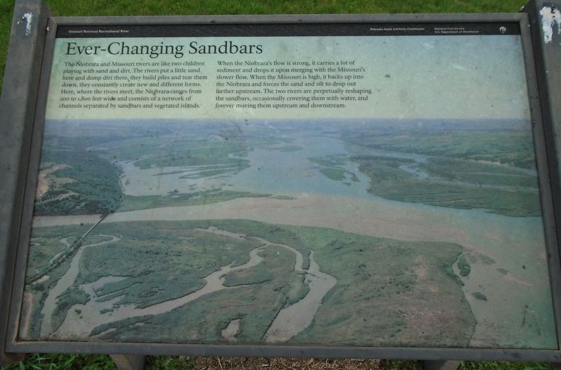
3. Ever-Changing Sandbars Marker
Nearby marker that supports Captain Clark's observations.

Photographed by William Fischer, Jr., September 17, 2026
4. Niobrara River, looking upriver (west)
Credits. This page was last revised on September 27, 2026. It was originally submitted on September 25, 2026, by William Fischer, Jr. of Reynoldsburg, Ohio. This page has been viewed 7 times since then. Photos: 1, 2, 3, 4. submitted on September 25, 2026, by William Fischer, Jr. of Reynoldsburg, Ohio.
