Near Lucerne in Fraser-Fort George, British Columbia — Canada’s West Coast (North America)
Modern Travel/Les voyages des temps modernes
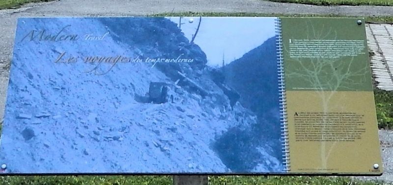
Photographed by Cosmos Mariner, July 6, 2022
1. Modern Travel/Les voyages des temps modernes Marker

this page online
Erected by Parks Canada / Parcs Canada.
Topics. This historical marker is listed in these topic lists: Roads & Vehicles • War, World II. A significant historical year for this entry is 1940.
Location. 52° 52.928′ N, 118° 27.066′ W. Marker is near Lucerne, British Columbia, in Fraser-Fort George. It is on Yellowhead Highway (Provincial Highway 16) 24.8 kilometers west of Icefields Parkway (Provincial Highway 93), on the right when traveling west. The marker is at the Yellowhead Pass National Historic Site in Mount Robson Provincial Park, just west of the British Columbia-Alberta boundary line. Touch for map. Marker is in this post office area: Lucerne BC V0E 2Z0, Canada. Touch for directions.

Regionally, this marker is in the BC Interior and in Cariboo Chilcotin
Photographed by Cosmos Mariner, July 6, 2022
2. Modern Travel/Les voyages des temps modernes Marker
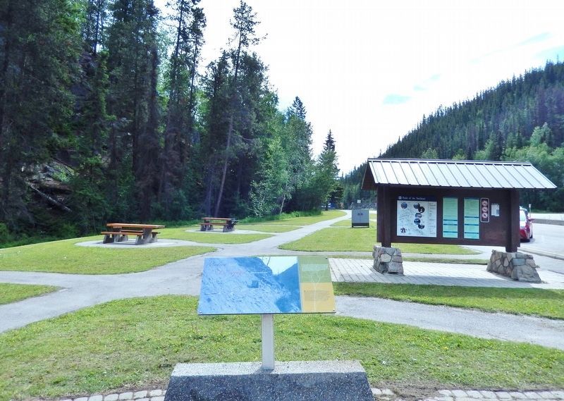
Looking east through the rest area. The parking lot and Yellowhead Highway are on the right.
Other nearby markers. At least 8 other markers are within walking distance of this marker: Connecting Canada/D'un océan à l'autre (here, next to this marker); Yellowhead Pass (here, next to this marker); Historic Yellowhead Pass (here, next to this marker); The Yellowhead Pass / Le col Tête-Jaune (here, next to this marker); Travelling a Traditional Route/Parcourir une route traditionnelle (a few steps from this marker); Crossing the Great Divide/Traverser la ligne de partage des eaux (a few steps from this marker); Welcome to Yellowhead Pass National Historic Site (a few steps from this marker); Rails Through the Rockies/Des rails à travers les Rocheuses (a few steps from this marker). Touch for a list and map of all markers in Lucerne.
Also see . . .
1. Internment of Japanese Canadians (Wikipedia).
Excerpt: From 1942 to 1949, Canada forcibly relocated and interned over 22,000 Japanese Canadians—comprising over 90% of the total Japanese Canadian population—from British Columbia on the grounds of national security. The majority were Canadian citizens by birth and were targeted based on their ancestry. This decision followed the events of the Empire of Japan's war in the Pacific against the Western Allies, such as the invasion of Hong Kong, the attack on Pearl Harbor in Hawaii, and the Fall of Singapore which led to the Canadian declaration of war on Japan during World War II. Similar to the actions taken against Japanese Americans in neighbouring United States, Japanese Canadians were also subjected to government-enforced curfews and interrogations, job and property losses, and forced repatriation to Japan. From shortly after the December 1941 attack on Pearl Harbor until 1949, Japanese Canadians were stripped of their homes and businesses, then sent to internment camps and farms in British Columbia as well as other parts of Canada, mostly towards the interior.(Submitted on September 27, 2026, by Cosmos Mariner of Cape Canaveral, Florida.)
2. Eagle Pass (Revelstoke-Sicamous) Highway Road Camp.
Excerpt: The road camps at Hope-Princeton, Eagle Pass (Revelstoke-Sicamous) and Yellowhead-Blue River were part of the 1942 internment of Japanese Canadians in World War II, and used for the strategic expansion of B.C.'s highway system during the war. The 'voluntary' forced employment of Japanese Canadians over the age of 18 on the three provincial highway projects is significant because it represents a deliberate government decision to separate men from their homes and families, sending them to live in remote road camps with their future uncertain. Projects which came under immediate consideration were road construction activities in various parts of B.C., with the focus on those particularly adaptable to hand labour.(Submitted on September 27, 2026, by Cosmos Mariner of Cape Canaveral, Florida.)
Shipped out on trains from the internee collection centre at Hastings Park in Vancouver, the men's status and age determined their destination. Those destined for road camps along the Hope-Princeton or Eagle Pass highways were mostly young or middle-aged Nisei (Canadian-born second generation) and naturalized Japanese Canadians. Others shipped to the Yellowhead-Blue River highway originally consisted of more old men and fewer young men, since these camps were reserved for Japanese nationals (born in Japan), then considered to be enemy aliens.
Credits. This page was last revised on September 27, 2026. It was originally submitted on September 25, 2026, by Cosmos Mariner of Cape Canaveral, Florida. This page has been viewed 4 times since then. Photos: 1, 2. submitted on September 27, 2026, by Cosmos Mariner of Cape Canaveral, Florida.
