Conanicut Battery Historic Park in Jamestown in Newport County, Rhode Island — The American Northeast (New England)
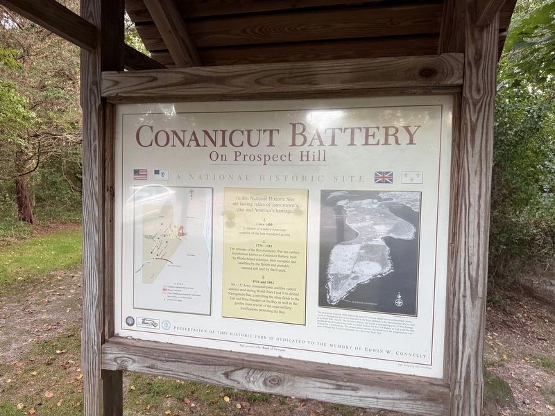
Conanicut Battery On Prospect Hill
A National Historic Site
⎯⎯⎯
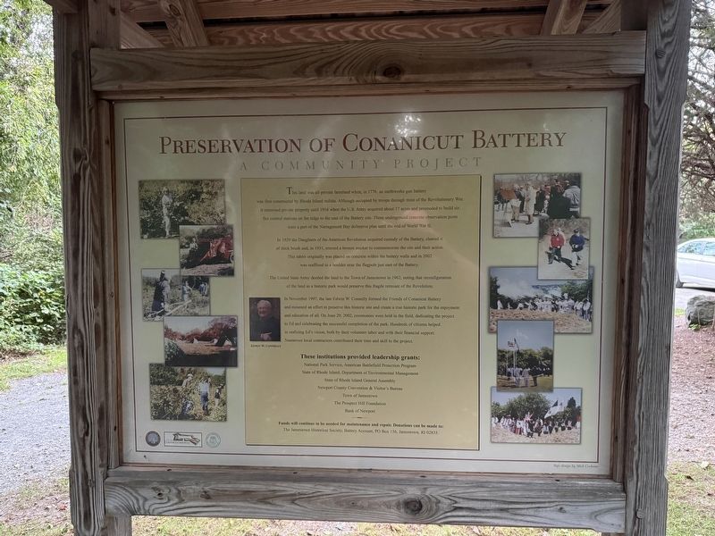
Preservation of Conanicut Battery
A Community Project
Photographed by Devry Becker Jones (CC0), September 18, 2026
1. Conanicut Battery On Prospect Hill side of the marker
On Prospect Hill
A National Historic Site
Circa 1400
1776-1783
1916 and 1953
Preservation of this historic park is dedicated to the memory of Edwin W. Connelly
[Caption:]
This photograph from the 1950s depicts the part of Conanicut Island known as Beavertail. At the mouth of the Narragansett Bay, it was important to the Bay's defenses in the Revolutionary War as well as in the World Wars I and II. The Conanicut Battery site boasts a commanding view of West Passage and Rhode Island Sound to the south, a suitable location for the 1776 Battery as well as for the 20th Century fire control stations. The cleared spaces, antenna and structures in the foreground are remnants of World War II era Fort Burnside, now Beavertail State Park.
A Community Project
this page online
In 1929 the Daughters of the American Revolution acquired custody of the Battery, cleared it of thick brush and, in 1931, erected a bronze marker to commemorate the site and their action. This tablet originally was placed on concrete within the battery walls and in 2002 was reaffixed to a boulder near the flagpole just east of the Battery.
The United States Army deeded the land to the Town of Jamestown in 1962, noting that reconfiguration of the land as a historic park would preserve this fragile remnant of the Revolution.
In November 1997, the late Edwin W. Connelly formed the Friends of Conanicut Battery and mounted an effort to preserve this
Photographed by Devry Becker Jones (CC0), September 18, 2026
2. Preservation of Conanicut Battery side of the marker
These institutions provided leadership grants:
National Park Service, American Battlefield Protection Program • State of Rhode Island, Department of Environmental Management • State of Rhode Island General Assembly • Newport County Convention & Visitor's Bureau • Town of Jamestown • The Prospect Hill Foundation • Bank of Newport
Funds will continue to be needed for maintenance and repair. Donations can be made to:
The Jamestown Historical Society, Battery Account, PO Box 156, JAmestown, RI 02835.
Erected by Jamestown Historical Society; Friends of Conanicut Battery; Town of Jamestown, Rhode Island.
Topics. This historical marker is listed in these topic lists: Parks & Recreational Areas •
Photographed by Devry Becker Jones (CC0), September 18, 2026
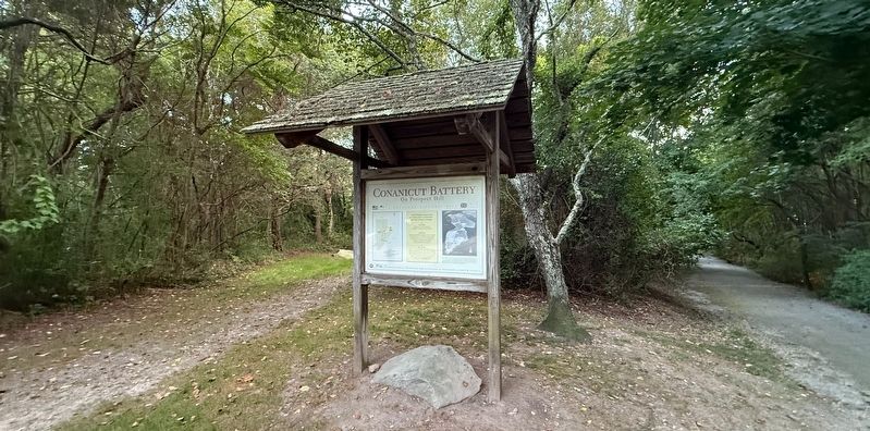
3. Conanicut Battery On Prospect Hill / Preservation of Conanicut Battery Marker
Location. 41° 28.887′ N, 71° 23.572′ W. Marker is in Jamestown, Rhode Island, in Newport County. It is in Conanicut Battery Historic Park. It can be reached from Battery Lane 0.2 miles west of Beavertail Road, on the right when traveling south. Touch for map. Marker is at or near this postal address: 43 Battery Ln, Jamestown RI 02835, United States of America. Touch for directions.

Regionally, this marker is on Narragansett Bay. It is also in the American Northeast, in New England, and on the Eastern Seaboard. Globally, it is in the North Atlantic Region, North America, the Western Hemisphere, the Western World, and the Anglosphere. Historically, it finds itself in what was once one of the original Thirteen Colonies.
Other nearby markers. At least 8 other markers are within 2 miles of this marker, measured as the crow flies: Prospect Hill (about 300 feet away, measured in a direct line); 1772 - 1781 (about 700 feet away); Conanicut Battery (about 800 feet away); Fort Getty (approx. 0.6 miles away); Memorial to the Veterans of Jamestown (approx. 1.4 miles away); Jamestown and Newport Ferry Service: 1675-1969 (approx. 1.7 miles away); Roger Williams and Canonicus (approx. 1.7 miles away); Veterans Memorial (approx. 1.7 miles away). Touch for a list and map of all markers in Jamestown.
Credits. This page was last revised on September 26, 2026. It was originally submitted on September 26, 2026, by Devry Becker Jones of Washington, District of Columbia. This page has been viewed 6 times since then. Photos: 1, 2, 3. submitted on September 26, 2026, by Devry Becker Jones of Washington, District of Columbia.
