Conanicut Battery Historic Park in Jamestown in Newport County, Rhode Island — The American Northeast (New England)
1772 - 1781
Revolutionary Years
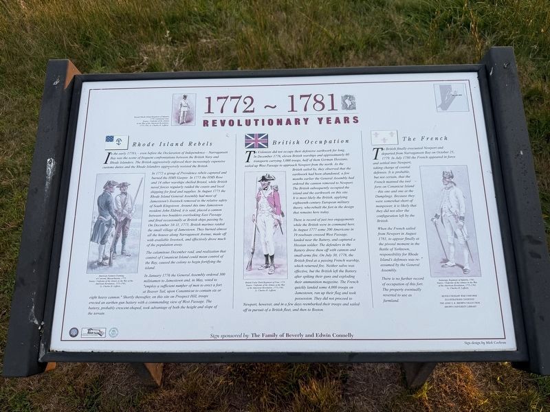
Rhode Island Rebels
In the early 1770's — even before the Declaration of Independence — Narragansett Bay was the scene of frequent confrontations between the British Navy and Rhode Islanders. The British aggressively enforced their increasingly expensive customs duties and the Rhode Islanders aggressively resisted the British.
In 1772 a group of Providence rebels captured and burned the HMS Gaspee. In 1775 the HMS Rose and 14 other warships shelled Bristol, while British naval forces regularly raided the coasts and local shipping for food and supplies. In August 1775 the Rhode Island General Assembly had most of Jametown's livestock removed to the relative safety of South Kingstown. Around this time Jamestown resident John Eldred, it is said, placed a cannon between two boulders overlooking East Passages and fired occasionally at British ships passing by. On December 10-11, 1775, British marines raided the small village of Jamestown. They burned almost all the houses along Narragansett Avenue, made off with available livestock, and effectively drove much of the population away.
The calamitous December raid, and
this page online
In January 1776 the General Assembly ordered 300 militiamen to Jamestown and, in May, voted to "employ a sufficient number of men to erect a fort at Beaver Tail, upon Conannicut to contain six or eight heavy cannon." Shortly thereafter, on this site on Prospect Hill, troops erected an earthen gun battery with a commanding view of West Passage. The battery, probably crescent-shaped, took advantage of both the height and slope of the terrain.
British Occupation
The Colonists did not occupy their defensive earthwork for long. In December 1776, eleven British warships and approximately 60 transports carrying 5,000 troops, half of them German Hessians, sailed up West Passage to approach Newport from the north. As the British sailed by, they observed that the earthwork had been abandoned; a few months earlier the General Assembly had ordered the cannon removed to Newport. The British subsequently occupied the island and the earthwork on this site. It is most likely British, applying eighteenth-century European
There is record of just two engagements while the British were in command here. In August 1777 some 200 Americans in 19 rowboats crossed West Passage, landed near the Battery, and captured a Hessian soldier. The defenders in the Battery drove them off with cannon and small-arms fire. On July 30, 1778, the British fired at a passing French warship, which returned fire. Neither salvo was effective, but the British left the Battery after spiking their guns and exploding their ammunition magazine. The French quickly landed some 4,000 troops on Jamestown, ran up their flag and took possession. They did not proceed to Newport, however, and in a few days reembarked their troops and sailed off in pursuit of a British fleet, and then to Boston.
The French
The British finally evacuated Newport and departed from the Narragansett Bay on October 25, 1779. In July 1780 the French appeared in force and settled into Newport, taking charge of coastal defenses. It is probably, but not certain, that the French manned the two forts on Conanicut Island — this one and one at the Dumplings. Because they were somewhat short of manpower, it is likely that they did not alter the configuration left by the British.
When the French sailed from Newport in August 1781, to appear finally at the pivotal moment in the Battle of Yorktown, responsibility for Rhode Island's defenses was reassumed by the General Assembly.
There is no further record of occupation of this fort. The property eventually reverted to use as farmland.
Erected by Jamestown Historical Society; Friends of Conanicut Battery; Town of Jamestown, Rhode Island; sign sponsored by The Family of Beverly and Edwin Connelly.
Topics. This historical marker is listed in these topic lists: Forts and Castles • War, US Revolutionary • Waterways & Vessels. A significant historical date for this entry is December 10, 1775.
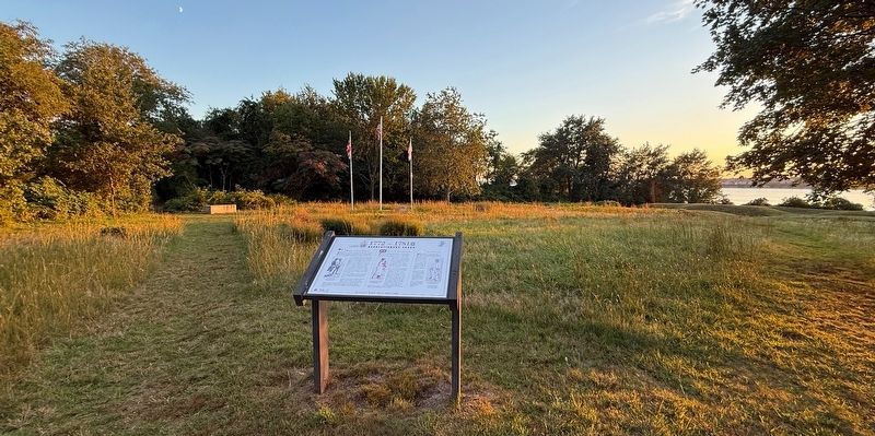
Location. 41° 28.797′ N, 71° 23.658′ W. Marker is in Jamestown, Rhode Island, in Newport County. It is in Conanicut Battery Historic Park. It can be reached from Battery Lane west of Beavertail Road, on the left when traveling west. Touch for map. Marker is at or near this postal address: 120 Battery Ln, Jamestown RI 02835, United States of America. Touch for directions.

Regionally, this marker is on Narragansett Bay. It is also in the American Northeast, in New England, and on the Eastern Seaboard. Globally, it is in the North Atlantic Region, North America, the Western Hemisphere, the Western World, and the Anglosphere. Historically, it finds itself in what was once one of the original Thirteen Colonies.
Other nearby markers. At least 8 other markers are within 2 miles of this marker, measured as the crow flies: Conanicut Battery (within shouting distance of this marker); Prospect Hill (about 400 feet away, measured in a direct line); Conanicut Battery On Prospect Hill / Preservation of Conanicut Battery (about 700 feet away); Fort Getty (approx. 0.7 miles away); Memorial to the Veterans of Jamestown (approx. 1½ miles away); Jamestown and Newport Ferry Service: 1675-1969 (approx. 1.8 miles away); Roger Williams and Canonicus (approx. 1.8 miles away); Veterans Memorial (approx. 1.8 miles away). Touch for a list and map of all markers in Jamestown.
Credits. This page was last revised on September 26, 2026. It was originally submitted on September 26, 2026, by Devry Becker Jones of Washington, District of Columbia. This page has been viewed 5 times since then. Photos: 1, 2. submitted on September 26, 2026, by Devry Becker Jones of Washington, District of Columbia.
