Fort Getty Park in Jamestown in Newport County, Rhode Island — The American Northeast (New England)
Fort Getty
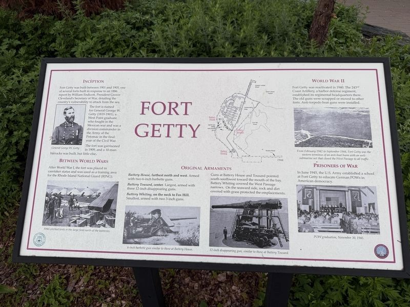
The fort is named for General George W. Getty (1819-1901), a West Point graduate who fought in the Mexican war and was a division commander in the Army of the Potomac in the final year of the Civil War.
The fort was garrisoned in 1909, and a 10-man barracks was built, but little else.
Battery Tousard, center. Largest, armed with three 12-inch disappearing guns.
Battery Whiting, on the neck to Fox Hill. Smallest, armed with two 3-inch guns.
Guns at Battery House and Tousard pointed south-southwest toward the mouth of the bay. Battery Whiting covered the West Passage narrows. On the seaward side, rock and dirt covered
this page online
[Captions:]
General George W. Getty
RING pitched tents in the large field north of the batteries.
6-inch barbette gun similar to those at Battery House.
12-inch disappearing gun, similar to those at Battery Tousard.
From February 1942 to September 1944, Fort Getty was the eastern terminus of an anti-boat boom with an anti-submarine net that closed the West Passage to all traffic.
POW graduation, November 30, 1945.
Erected by Town of Jamestown, Rhode Island; Jamestown Historical Society.
Topics. This historical marker is listed in these topic lists: Forts and Castles • War, World I • War, World II • Waterways & Vessels. A significant historical month for this entry is February 1942.
Location. 41° 29.326′ N, 71° 23.93′ W. Marker is in Jamestown, Rhode Island, in Newport County. It is in Fort Getty Park. It is on Fort Getty Road 0.7 miles west of Beavertail Road, on the left when traveling west. Touch for map. Marker is at or near this postal

Regionally, this marker is on Narragansett Bay. It is also in the American Northeast, in New England, and on the Eastern Seaboard. Globally, it is in the North Atlantic Region, North America, the Western Hemisphere, the Western World, and the Anglosphere. Historically, it finds itself in what was once one of the original Thirteen Colonies.
Other nearby markers. At least 8 other markers are within 2 miles of this marker, measured as the crow flies: Conanicut Battery On Prospect Hill / Preservation of Conanicut Battery (approx. 0.6 miles away); Prospect Hill (approx. 0.6 miles away); 1772 - 1781 (approx. 0.7 miles away); Conanicut Battery (approx. 0.7 miles away); Memorial to the Veterans of Jamestown (approx. 1.4 miles away); Jamestown and Newport Ferry Service: 1675-1969 (approx. 1.7 miles away); Roger Williams and Canonicus (approx. 1.7 miles away); Veterans Memorial (approx. 1.7 miles away). Touch for a list and map of all markers in Jamestown.
Credits. This page was last revised on September 26, 2026. It was originally submitted on September 26, 2026, by Devry Becker Jones of Washington, District of Columbia. This page has been viewed 4 times since then. Photos: 1, 2. submitted on September 26, 2026, by Devry Becker Jones of Washington, District of Columbia.
