Windmill Hill in Jamestown in Newport County, Rhode Island — The American Northeast (New England)
Jamestown Windmill
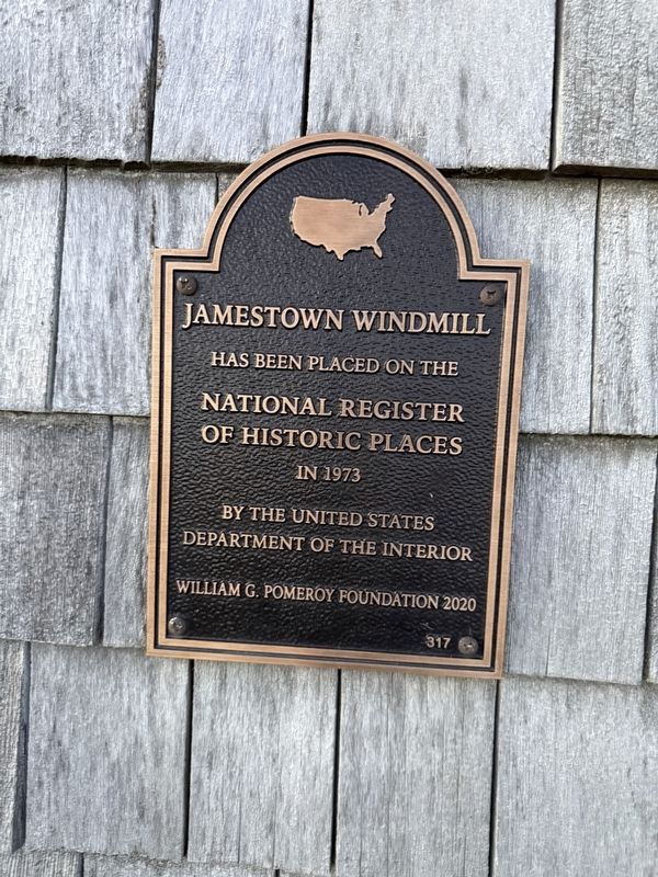
has been placed on the
National Register
of Historic Places
in 1973
by the United States
Department of the Interior
Erected 2020 by William G. Pomeroy Foundation. (Marker Number 317.)
Topics and series. This historical marker is listed in these topic lists: Agriculture • Architecture • Industry & Commerce. In addition, it is included in the William G. Pomeroy Foundation series list. A significant historical year for this entry is 1973.
Location. 41° 30.934′ N, 71° 22.449′ W. Marker is in Jamestown, Rhode Island, in Newport County. It is in Windmill Hill. It is on North Road north of Weeden Lane, on the right when traveling north. Touch for map. Marker is at or near this postal address: 378 North Rd, Jamestown RI 02835, United States of America. Touch for directions.

Regionally, this marker is on Narragansett Bay. It is also in the American Northeast, in New England, and on the Eastern Seaboard. Globally, it is in the North Atlantic Region, North America, the Western Hemisphere, the Western World, and the Anglosphere. Historically, it finds itself in what was once one of
this page online
Other nearby markers. At least 8 other markers are within 3 miles of this marker, measured as the crow flies: Operation of the Jamestown Windmill (a few steps from this marker); History of the Jamestown Windmill (a few steps from this marker); Leaching Stone (within shouting distance of this marker); Memorial to the Veterans of Jamestown (approx. 1.3 miles away); Veterans Memorial (approx. 1.4 miles away); Roger Williams and Canonicus (approx. 1.4 miles away); Jamestown and Newport Ferry Service: 1675-1969 (approx. 1.4 miles away); Fort Getty (approx. 2.3 miles away). Touch for a list and map of all markers in Jamestown.
Also see . . . National Register of Historic Places nomination form.
This form was prepared by B. Christopher Bene (Surveyor-Researcher) and Richard B. Harrington (Consultant) for the Rhode Island Historical Preservation Commission on January 8, 1972. A statement of historical significance is on page 3:
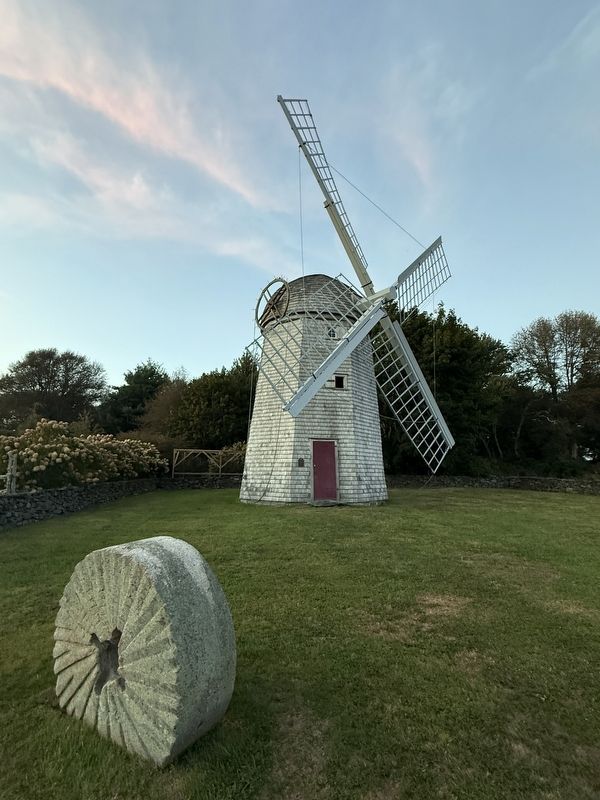
Windmills of this type, once common and basic necessities, are now fast-disappearing, interesting examples of former ways of grinding grain. Believed to be the third(Submitted on September 26, 2026, by Devry Becker Jones of Washington, District of Columbia.)windmill on Jamestown Island, this structure has stood (with the exception of repair and replacement when necessary) unchanged since 1787. It was then built with town appropriations, and later it came into the coöperative ownership of fourteen individual, local millers who used it. It is a good example of early civic endeavor to provide a public facility or utility, and it is a fine example also of early utilitarian architecture and early mechanical contrivance.
The mill remained in continual operation until 1896. Since that time it has been under the care, first, of the Windmill Society which in 1904 bought it to preserve it and--soon afterwards and since--of the Jamestown Historical Society. The windmill has been restored to operating condition largely through locally-gathered funds. Although the windshaft and vanes had to be replaced after severe hurricane damage, the millstones, gears, crane etc. are all original, as are most of the structure's timbers.
A picturesque landmark at all times, the building is open to the public during the summer season, giving opportunity to inspect the machanism and operation of an early gristmill and the fine internal construction of this particular one.
Additional commentary.
1. About the marker
Usually, National Register plaques do not receive their own profile when more descriptive markers are nearby. However, this marker has its own profile because it's part of the William G. Pomeroy Foundation series. Note To Editor only visible by Contributor and editor
— Submitted September 26, 2026, by Devry Becker Jones of Washington, District of Columbia.
Credits. This page was last revised on September 26, 2026. It was originally submitted on September 26, 2026, by Devry Becker Jones of Washington, District of Columbia. This page has been viewed 6 times since then. Photos: 1, 2. submitted on September 26, 2026, by Devry Becker Jones of Washington, District of Columbia.
