Windmill Hill in Jamestown in Newport County, Rhode Island — The American Northeast (New England)
History of the Jamestown Windmill
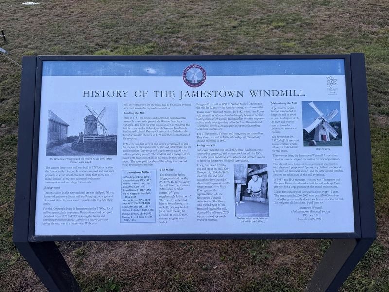
Photographed by Devry Becker Jones (CC0), September 18, 2026
1. History of the Jamestown Windmill Marker
The current Jamestown mill was built in 1787, shortly after the American Revolution. It is wind-powered and was used primarily to grind dried kernels of white flint corn, also called "Indian" corn, into cornmeal for human consumption and into silage for animals.
Background
Transportation in the early national era was difficult. Taking harvested grain to a distant mill and bringing home ground flour took time. Farmers wanted nearby mills to grind their grain.
For the 400 people living in Jamestown in the 1780s, a local mill was particularly important. British forces had occupied the island from 1776 to 1779, isolating the farms and disrupting communication. Newport, a major customer before the war, was in a depression. Without a mill, the corn grown on the island had to be ground by hand or ferried across the bay to distant mills.
Building the Mill
Early in 1787, the town asked the Rhode Island General Assembly to set aside part of the Watson farm for a windmill. The farm on what is now known as North Road had been owned by Colonel Joseph Wanton, Jr., a British Loyalist and colonial Deputy Governor. He fled
this page online
In March, one-half acre of the farm was "assigned to and for the use of the inhabitants of the town Jamestown" on the condition that "they erect and keep in repair a good wind-mill for grinding grain." The windmill and a cottage for the miller were built at once. Both still stand in their original spots. The town paid for the mill by selling small-wooded tracts to individual farmers.
Jamestown Millers
Jethro Briggs, 1788-1795 • Nathan Munro, 1795-1827 • Caleb F. Weaver, 1827-1847 • William G. Carr, 1847 • Arnold Hazard, 1847-1850 • Job W. Hazard & Eben Tefft, 1850-1855 • John W. Potter, 1855-1874 • Isaac W. Potter, 1874-1882 • Elijah Anthony, 1882-1883 • William A. Barber, 1883-1888 • Philip A. Brown, 1888-1893 • Thomas A. H. & Jesse C. Tefft, 1893-1896
The Millers
The first miller, Jethro Briggs, was hired on May 25, 1788. He later bought the mill from the town for 200 bushels (7 cubic meters) of "good merchantable Indian corn." The transfer authorized him to keep three quarts, or 3/32, of every bushel (.035 cubic meters)
Briggs sold the mill in 1795 to Nathan Munro. Munro ran the mill for 32 years—the longest serving Jamestown miller.
Twelve millers followed Munro. By 1887, when Isaac Potter sold the mill to Elijah Anthony, use had already begun to decline. Roller mills, which quickly crushed grain between huge steel rollers, made stone-grinding mills obsolete. Railroads and steamboats moved corn and grain inexpensively, making local mills unnecessary.
The Tefft brothers, Thomas and Jesse, were the last millers. They closed the mill in 1896, although Jesse occasionally ground cornmeal until 1897.
Saving the Mill
For seven years, the mill stood neglected. Equipment was removed or destroyed, and weather took its toll. In 1904, the mill's pitiful condition touched residents and summer visitors to form the Jamestown Windmill Association.
The group raised $900 to buy and repair the mill. On October 15, 1904, the Teffts sold "the mill and land enough to drive around it"—about 3,600 square feet (335 square meters)—to Mary Rosengarten, the representative of the Jamestown Windmill Association. The Carrs, who owned most of the farm around the mill, donated the half-acre (2024 square meters) approach south of the mill.
Maintaining the Mill
A permanent organization was needed to keep the mill in good repair. In August 1912, 26 men and women met to form the Jamestown Historical Society.
On September 10, 1912, the JHS received a state charter, which allowed it to hold title to real estate.
Three weeks later, the Jamestown Windmill Association transferred ownership of the mill to the new organization.
The old mill now belonged to a permanent organization with the stated purpose of "preserving old landmarks and collection of historical relics," and the Jamestown Historical Society has taken care of the mill ever since.
In 1987, two JHS members—sisters Nan Thompson and Margaret Evans—endowed a fund for mill upkeep. Their gift pays for a large portion of the annual maintenance.
Major restoration work is required about every 15 years. The restoration in 2000-2001 cost over $70,000 and was funded by grants and by donations from visitors to the mill. We welcome all donations. Send them to:
c/o Jamestown Historical Society
P.O. Box 156
Jamestown, RI 02835.
Erected by Jamestown Historical Society; Rhode Island Council for the Humanities.
Topics. This historical marker is listed in these topic lists: Agriculture • Industry & Commerce. A significant historical date for this entry is May 25, 1788.
Location. 41° 30.925′ N, 71° 22.439′ W. Marker is in Jamestown, Rhode Island, in Newport County. It is in Windmill Hill. It is on North Road north of Weeden Lane, on the right when traveling north. Touch for map. Marker is at or near this postal address: 378 North Rd, Jamestown RI 02835, United States of America. Touch for directions.

Regionally, this marker is on Narragansett Bay. It is also in the American Northeast, in New England, and on the Eastern Seaboard. Globally, it is in the North Atlantic Region, North America, the Western Hemisphere, the Western World, and the Anglosphere. Historically, it finds itself in what was once one of the original Thirteen Colonies.
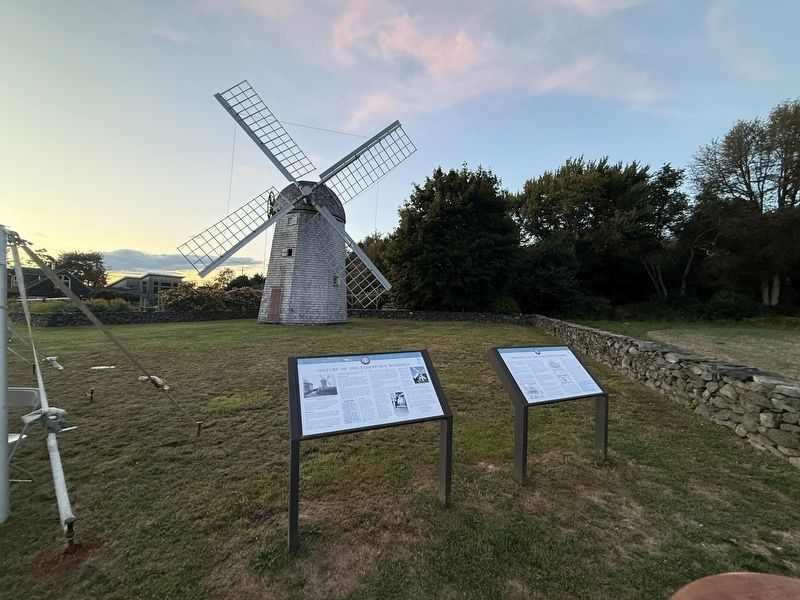
Other nearby markers. At least 8 other markers are within 3 miles of this marker, measured as the crow flies: Operation of the Jamestown Windmill (here, next to this marker); Leaching Stone (a few steps from this marker); Jamestown Windmill (a few steps from this marker); Memorial to the Veterans of Jamestown (approx. 1.3 miles away); Veterans Memorial (approx. 1.4 miles away); Roger Williams and Canonicus (approx. 1.4 miles away); Jamestown and Newport Ferry Service: 1675-1969 (approx. 1.4 miles away); Fort Getty (approx. 2.2 miles away). Touch for a list and map of all markers in Jamestown.
Credits. This page was last revised on September 26, 2026. It was originally submitted on September 26, 2026, by Devry Becker Jones of Washington, District of Columbia. This page has been viewed 6 times since then. Photos: 1, 2. submitted on September 26, 2026, by Devry Becker Jones of Washington, District of Columbia.
