Windmill Hill in Jamestown in Newport County, Rhode Island — The American Northeast (New England)
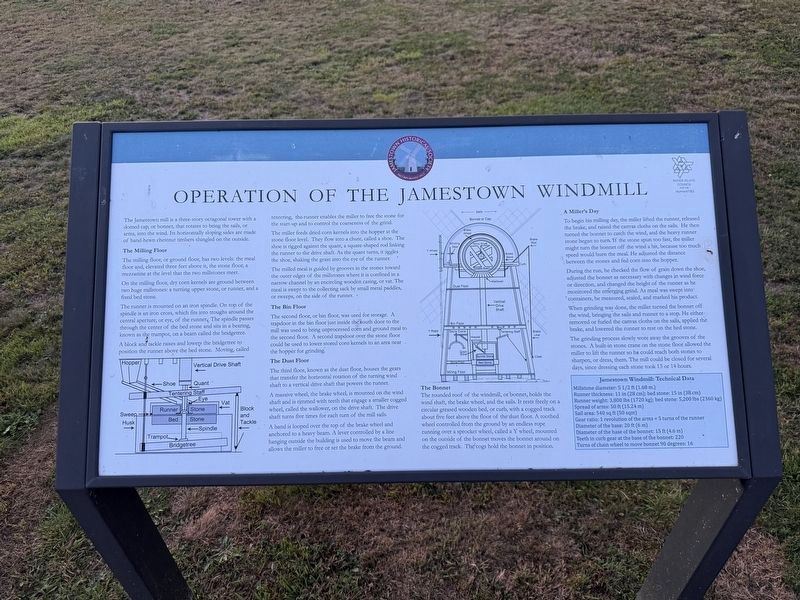
Operation of the Jamestown Windmill
Photographed by Devry Becker Jones (CC0), September 18, 2026
1. Operation of the Jamestown Windmill Marker
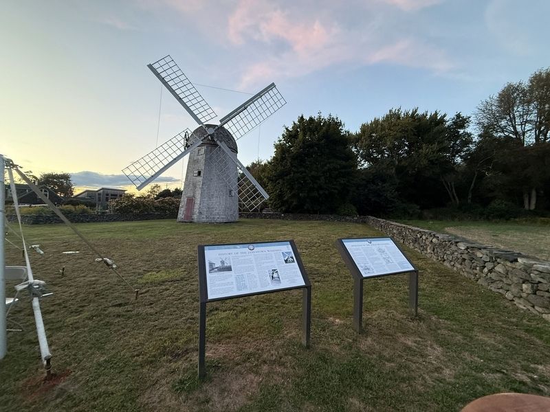
The Jamestown mill is a three-story octagonal tower with a domed cap, or bonnet, that rotates to bring the sails, or arms, into the wind. Its horizontally sloping sides are made of hand-hewn chestnut shingles on the outside.
The Milling Flour
The milling floor, or ground floor, has two levels: the meal floor and, elevated three feet above it, the stone floor. A mezzanine is the level where the two millstones meet.
On the milling floor, dry corn kernels are ground between two huge millstones: a rotating upper stone, or runner, and a fixed bed stone.
The runner is supported on an iron spindle. On top of the spindle is an iron cross, which fits into troughs around the central aperture, or eye, of the runner. The spindle passes through the center of the bed stone and sits in a bearing, known as the trampot, on a beam called the bridgetree.
A block and tackle raises and lowers the bridgetree to position the runner above the bed stone. Milling, called tentering, the runner establishes the spacing between the stones and controls the coarseness of the grind.
The miller feeds dried corn kernels into the hopper
this page online
The milled meal is guided by grooves in the stones toward the outer edges of the millstones where it is confined in a narrow channel by an encircling wooden casing, or vat. The meal is swept into the collecting vat by small metal paddles, or sweeps, on the side of the runner.
The Bin Floor
The second floor, or bin floor, was used for storage. A trapdoor in the bin floor just inside the south door to the mill was used to hoist unprocessed corn and ground meal to the second floor. A second trapdoor over the stone floor could be used to lower stored corn kernels into an area near the hopper for grinding.
The Dust Floor
The third floor, known as the dust floor, houses the gears that transfer the horizontal rotation of the turning wind shaft to a vertical drive shaft that powers the runner.
A massive wheel, the brake wheel, is mounted on the wind shaft and is rimmed with
A band is looped over the top of the brake wheel and anchored to a heavy beam. A lever controlled by a line hanging outside the building is used to move the beam and allows the miller to free or set the brake from the ground.
The Bonnet
The rounded roof of the windmill, or bonnet, holds the wind shaft, the brake wheel, and the sails. It sits freely on a greased wooden track, or curb, with a cogged track about five feet above the floor of the dust floor. A toothed wheel controlled from the ground by an endless rope running over a sprocket wheel, called a Y wheel, mounted on the outside of the bonnet moves the bonnet around on the cogged track. The cogs hold the bonnet in position.
A Miller's Day
To begin his milling day, the miller lifted the runner, released the brake, and spread the canvas cloths on the sails. He then turned the bonnet to catch the wind, and the heavy runner stone began to turn. If the wind spun too fast, the miller might turn the bonnet off the wind a bit, because too much speed would burn the meal. He adjusted the distance between the stones and fed corn into the hopper.
During the run, he checked the flow of grain down the shoe, adjusted the bonnet as necessary with changes in wind force or direction, and changed the height of the runner as he monitored the emerging grind. As meal was swept into containers, he measured, sacked, and marked his product.
When grinding was done, the miller turned the bonnet off the wind, bringing the sails and runner to a stop. He either removed or furled the canvas cloths on the sails, applied the brake, and lowered the runner to rest on the bed stone.
The grinding process slowly wore away the grooves of the stones. A built-in stone crane on the stone floor allowed the miller to lift the runner so he could touch both stones to sharpen, or dress, them. The mill could be closed for several days, since dressing each stone took 12 or 14 hours.
Jamestown Windmill: Technical Data Millstone diameter: 5 1/2 ft (1.68 m.)
Runner thickness: 11 in (28 cm); bed stone: 15 in (38 cm)
Runner weight: 3,00 lbs (1720 kg); bed stone: 5,200 lbs (2360 kg)
Spread of arms: 50 ft (15.24 m)
Sail area: 540 sq ft (50 sqm)
Gear ratio: 1 revolution of the arms = 5 turns of the runner
Diameter of the base: 20 ft (6 m)
Diameter of the base of the bonnet: 15 ft (4.6 m)
Teeth in curb gear at the base of the bonnet: 220
Turns of chain wheel to move bonnet 90 degrees: 16
Erected by Jamestown Historical Society; Rhode Island Council for the Humanities.
Topics. This historical marker is listed in these topic lists: Agriculture • Industry & Commerce.
Location. 41° 30.926′ N, 71° 22.438′ W. Marker is in Jamestown, Rhode Island, in Newport County. It is in Windmill Hill. It is on North Road north of Weeden Lane, on the right when traveling north. Touch for map. Marker is at or near this postal address: 378 North Rd, Jamestown RI 02835, United States of America. Touch for directions.

Regionally, this marker is on Narragansett Bay. It is also in the American Northeast, in New England, and on the Eastern Seaboard. Globally, it is in the North Atlantic Region, North America, the Western Hemisphere, the Western World, and the Anglosphere. Historically, it finds itself in what was once one of the original Thirteen Colonies.
Other nearby markers. At least 8 other markers are within 3 miles of this marker, measured as the crow flies: History of the Jamestown Windmill (here, next to this marker); Leaching Stone (a few steps from this marker); Jamestown Windmill (a few steps from this marker); Memorial to the Veterans of Jamestown (approx. 1.3 miles away); Veterans Memorial (approx. 1.4 miles away); Roger Williams and Canonicus (approx. 1.4 miles away); Jamestown and Newport Ferry Service: 1675-1969 (approx. 1.4 miles away); Fort Getty (approx. 2.2 miles away). Touch for a list and map of all markers in Jamestown.
Credits. This page was last revised on September 26, 2026. It was originally submitted on September 26, 2026, by Devry Becker Jones of Washington, District of Columbia. This page has been viewed 5 times since then. Photos: 1, 2. submitted on September 26, 2026, by Devry Becker Jones of Washington, District of Columbia.
