Powers near Starbuck in Columbia County, Washington — The American West (Northwest)
The Race to the Pacific
Photographed by Barry Swackhamer, June 14, 2026
1. The Race to the Pacific Marker
Caption: Clark's map of "Bason Rapid"
Tribes from the region also had names for these rapids. Many of those names were lost when native peoples were forced to assimilate into Euro-American society.
Tribes from the region also had names for these rapids. Many of those names were lost when native peoples were forced to assimilate into Euro-American society.
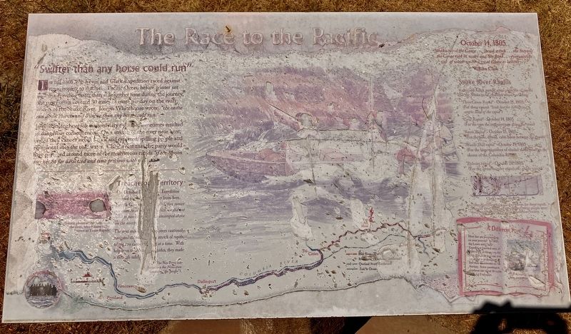
In fall 1805, the Lewis and Clark Expedition raced against time, hoping to reach the Pacific Ocean before winter set in. Traveling faster than at any other time during the journey, the party often covered 30 miles or more per day on the swift waters of the Snake River. Joseph Whitehouse wrote, "the canoe ran down this channel Swifter than any horse could run."
In their haste, they took extraordinary risks that sometimes resulted in dangerous consequences. On a stretch of the river near here, one of their canoes struck a rock and capsized, spilling people and equipment into the cold water. Clark wrote that the party would have portaged around more of the treacherous rapids "if the Season was not So far advanced and time precious with us."
Treacherous Territory
On October 12, 1805, the Expedition camped just across the river from here. Patrick Gass wrote, "Little before sunset we came to a bad (rapid?) which we did not wish to pass (?) encamped about on the north side."
The next morning (?) explorers cautiously navigate the (?) stretch of rapids taking two canoes through
this page online
The Nez Percés called themselves the Nimiipuu (meaning "the people."
"at this rapid the Canoe ...Struck a rock ...the Stern of the Canoe took ibuprofen water and She Sunk ...every article wet of which we have great Cause to lament ..."
William Clark
Snake River Rapids
Lewis and Clark named some stretches of rapids on the Snake and Columbia rivers including:
"Three Canoes Rapid," - October 14, 1805 (For three canoes "Stuk fast for Some time on the head of the rapids")
"Cave Rapid" - October 14 1805 (For the caves the explores saw along the river)
"Bason Rapid" - October 15, 1805 (For the wide, round calm basin between the rapids)
"Muscle Shell rapid" - October 19, 1805 (For the large quantities of Mussel Shells piled on the shores of the Columbia River)
"Pelican rapid" - October 23, 1805 (For the "great number of pelicans on the wing")
Erected by Washington Lewis & Clark Expedition Bicentennial Commission.
Topics and series. This historical marker is listed in these topic lists: Exploration
Photographed by Barry Swackhamer, June 14, 2026
2. The Race to the Pacific Marker
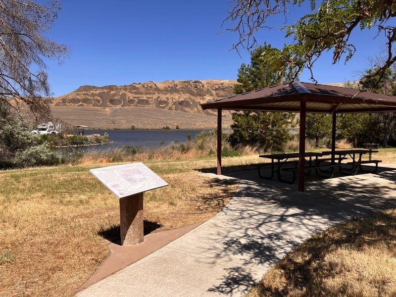
Location. 46° 33.828′ N, 118° 5.937′ W. Marker is near Starbuck, Washington, in Columbia County. It is in Powers. It can be reached from Little Goose Dam Road near Route 261, on the left when traveling east. This marker is located at Texas Rapids Campground & Recreation Area. Touch for map. Marker is in this post office area: Starbuck WA 99359, United States of America. Touch for directions.

Regionally, this marker is in the Palouse. It is also in the American Mountain West and in the Lewis & Clark Corridor. Globally, it is in North America, on the Pacific Rim, in the Western Hemisphere, in the Western World, and in the Anglosphere.
Other nearby markers. At least 8 other markers are within 10 miles of this marker, measured as the crow flies: Drewyers River (approx. 6.1 miles away); M-R Military Wagon Road (approx. 6.1 miles away); M - R Military Road (approx. 6.1 miles away); Cataclysmic Floods (approx. 6.1 miles away); Floods Reveal the Past (approx. 6.1 miles away); Small Town, Big Voice (approx. 9.2 miles away); Overwhelming Proof for an "Outrageous" Theory (approx. 9.2 miles away); Setting the Stage (approx. 9.2 miles away).
Credits. This page was last revised on September 26, 2026. It was originally submitted on September 26, 2026, by Barry Swackhamer of Brentwood, California. This page has been viewed 10 times since then. Photos: 1, 2. submitted on September 26, 2026, by Barry Swackhamer of Brentwood, California.
