Erick in Beckham County, Oklahoma — The American South (West South Central)
Oklahoma
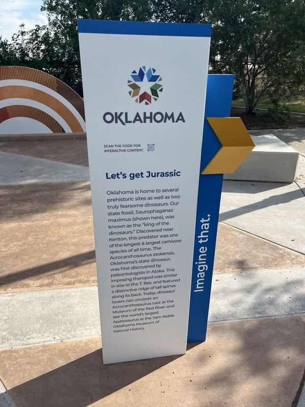
Let's get Jurassic
Photographed by Thomas Smith, September 19, 2026
1. Oklahoma Marker
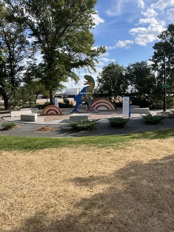
Oklahoma is home to several prehistoric sites as well as two truly fearsome dinosaurs. Our state fossil, Saurophaganax maximus (shown here), was known as the "king of the dinosaurs." Discovered near Kenton, this predator was one of the longest & largest carnivore species of all time. The Acrocanthosaurus atokensis, Oklahoma's state dinosaur, was first discovered by paleontologists in Atoka. This imposing theropod was similar in size to the T. Rex and featured a distinctive ridge of tall spines along its back. Today, dinosaur lovers can uncover an Acrocanthosaurus cast at the Museum of the Red River and see the world's largest Apatosaurus at the Sam Noble Oklahoma Museum of Natural History Imagine that.
Topics. This historical marker is listed in these topic lists: Animals • Anthropology & Archaeology.
Location. 35° 13.648′ N, 99° 49.694′ W. Marker is in Erick, Oklahoma, in Beckham County. It is on I-40 3 miles north of North County Road 1760. Touch for map. Marker is at or near this postal address: 17672 I- 40, Erick OK 73645, United States
this page online

Regionally, this marker is in Southwest Oklahoma—Great Plains Country. It is also in the American South, specifically on the prairies, and on the Southern Plains. Globally, it is in North America, the Western Hemisphere, the Western World, and the Anglosphere. Historically, it finds itself in what was once the Comanchería, the territory of the Mississippian Culture, the Dust Bowl, and the Louisiana Purchase.
Other nearby markers. At least 7 other markers are within 12 miles of this marker, measured as the crow flies: Sandhills Curiosity Shop, Erick, Oklahoma (approx. 2.4 miles away); Delhi (approx. 9.3 miles away); Will Rogers Highway (approx. 9.6 miles away); Rock Island Depot (approx. 11.6 miles away); WPA (approx. 11.7 miles away); Beckham County Veterans Memorial (approx. 11.7 miles away); Beckham County Courthouse (approx. 11.7 miles away).
Photographed by Thomas Smith, September 19, 2026
2. Oklahoma Marker
Credits. This page was last revised on October 1, 2026. It was originally submitted on September 26, 2026, by Thomas Smith of Waterloo, Ill. This page has been viewed 7 times since then. Photos: 1, 2. submitted on September 26, 2026, by Thomas Smith of Waterloo, Ill. • J. Makali Bruton was the editor who published this page.
