Aylesbury in Buckinghamshire, England, United Kingdom — Northwestern Europe (the British Isles)
Episcopal Chapel
Photographed by Ray Gurganus, May 23, 2026
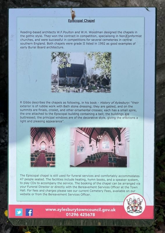
1. Episcopal Chapel Marker
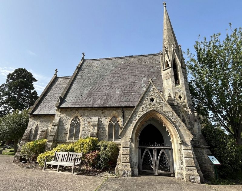
R. Gibbs describes the chapels as following, in his book - History of Aylesbury: "their exterior is of rubble work with Bath stone dressing; they are gabled, and on the summits are finials, croslet, and other ornamental crosses; each has a small spire, the one attached to the Episcopal building containing a bell; the buildings are buttressed; the principal windows are of the decorative style, giving the erections a light and pleasing appearance".
The Episcopal chapel is still used for funeral services and comfortably accommodates 47 people seated. The facilities include heating, hymn books, and a speaker system, to play CDs to accompany the service. The booking of the chapel can be arranged via your Funeral Director or directly with the Bereavement Services Officer
this page online
Erected by Aylesbury Town Council.
Topics. This historical marker is listed in these topic lists: Architecture • Cemeteries & Burial Sites • Religion & Religious Structures.
Location. 51° 48.889′ N, 0° 47.881′ W. Marker is in Aylesbury, England, in Buckinghamshire. It can be reached from Tring Road, on the right when traveling east. On the grounds of Tring Road Cemetery. Touch for map. Marker is at or near this postal address: 51 Tring Road, Aylesbury, England HP20 1LD, United Kingdom. Touch for directions.

Regionally, this marker is in the Greater South East. Globally, it is on the Atlantic Ocean, in the North Atlantic Region, in Europe, in Atlantic Europe, on one of the British Isles, in the Western World, and in the Anglosphere. Historically, it finds itself in what was once the Roman Empire.
Other nearby markers. At least 8 other markers are within walking distance of this marker: Dissenters' Chapel (within
Photographed by Ray Gurganus, May 23, 2026
2. Episcopal Chapel and Marker
Credits. This page was last revised on September 28, 2026. It was originally submitted on September 26, 2026, by Ray Gurganus of Washington, District of Columbia. This page has been viewed 6 times since then. Photos: 1, 2. submitted on September 26, 2026, by Ray Gurganus of Washington, District of Columbia. • Andrew Ruppenstein was the editor who published this page.
