Varna near Dayton in Columbia County, Washington — The American West (Northwest)
"a pleasant looking Country"
Photographed by Barry Swackhamer, June 14, 2026
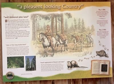
1. "a pleasant looking Country" Marker
Captions: (lower left Ponderroaa pine trees, needles and cones; (at right) River Otter and Beaver. Illustrations from Animals Tracks of Washington and Oregon by Ian Sheldon.
While camped along the Touchet River a few miles west of here, Lewis and Clark commented on the familiarity of the countryside: "I see very little difference between the apparent face of the country here and that of the plains of the Missouri only that these are not enlivened by the vast herds of buffaloe Elk &c. which ornament the other."
The Expedition passed through here on the afternoon of May 2, 1806. The landscape still looks like Meriwether Lewis described it; "some pine of the long leafed kind appears on the sides of the creek hills, also about 50 acres of well timbered pine land where we passed the creek."
"pine of the long leafed kind"
Ponderosa pine (Pinus ponderosa), observed by Lewis and Clark and still found throughout this area, is named for its ponderosa or heavy wood. A ponderosa pine can reach over 150 feet in height and can live as long as 400 to 500 years. Its bark has a distinctive, sweet, vanilla-like scent, and its cones are three to six inches long. The needles are extra long (five to ten inches) and grow in bundles of three. When crushed, the needles exude
this page online
"much appearance of beaver and otter"
The Lewis and Clark Expedition encountered American beaver (Castor canadensis) and river otter (Lutra canadensis) on the Touchet River while traveling through this valley. Patrick Gass wrote, "there are a great many beaver sighs on this branch." Beaver and otter can still be found in this area today. Look for signs and tracks of beaver and otter near rivers and streams as you travel along the trail.
"the timber on the Creek become more abundant and less burnt, and its extensive bottoms afford a pleasant looking Country."
William Clark
"continued our journey up this branch; and saw to our right a range of high hills covered with timber and snow."
Patrick Gass
May 2, 1806
"about noon we proceed on up the branch over high plains & Smooth bottoms ...we crossed the branch in several places, where it was 3 feet deep."
John Ordway
Erected by Washington Lewis & Clark Expedition Bicentennial Commission.
Topics and series. This historical marker is listed in these topic lists: Animals • Exploration • Horticulture & Forestry
Photographed by Barry Swackhamer, June 14, 2026
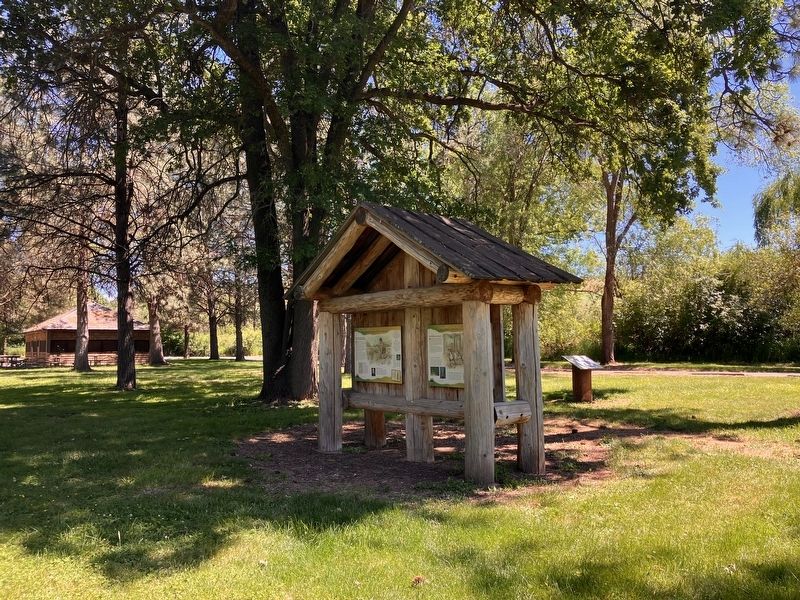
2. "a pleasant looking Country" Marker
Location. 46° 17.216′ N, 118° 4.403′ W. Marker is near Dayton, Washington, in Columbia County. It is in Varna. It can be reached from U.S. 12 near Timpey Road, on the right when traveling east. This marker is located in Lewis and Clark State Park. Touch for map. Marker is in this post office area: Dayton WA 99328, United States of America. Touch for directions.

Regionally, this marker is in the Palouse. It is also in the American Mountain West and in the Lewis & Clark Corridor. Globally, it is in North America, on the Pacific Rim, in the Western Hemisphere, in the Western World, and in the Anglosphere.
Other nearby markers. At least 8 other markers are within 5 miles of this marker, measured as the crow flies: Meriwether Lewis, Field Botanist (here, next to this marker); Lewis and Clark National Historic Trail (a few steps from this marker); Snake River Passage & Columbia Plains Crossing (a few steps from this marker); Cayuse, Umatilla, and Walla Walla Homeland (a few steps from this marker); On The Lewis and Clark Trail (about 300 feet away, measured in a direct line); "Good things from the Garden, (approx. 3.8 miles away); The Giant on the Hill (approx. 3.8 miles away); Dodge Quarantine Cabin (approx. 4.9 miles away). Touch for a list and map of all markers in Dayton.
Credits. This page was last revised on September 26, 2026. It was originally submitted on September 26, 2026, by Barry Swackhamer of Brentwood, California. This page has been viewed 7 times since then. Photos: 1, 2. submitted on September 26, 2026, by Barry Swackhamer of Brentwood, California.
