Tong in Shropshire, England, United Kingdom — Northwestern Europe (the British Isles)
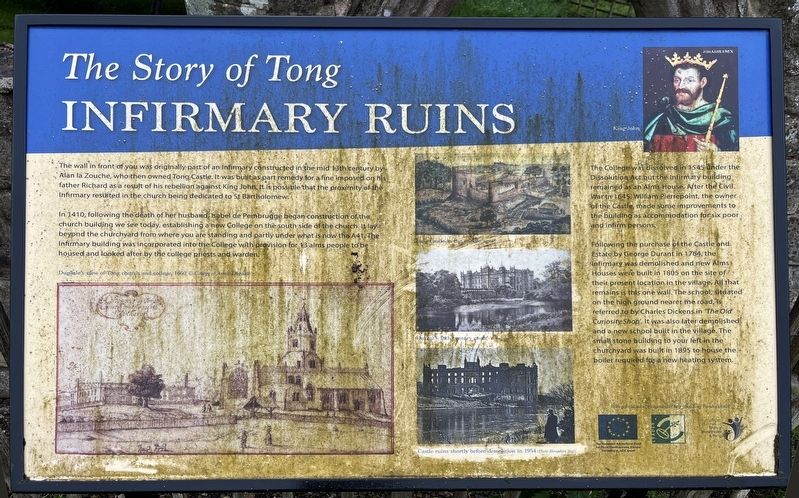
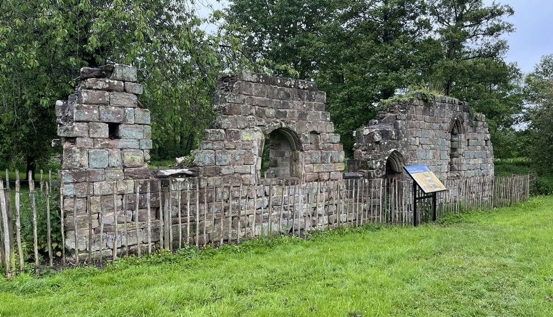
Infirmary Ruins
The Story of Tong
Photographed by Ray Gurganus, May 19, 2026
1. Infirmary Ruins Marker
In 1410, following the death of her husband, Isabel de Pembrugge began construction of the church building we see today, establishing a new College on the south side of the church. It lay beyond the churchyard from where you are standing and partly under what is now the A41. The Infirmary building was incorporated into the College with prevision for 13 alms people to be housed and looked after by the college priests and warden.
The College dissolved in 1545 under the Dissolution Act but the infirmary building remained as an Alms House. After the Civil War in 1645 William Pierrepoint, the owner of the Castle, made some improvements to the building as accommodation for six poor and infirm persons.
Following the purchase of the Castle and Estate by George
this page online
Erected by Tong Parish Council.
Topics. This historical marker is listed in these topic lists: Charity & Public Work • Education • Science & Medicine.
Location. 52° 39.837′ N, 2° 18.255′ W. Marker is in Tong, England, in Shropshire. It is on Newport Road. Touch for map. Marker is at or near this postal address: 2 Newport Road, Tong, England TF11 8PW, United Kingdom. Touch for directions.

Regionally, this marker is in the Midlands. It is also on the British Marches. Globally, it is on the Atlantic Ocean, in the North Atlantic Region, in Europe, in Atlantic Europe, on one of
Photographed by Ray Gurganus, May 19, 2026
2. Infirmary Ruins and Marker
Other nearby markers. At least 5 other markers are within 3 kilometers of this marker, measured as the crow flies: College Field (within shouting distance of this marker); The Story of Tong (within shouting distance of this marker); Albrighton, home of the English Rose (within shouting distance of this marker); St Bartholomew's Church (within shouting distance of this marker); a different marker also named Albrighton, home of the English Rose (approx. 3.4 kilometers away).
Credits. This page was last revised on September 28, 2026. It was originally submitted on September 26, 2026, by Ray Gurganus of Washington, District of Columbia. This page has been viewed 7 times since then. Photos: 1, 2. submitted on September 26, 2026, by Ray Gurganus of Washington, District of Columbia. • Andrew Ruppenstein was the editor who published this page.
