Charles City in Charles City County, Virginia — The American South (Mid-Atlantic)
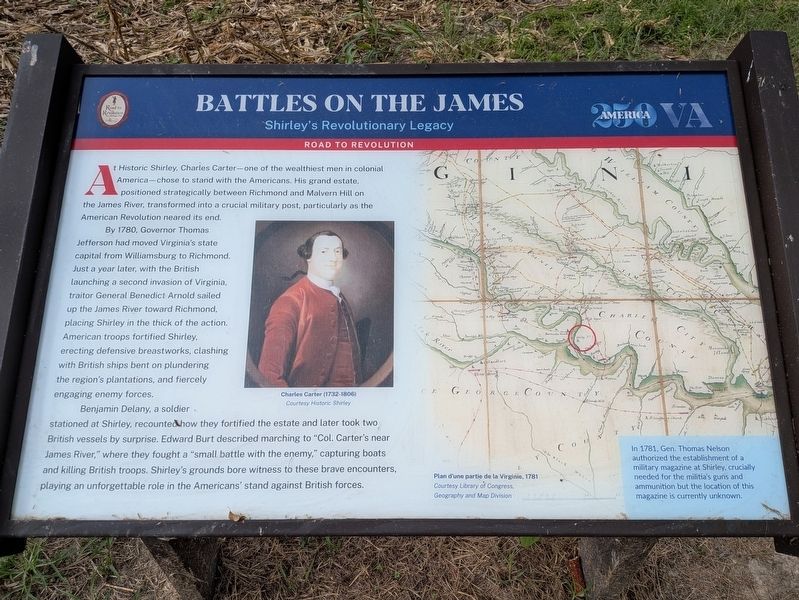
Battles on the James
Shirley's Revolutionary Legacy
| — | Road To Revolution | — |
Photographed by Evan Dwyer, September 26, 2026
1. Battles on the James Marker
By 1780, Governor Thomas Jefferson had moved Virginia's state capital from Williamsburg to Richmond. Just a year later, with the British launching a second invasion of Virginia, traitor General Benedict Arnold sailed up the James River toward Richmond, placing Shirley in the thick of the action. American troops fortified Shirley, erecting defensive breastworks, clashing with British ships bent on plundering the region's plantations, and fiercely engaging enemy forces.
Benjamin Delany, a soldier stationed at Shirley, recounted how they fortified the estate and later took two British vessels by surprise. Edward Burt described marching to "Col. Carter's near James River," where they fought a "small battle with the enemy," capturing boats and killing British troops. Shirley's grounds bore witness to these brave
this page online
Photo Captions:
Charles Carter (1732-1806)
Courtesy Historic Shirley
Plan d'une partie de la Virginie, 1781
Courtesy Library of Congress, Geography and Map Division
Erected by Road to Revolution Heritage Trail (Civil War Trails, Inc.).
Topics and series. This historical marker is listed in these topic lists: Patriots & Patriotism • War, US Revolutionary • Waterways & Vessels. In addition, it is included in the Road to Revolution Heritage Trail series list. A significant historical year for this entry is 1781.
Location. 37° 20.645′ N, 77° 15.275′ W. Marker is in Charles City, Virginia, in Charles City County. It is on Westbury Farm Road 0.2 miles north of Shirley Plantation Road, on the right when traveling south. The marker is just south of the entrance to Upper Shirley Vineyards. Touch for map. Marker is in this post office area: Charles City VA 23030, United States of America. Touch for directions.

Regionally, this marker is in Coastal Virginia. It is also in the American South, specifically in the Upper South, in the Tidewater,
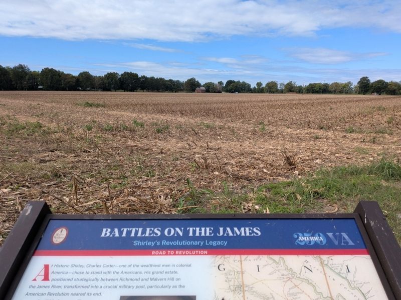
Photographed by Evan Dwyer, September 26, 2026
2. Shirley
The plantation's main house is visible beyond the marker at distant right. The nearest building is the ice house dependency.
Other nearby markers. At least 8 other markers are within 3 miles of this marker, measured as the crow flies: A Great Escape (approx. 0.4 miles away); Bermuda Hundred Landing (approx. 0.9 miles away); Bermuda Hundred (approx. 0.9 miles away); a different marker also named Bermuda Hundred (approx. 0.9 miles away); Stephen Bates (approx. 1.4 miles away); Shirley (approx. 1.4 miles away); Benjamin Harrison (approx. 1.9 miles away); City Point (approx. 2.2 miles away). Touch for a list and map of all markers in Charles City.
Another marker is no longer nearby. Bermuda Hundred Landing (was approx. 0.9 miles away but has been replaced with another marker now near it).
More about this marker. Marker is on the road to Historic Shirley, and the historic plantation is visible
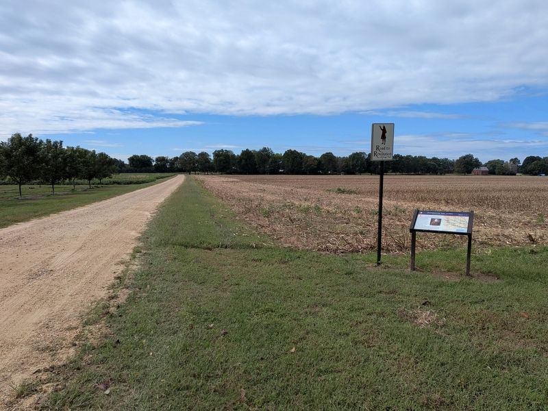
Photographed by Evan Dwyer, September 26, 2026
3. Battles on the James Marker
Shirley is at back right. The road to the plantation is at left. It curves around to the east at the intersection with Shirley's entry driveway, passes a Civil War Trails marker, and eventually intersects with VA-156.
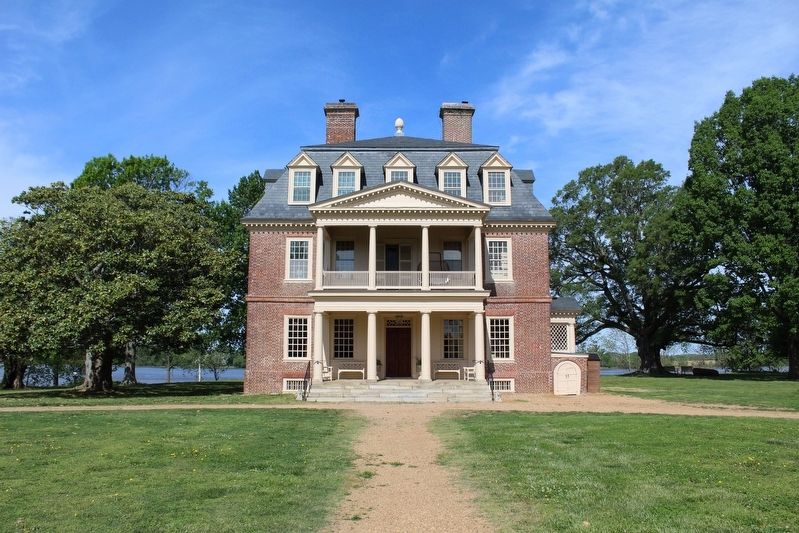
Photographed by Evan Dwyer, April 27, 2025
4. Shirley
The historic "Great House" at Shirley, built ca. 1738 (then remodeled in the 1770s, with further modifications - such as the porticos - being done in the 1830s). The farm surrounding it still functions under the Hill-Carter family as it has since 1638. The grounds of the historic plantation were regularly open to the public from the 1950s until 2024, and is now only accessible during the annual Virginia Garden Club Historic Homes & Garden Week.
Photographed by Evan Dwyer, April 27, 2025
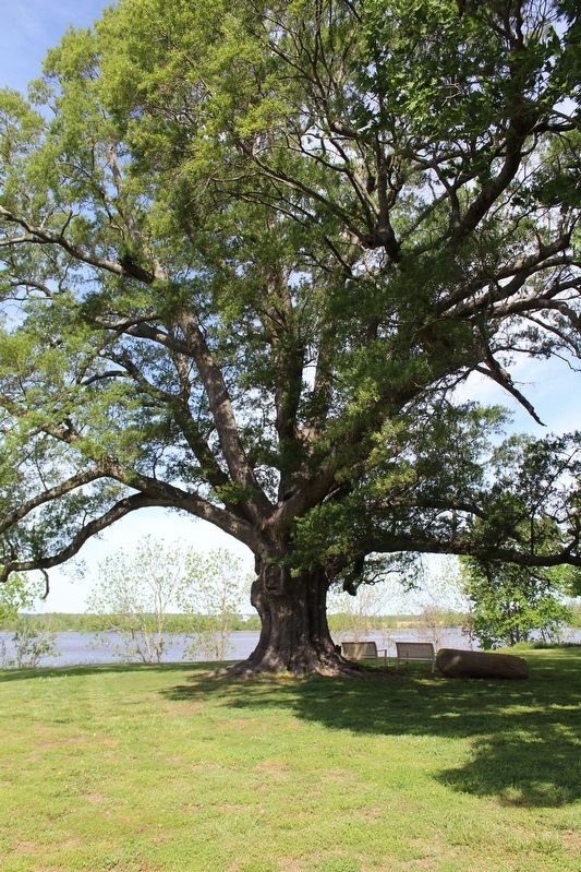
5. Willow Oak & James River
This tree, dating to around 1640, is less than 100' from the Great House's west (riverfront) entrance. It was on the property during the events described in the marker, and shows the proximity of the James River to the house. From this perspective, it's clear how local forces could harass vessels passing through this area of the river - even with small arms fire. The river width here is less than half a mile (about 800 yards), and rifles of the Revolutionary era could reach out to 300 yards. Depending on the draught of the vessel (larger ships needing deeper water near the middle of the river) and the course of the main channel in the 1770s and 1780s, safe navigation could bring a ship right up to the outside fringe of rifle range from the shore around Shirley.
Credits. This page was last revised on September 27, 2026. It was originally submitted on September 27, 2026, by Evan Dwyer of Richmond, Virginia. This page has been viewed 8 times since then. Photos: 1, 2, 3, 4, 5. submitted on September 27, 2026, by Evan Dwyer of Richmond, Virginia.
