Carlsbad in San Diego County, California — The American West (Pacific Coastal)
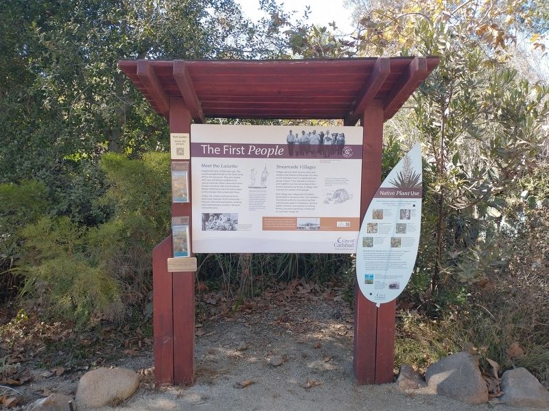
The First People
Photographed by Tom Bosse, September 5, 2026
1. The First People Marker
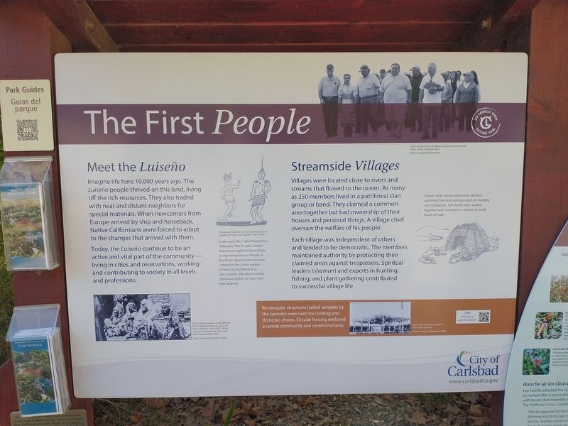
Meet the Luiseno
Imagine life here 10,000 years ago. The Luiseno people thrived on this land, living off the rich resources. They also traded with near and distant neighbors for special materials. When newcomers from Europe arrived by ship and horseback, Native Californians were forced to adapt to the changes that arrived with them.
Today, the Luiseno continue to be an active and vital part of the community – living in cities and reservations, working and contributing to society in all levels and professions.
Streamside Villages
Villages were located close to rivers and streams that flowed to the ocean. As many as 250 members lived in a patrilineal clan group or band. They claimed a common area together but had ownership of their houses and personal things. A village chief oversaw the welfare of his people.
Each village was independent of others and tended to be democratic. The members maintained authority by protecting their claimed areas against trespassers. Spiritual leaders (shaman) and experts in hunting, fishing, and plant gathering contributed to successful village life.
[Caption]: San Luis Rey Band
this page online
[Caption]: Drawing of Luiseno men in traditional dance regalia, by Pablo Tac (Luiseno, 1822-1844).
[Insert]: In the past, they called themselves Ataaxum (The People). Native American neighbors knew them as Payomkowishum (People of the West). Spanish missionaries referred to the native people as San Luis Rey Mission as San Luiseno. The name Luiseno (pronounced loo-ee-sane-yoh) was adopted.
[Caption]: Four Luiseno women at the Mission San Luis Rey de Fancia, San Luis Rey, California, circa 1893. All the women were believed to be over 100 years old at the time. Photo courtesy Museum of Man.
[Caption]: Homes were conical pithouses (kiichas) anchored two feet underground for stability and insulation. Tree limbs were arched together and covered by a thatch of reeds, brush or bark.
[Insert]: Rectangular structures (called ramadas by the Spanish) were used for cooking and domestic chores. Circular fencing enclosed a central community and ceremonial area.
[Caption]: Early 20th century ramada in San Diego County. Photo courtesy Museum of Man.
Erected by Leo
Photographed by Tom Bosse, September 5, 2026
2. The First People Marker
Topics and series. This historical marker is listed in this topic list: Indigenous Peoples and Communities. In addition, it is included in the Leo Carrillo Ranch Historic Park series list. A significant historical year for this entry is 2012.
Location. 33° 7.228′ N, 117° 14.197′ W. Marker is in Carlsbad, California, in San Diego County. It can be reached from Flying Leo Carrillo Lane, on the left when traveling north. Marker is located within the Leo Carrillo Ranch Historic Park. Touch for map. Marker is in this post office area: Carlsbad CA 92009, United States of America. Touch for directions.

Regionally, this marker is in the Peninsular Ranges. It is also in the American Borderlands and on the Pacific Coast. Globally, it is in North America, on the Ring of Fire, on the Pacific Rim, in the Western Hemisphere, in the Western World, and in the Anglosphere. Historically, it finds itself in what was once New Spain and also Mexico’s Alta California.
Other nearby markers. At least 8 other markers are within walking distance of this marker: Gateway to a Golden Era (a few steps from this marker);
Photographed by Tom Bosse, September 5, 2026
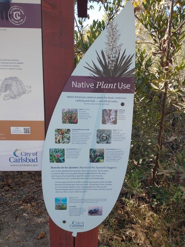
3. Native Plant Use
Also see . . .
1. The Luiseño of Southern California. (Submitted on September 27, 2026, by Tom Bosse of Jefferson City, Tennessee.)
2. Leo Carrillo Ranch Historic Park. (Submitted on September 27, 2026, by Tom Bosse of Jefferson City, Tennessee.)
Photographed by Tom Bosse, September 5, 2026
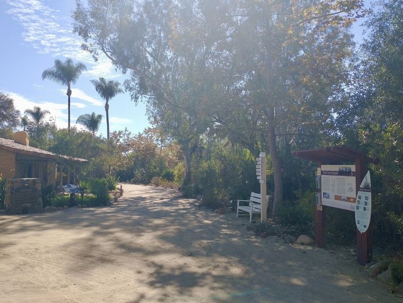
4. The First People Marker
Credits. This page was last revised on October 7, 2026. It was originally submitted on September 27, 2026, by Tom Bosse of Jefferson City, Tennessee. This page has been viewed 5 times since then. Photos: 1, 2, 3, 4. submitted on September 27, 2026, by Tom Bosse of Jefferson City, Tennessee. • Andrew Ruppenstein was the editor who published this page.
