Portsmouth in Newport County, Rhode Island — The American Northeast (New England)
The Battle of Rhode Island - 1778
Photographed by Devry Becker Jones (CC0), September 18, 2026
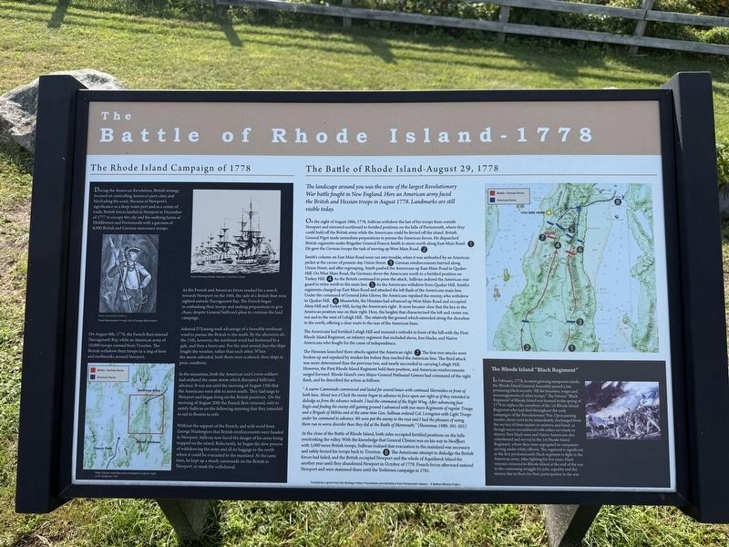
1. The Battle of Rhode Island - 1778 Marker
The Rhode Island Campaign of 1778
During the American Revolution, British strategy focused on controlling America’s port cities and blockading the coast. Because of Newport’s significance as a deep-water port and as a center of trade, British forces landed in Newport in December of 1777 to occupy the city and the outlying farms of Middletown and Portsmouth with a garrison of 8,000 British and German mercenary troops.
On August 8th, 1778, the French fleet entered Narragansett Bay, while an American army of 10,000 troops crossed from Tiverton. The British withdrew their troops to a ring of forts and earthworks around Newport.
As the French and American forces readied for a march towards Newport on the 10th, the sails of a British fleet were sighted outside Narragansett Bay. The French began re-embarking their troops and making preparations to give chase, despite General Sullivan’s pleas to continue the land campaign.
Admiral D’Estaing took advantage of a favorable northeast wind to pursue the British to the south. By the afternoon of the 11th, however, the northeast wind had freshened to a gale, and then a hurricane.
this page online
In the meantime, both the American and Crown soldiers had endured the same storm which disrupted Sullivan’s advance. It was not until the morning of August 15th that the Americans were able to move south. They laid siege to Newport and began firing on the British positions. On the morning of August 20th the French fleet returned, only to notify Sullivan on the following morning that they intended to sail to Boston to refit.
Without the support of the French, and with word from George Washington that British reinforcements were headed to Newport, Sullivan now faced the danger of his army being trapped on the island. Reluctantly, he began the slow process of withdrawing the army and all its baggage to the north where it could be evacuated to the mainland. At the same time, he kept up a steady cannonade on the British in Newport, to mask the withdrawal.
The Battle of Rhode Island - August 29, 1778
The landscape around you was the scene of the largest Revolutionary War battle fought in New England. Here an American army faced the British and Hessian troops in August 1778. Landmarks are still visible today.
On
Photographed by Devry Becker Jones (CC0), September 18, 2026
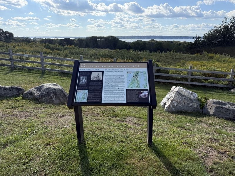
2. The Battle of Rhode Island - 1778 Marker
Smith’s column on East Main Road soon ran into trouble, when it was ambushed by an American picket at the corner of present-day Union Street. ❸ German reinforcements hurried along Union Street, and after regrouping, Smith pushed the Americans up East Main Road to Quaker Hill. On West Main Road, the Germans drove the Americans north to a fortified position on Turkey Hill. ❹ As the British continued to press the attack, Sullivan ordered the American rear guard to retire north to the main line. ❺ As the Americans withdrew from Quaker Hill, Smith’s regiments charged up East Main Road and attacked the left flank of the Americans main line. Under the command of General John Glover, the Americans repulsed the enemy, who withdrew to Quaker Hill. ❻ Meanwhile, the Hessians had advanced up West Main Road and occupied Almy Hill and Turkey Hill, facing the American’s right. It soon became clear that the key to the American position was on their right. Here, the heights that characterized the left and center ran out and to the west of Lehigh Hill. The relatively flat ground which extended along the shoreline to the north, offering a clear route to the rear of the American lines.
The Americans had fortified Lehigh Hill and manned a redoubt in front of the hill with the First Rhode Island Regiment, an infantry regiment that included slaves, free blacks, and Native Americans who fought for the cause of independence.
The Hessians launched three attacks against the American right. ❼ The first two attacks were broken up and repulsed by musket fire before they reached the American line. The third attack was more determined than the previous two, and nearly succeeded in carrying Lehigh Hill. However, the First Rhode Island Regiment held their position, and American reinforcements surged forward. Rhode Island’s own Major-General Nathaniel Greene had command of the right flank, and he described the action as follows:
“A warm Cannonade commenced and lasted for several hours with continual Skirmishes in front of both lines. About two o’Clock the enemy began to advance in force upon our right as if they intended to dislodge us from the advance redoubt. I had the command of the Right Wing. After advancing four Regts and finding the enemy still gaining ground I advanced with two more Regiments of regular Troops and a Brigade of Militia and at the same time Gen. Sullivan ordered Col. Livingston with Light Troops under his command to advance. We soon put the enemy to the rout and I had the pleasure of seeing them run in worse disorder than they did at the Battle of Monmouth.” (Showman 1980: 501-502)
At the close of the Battle of Rhode Island, both sides occupied fortified positions on the hills overlooking the valley. With the knowledge that General Clinton was on his way to Newport with 5,000 more British troops, Sullivan realized that evacuation to the mainland was necessary and safely ferried his troops back to Tiverton. ❽ The Americans attempt to dislodge the British forces had failed, and the British occupied Newport and the whole of Aquidneck Island for another year until they abandoned Newport in October of 1779. French forces afterward entered Newport and were stationed there until the Yorktown campaign in 1781.
The Rhode Island “Black Regiment”
In February, 1778, to meet growing manpower needs, the Rhode Island General Assembly passed a law promising black recruits “All the bounties, wages and encouragements of other troops.” The famous “Black Regiment” of Rhode Island was formed in the spring of 1778 to replace the members of the 1st Rhode Island Regiment who had died throughout the early campaigns of the Revolutionary War. Upon passing muster, slaves were to be immediately discharged from the service of their master or mistress and freed, as though never encumbered with either servitude or slavery. Free black men and Native Americans also volunteered and served in the 1st Rhode Island Regiment, where they were segregated in companies serving under white officers. The regiment is significant as the first predominantly black regiment to fight in the American army. After fighting for five years, black veterans returned to Rhode Island at the end of the war to the continuing struggle for jobs, equality and the money due to them for their participation in the war.
Topics. This historical marker is listed in these topic lists: War, US Revolutionary • Waterways & Vessels. A significant historical month for this entry is February 1778.
Location. 41° 36.68′ N, 71° 15.626′ W. Marker is in Portsmouth, Rhode Island, in Newport County. It is on West Main Road (Rhode Island Route 114) south of Willow Lane, on the right when traveling south. Touch for map. Marker is at or near this postal address: 158 W Main Rd, Portsmouth RI 02871, United States of America. Touch for directions.

Regionally, this marker is on Narragansett Bay and in Newport and Aquidneck Island. It is also in the American Northeast, in New England, and on the Eastern Seaboard. Globally, it is in the North Atlantic Region, North America, the Western Hemisphere, the Western World, and the Anglosphere. Historically, it finds itself in what was once one of the original Thirteen Colonies.
Other nearby markers. At least 8 other markers are within 2 miles of this marker, measured as the crow flies: The Garden of New England (here, next to this marker); Butts Hill Fort (approx. 0.6 miles away); The 1st Rhode Island Regiment and the Battle of Rhode Island (approx. 0.7 miles away); Site of the Battle of Rhode Island (approx. 0.7 miles away); The Black Regiment (approx. 0.7 miles away); Sri Chinmoy Peace Town (approx. 1.3 miles away); Portsmouth Compact (approx. 1.3 miles away); Anne Hutchinson/Mary Dyer Memorial Herb Garden (approx. 1.3 miles away). Touch for a list and map of all markers in Portsmouth.
Other markers no longer nearby. The Battle of Rhode Island - 1778 (has been replaced with this marker); a different marker also named Garden of New England (was a few steps from this marker but has been replaced with another marker now near it).
Credits. This page was last revised on September 27, 2026. It was originally submitted on September 27, 2026, by Devry Becker Jones of Washington, District of Columbia. This page has been viewed 4 times since then. Photos: 1, 2. submitted on September 27, 2026, by Devry Becker Jones of Washington, District of Columbia.
