Chattahoochee in Gadsden County, Florida — The American South (South Atlantic)
What was the Creek War of 1813-1814?
Photographed by James L.Whitman, September 26, 2026
1. What was the Creek War of 1813-1814 Marker
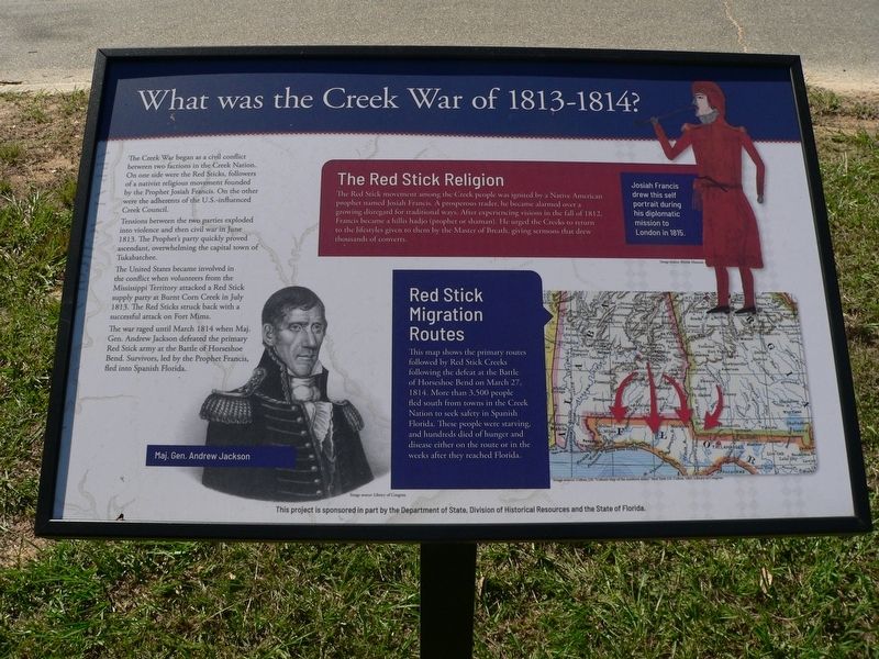
The Creek War began as a chill conflict between two factions in the Creek Nation. On one side were the Red Sticks, followers of a nativist religious movement founded by the Prophet Josiah Francis. On the other were the adherents of the U.S.-influenced Creek Council.
Tensions between the two parties exploded into violence and then civil war in June 1813. The Prophet's party quickly proved ascendant, overwhelming the capital town of Tukabatchee.
The United States became involved in the conflict when volunteers from the Mississippi Territory attacked a Red Stick supply party at Burnt Corn Creek in July 1813. The Red Sticks struck back with a successful attack on Fort Mims.
The war raged until March 1814 when Maj. Gen. Andrew Jackson defeated the primary Red Stick army at the Battle of Horseshoe Bend. Survivors, led by the Prophet Francis, fled into Spanish Florida.
The Red Stick Religion
The Red Stick movement among the Creek people was ignited by a Native American prophet named Josiah Francis. A prosperous trader, he became alarmed over a growing disregard for traditional ways. After experiencing visions in
this page online
Josiah Francis drew this self portrait during his diplomatic mission to London in 1815. Image source: British Museum
Red Stick Migration Routes
This map shows the primary routes followed by Red Stick Creeks following the defeat at the Battle of Horseshoe Bend on March 27, 1814. More than 3,500 people fled south from towns in the Creek Nation to seek safety in Spanish Florida. These people were starving and hundreds died of hunger and disease either on the route or in the weeks after they reached Florida. Image source: Colton, J.H. "Colton's Map of the southern states," New York J.H. Colton, 1861, Library of Congress
Maj. Gen. Andrew Jackson Image source: Library of Congress
This project is sponsored in part by the Department of State. Division of Historical Resources and the State of Florida
Erected 2026 by Department of State, Division of Historical Resources and the State of Florida.
Topics. This historical
Photographed by James L.Whitman, September 26, 2026
2. What was the Creek War of 1813-1814 Marker
Location. 30° 42.035′ N, 84° 51.391′ W. Marker is in Chattahoochee, Florida, in Gadsden County. It is at the intersection of South River Landing Road and North River Landing Road, on the left when traveling south on South River Landing Road. Touch for map. Marker is at or near this postal address: 500 S River Landing Rd, Chattahoochee FL 32324, United States of America. Touch for directions.

Regionally, this marker is in Greater Tallahassee and on the Florida Panhandle. It is also in the American South and specifically in the Deep South. Globally, it is in the North Atlantic Region, North America, a Gulf of Mexico state, the Western Hemisphere, the Western World, and the Anglosphere. Historically, it finds itself in what was once New Spain, the territory of the Mississippian Culture, one of the Confederate States of America, and the Antebellum South.
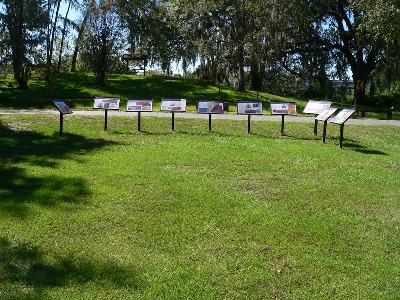
Other nearby markers. At least 8 other markers are within walking distance of this marker: Red Coat Arrival (here, next to this marker); Seminole Appeal (here, next to this marker); Construction of Nicolls'Outpost (here, next to this marker); Archaeology of Nicolls' Outpost (here, next to this marker); The Front Line of Freedom (here, next to this marker); The British Evacuation (here, next to this marker); Confrontation with the United States (here, next to this marker); The Treaty of Nicolls' Outpost (here, next to this marker). Touch for a list and map of all markers in Chattahoochee.
Credits. This page was last revised on October 19, 2026. It was originally submitted on September 28, 2026, by James L.Whitman of Eufaula, Alabama. This page has been viewed 3 times since then. Photos: 1, 2. submitted on September 28, 2026, by James L.Whitman of Eufaula, Alabama. • Bernard Fisher was the editor who published this page.
