Jasper, Alberta — Canada’s Prairie Region (North America)
‘Unknown’ Lands
Peaks and People
⎯⎯⎯
Terra incognita
Des sommets et des hommes
| — | Jasper Discovery Trail / Sentier de la découverte-de-Jasper | — |
Photographed by Cosmos Mariner, July 5, 2022
1. ‘Unknown’ Lands / Terra incognita Marker

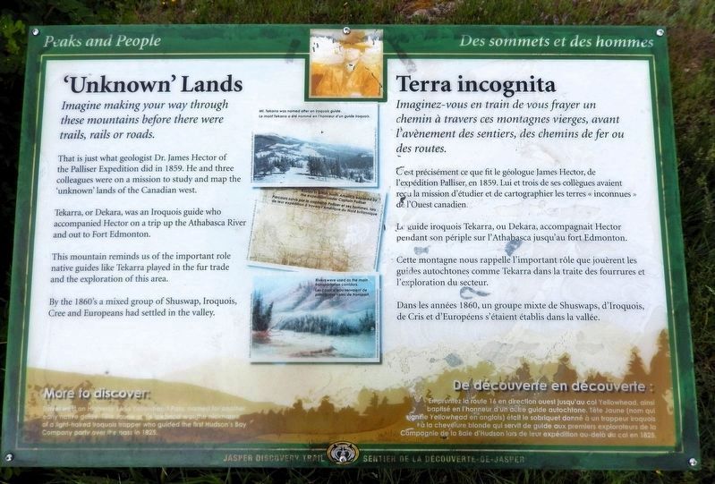
Imagine making your way through these mountains before there were trails, rails or roads.
That is just what geologist Dr. James Hector of the Palliser Expedition did in 1859. He and three colleagues were on a mission to study and map the ‘unknown’ lands of the Canadian west.
Tekarra, or Dekara, was an Iroquois guide who accompanied Hector on a trip up the Athabasca River and out to Fort Edmonton.
This mountain reminds us of the important role native guides like Tekarra played in the fur trade and the exploration of this area.
By the 1860's a mixed group of Shuswap, Iroquois, Cree and Europeans had settled in the valley.
[image captions]
• Mt. Tekarra was named after an Iroquois guide. [Jasper-Yellowhead Museum and Archives (89.36.27)]
• Routes in British North America explored by the expedition under Captain Palliser [Library and Archives Canada (G3466.S12 1857.P34 H1 I-3)]
• Rivers were used as the main transportation corridors. [Library and Archives Canada: Sir Henry James Warre’s fonds]
More to discover: Travel west on Highway 16 to Yellowhead Pass, named for another early native guide. Tête Jaune or Yellowhead was the nickname of a light-haired Iroquois trapper who guided the first Hudson’s Bay Company party over the pass in 1825.
this page online
Imaginez-vous en train de vous frayer un chemin à travers ces montagnes vierges, avant l'avènement des sentiers, des chemins de fer ou des routes.
C’est précisément ce que fit le géologue James Hector, de l'expédition Palliser, en 1859. Lui et trois de ses collègues avaient reçu la mission d'étudier et de cartographier les terres « inconnues » de l'Ouest canadien.
Le guide iroquois Tekarra, ou Dekara, accompagnait Hector pendant son périple sur l'Athabasca jusqu'au fort Edmonton.
Cette montagne nous rappelle l'important rôle que jouèrent les guides autochtones comme Tekarra dans la traite des fourrures et l'exploration du secteur.
Dans les années 1860, un groupe mixte de Shuswaps, d'Iroquois, de Cris et d'Européens s'étaient établis dans la vallée.
[légendes d'images]
• Le mont Tekarra a été nommé en l’honneur d’un guide iroquois. [Musée et centre d’archives Jasper-Yellowhead (89.36.27)]
• Parcours suivis par le capitaine Palliser et ses hommes, lors de leur expédition à travers l’Amérique du Nord britannique. [Bibliothèque et Archives Canada (G3466.S12 1857.P34 H1 I-3)]
• Les cours d’eau servaient de principales voles de
Photographed by Cosmos Mariner, July 5, 2022
2. ‘Unknown’ Lands / Terra incognita Marker
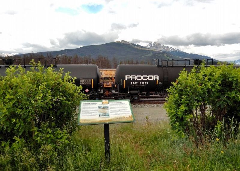
Looking east from the recreational trail that parallels Connaught Drive. Mount Tekarra is beyond the active rail yard in the background.
De découverte en découverte : Empruntez la route 16 en direction ouest jusqu'au col Yellowhead, ainsi baptisé en l’honneur d’un autre guide autochtone. Tête Jaune (nom qui signifie Yellowhead en anglais) était le sobriquet donné à un trappeur iroquois à la Chevelure blonde qui servit de guide aux premiers explorateurs de la Compagnie de la Baie d'Hudson lors de leur expédition au-delà el col en 1825.
Erected by Jasper Discovery Trail / Sentier de la découverte-de-Jasper.
Topics. This historical marker is listed in these topic lists: Exploration • Indigenous Peoples and Communities • Settlements & Settlers. A significant historical year for this entry is 1859.
Location. 52° 52.945′ N, 118° 4.662′ W. Marker is in Jasper, Alberta. It can be reached from Connaught Drive just north of Aspen Avenue, on the right when traveling north. The marker is on the recreational trail that parallels Connaught Drive, about 10 meters east of the street. Touch for map. Marker is in this post office area: Jasper AB T0E 0A8, Canada. Touch for directions.

Regionally, this marker is in the Canadian Rockies. It is also in the Prairies. Globally, it is in North America, the Rocky Mountains, the Western Hemisphere, the Western World, and the Anglosphere. Historically, it finds itself in what was once a British colony and also Rupert’s Land.
Other nearby markers. At least 8 other markers are within walking distance of this marker: First People / Les premiers habitants (approx. 0.4 kilometers away); Memories of Home / Souvenirs d'un lieu de résidence / Weekiwawoo isitapatamook (approx. half a kilometer away); A Lasting Legacy / Un legs durable / Aniskoonamakewin (approx. half a kilometer away); The First Homesteaders / Les premiers homesteaders / Nistum Oota Ka Ki Weekichik (approx. half a kilometer away); Original Jasper National Park Information Centre (approx. 0.6 kilometers away); Jasper's Raven Totem Pole 1915-2009 / Mât totémique du Corbeau de Jasper de 1915 à 2009 (approx. 0.6 kilometers away); Two Brothers Totem Pole 2011 / Mât totémique des Deux-Frères 2011 (approx. 0.6 kilometers away); Jasper Information Centre/Le centre d'information de Jasper (approx. 0.6 kilometers away). Touch for a list and map of all markers in Jasper.
Also see . . . Palliser Expedition (Wikipedia).
Excerpt: The Palliser expedition, officially the British North American Exploring Expedition, explored and surveyed the open prairies and rugged wilderness of western Canada from 1857 to 1860. The expedition was led by Irish-born explorer John Palliser and accompanied by a party of four other men: James Hector, Eugène Bourgeau, Thomas Blakiston and John W. Sullivan. With the support of the British government and the Royal Geographical Society it became an official expedition with the stated purpose of gathering scientific information about the landscapes of British-claimed north-western North America (today's western Canada), in particular the territory of Rupert's Land, including information on the geography, climate, soil, flora and fauna, in order to discover its capabilities for settlement and transportation. As well, local guides and interpreters traveled with the party and assisted with its work.(Submitted on September 30, 2026, by Cosmos Mariner of Cape Canaveral, Florida.)
The expedition was the first detailed and scientific survey of the region between Lake Superior and the southern passes of the Rocky Mountains in British North America. The expedition provided a better understanding of the remote western frontier, and the new observations and knowledge were significant for the expansion into and development of the western prairies by European settlers. The expedition's reports impacted changes in the economy, settlement, transportation, Indigenous communities and the campaign for expansionism in Canada.
Credits. This page was last revised on September 30, 2026. It was originally submitted on September 29, 2026, by Cosmos Mariner of Cape Canaveral, Florida. This page has been viewed 5 times since then. Photos: 1, 2. submitted on September 30, 2026, by Cosmos Mariner of Cape Canaveral, Florida.
