Gouda, South Holland, Netherlands — Northwestern Europe
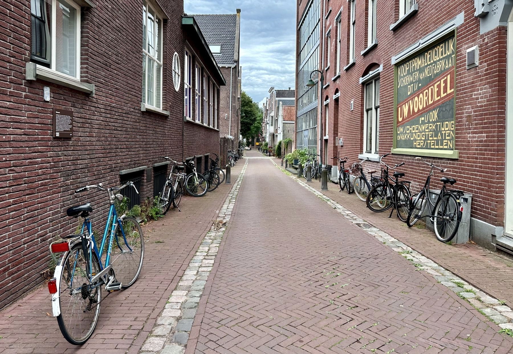
Molenwerf
Photographed by Andrew Ruppenstein, September 2, 2026
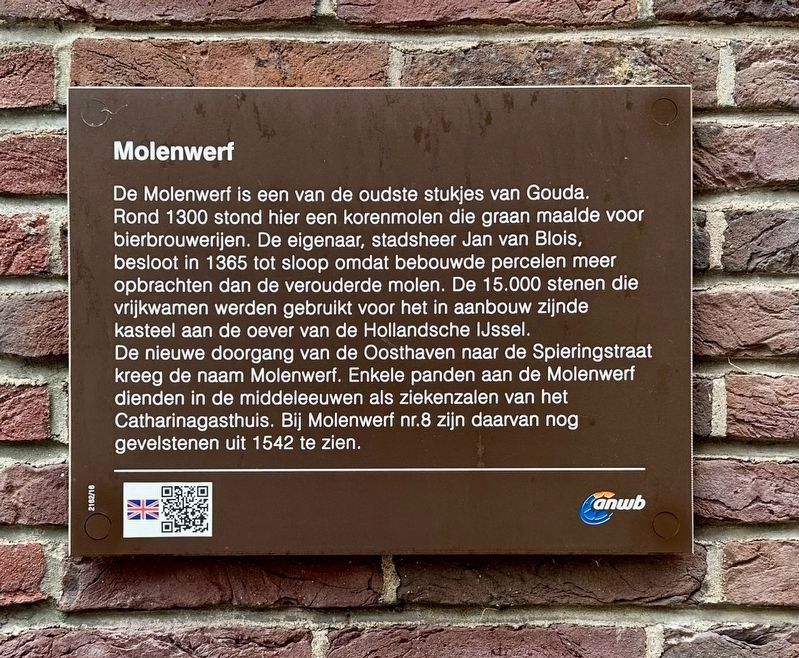
1. Molenwerf Marker
Inscription.
De Mollenwerf is een van de oudste stukjes van Gouda.
Rond 1300 stond hier een korenmolen die graan maalde voor
bierbrouwerijen. De eigenaar, stadsheer Jan van Blois,
besloot in 1365 tot sloop omdat bebouwde percelen meer
opbrachten dan de verouderde molen. De 15.000 stenen die
vrijkwamen werden gebruikt voor het in aanbouw zijnde
kasteel aan de oever van de Hollandsche IJssel.
De nieuwe doorgang van de Oosthaven naar de Spieringstraat
kreeg de naam Molenwerf. Enkele panden aan de Molenwerf
dienden in de middeleeuwen als ziekenzalen van het
Catharinagasthuis. Bij Molenwerf nr.8 zijn daarvan nog
gevelstenen uit 1542 te zien.
De Mollenwerf is one of the oldest parts of Gouda. Around 1300, a windmill stood here, grinding grain for beer breweries. In 1365, the owner—the city's lord, Jan van Blois—decided to have it demolished, as developed plots yielded higher returns than the outdated mill. The 15,000 bricks recovered from the site were used for the castle then under construction on the banks of the Hollandsche IJssel. The new passageway connecting Oosthaven and Spieringstraat was named Molenwerf. During
Click or scan to see this page online
the Middle Ages, several buildings on Molenwerf served as wards for the Catharinagasthuis (St. Catherine’s Hospital); at No. 8 Molenwerf, original gable stones from 1542 can still be seen.
Erected by the ANWB. (Marker Number 2162/16.)
Topics. This historical marker is listed in these topic lists: Industry & Commerce • Roads & Vehicles. A significant historical year for this entry is 1300.
Location. 52° 0.589′ N, 4° 42.687′ E. Marker is in Gouda, Zuid-Holland (South Holland). It is on Mollenwerf near Oosthaven, on the right when traveling west. Touch for map. Marker is at or near this postal address: Oosthaven 12, Gouda, Zuid-Holland 2801 PP, Netherlands. Touch for directions.
Regionally, it is in Europe, the European Union, Atlantic Europe, the Benelux Low Countries, the Schengen Area, Western Europe, and the Western World. Historically, it finds itself in what was once the Roman Empire and specifically also the Holy Roman Empire.
Credits. This page was last revised on September 29, 2026. It was originally submitted on September 29, 2026, by Andrew Ruppenstein of Lamorinda, California. This page has been viewed 8 times since then. Photos:1, 2. submitted on September 29, 2026, by Andrew Ruppenstein of Lamorinda, California.