Jasper, Alberta — Canada’s Prairie Region (North America)
Memories of Home
⎯⎯⎯
Souvenirs d'un lieu de résidence
⎯⎯⎯
Weekiwawoo isitapatamook
Photographed by Cosmos Mariner, July 6, 2022
1. Memories of Home / Souvenirs d'un lieu de résidence / Weekiwawoo isitapatamook Marker

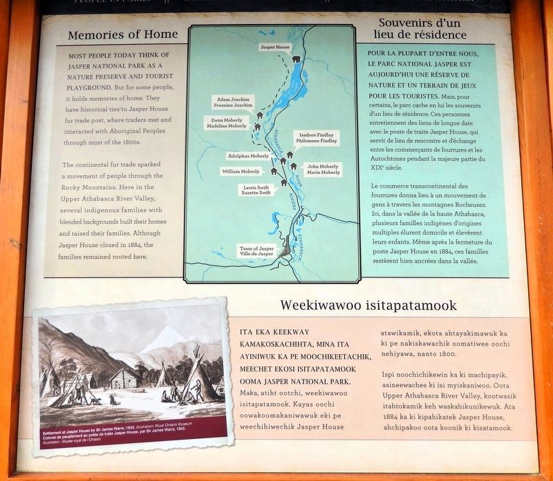
Most people today think of Jasper National Park as a nature preserve and tourist playground. But for some people, it holds memories of home. They have historical ties to Jasper House fur trade post, where traders met and interacted with Aboriginal Peoples through most of the 1800s.
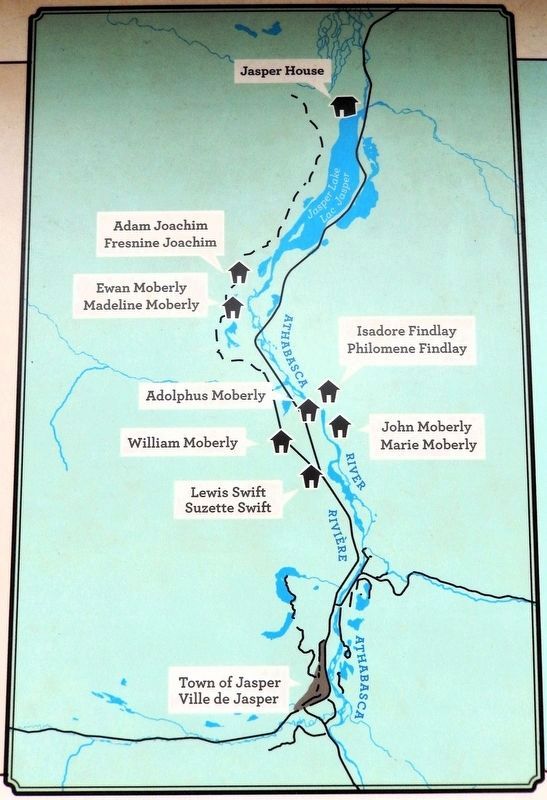
The continental fur trade sparked a movement of people through the Rocky Mountains. Here in the Upper Athabasca River Valley, several indigenous families with blended backgrounds built their homes and raised their families. Although Jasper House closed in 1884, the families remained rooted here.
Pour la plupart d'entre nous, le parc national Jasper est aujourd'hui une réserve de nature et un terrain de jeux pour les touristes. Mais, pour certains, le parc cache en lui les souvenirs d'un lieu de résidence. Ces personnes entretiennent des liens de longue date avec le poste de traite Jasper House, qui servit de lieu de rencontre et d'échange entre les commerçants de fourrures et les Autochtones pendant la majeure partie du XIXe siècle.
Le commerce transcontinental des fourrures donna
this page online
Ita eka keekway kamakoskachihta, mina ita ayiniwuk ka pe moochikeetachik, meechet ekosi isitapatamook ooma Jasper National Park. Maka, atiht ootchi, weekiwawoo isitapatamook. Kayas oochi oowakoomakaniwawuk eki pe weechihiwechik Jasper House atawikamik, ekota ahtayakimawuk ka ki pe nakiskawachik oomatiwee oochi nehiyawa, nanto 1800.
Ispi noochichikewin ka ki machipayik, asineewachee ki isi myiskaniwoo. Oota Upper Athabasca River Valley, kootwasik itahtokamik keh waskahikunikewuk. Ata 1884 ka ki kipahikatek Jasper House, ahchipakoo oota koonik ki kisatamook.
Topics. This historical marker is listed in these topic lists: Indigenous Peoples and Communities • Industry & Commerce. A significant historical year for this entry is 1884.
Location. 52° 52.669′ N, 118° 4.758′ W. Marker is in Jasper, Alberta.
2. Marker detail: Athabasca River Valley

Regionally, this marker is in the Canadian Rockies. It is also in the Prairies. Globally, it is in North America, the Rocky Mountains, the Western Hemisphere, the Western World, and the Anglosphere. Historically, it finds itself in what was once a British colony and also Rupert’s Land.
Other nearby markers. At least 8 other markers are within walking distance of this marker: The First Homesteaders / Les premiers homesteaders / Nistum Oota Ka Ki Weekichik (here, next to this marker); A Lasting Legacy / Un legs durable / Aniskoonamakewin (here, next to this marker); Original Jasper National Park Information Centre (within shouting distance of this marker); Jasper's Raven Totem Pole 1915-2009 / Mât totémique du Corbeau de Jasper de 1915 à 2009 (within shouting distance of this marker); Two Brothers Totem Pole 2011 / Mât totémique des Deux-Frères 2011 (within shouting distance of this marker); Jasper Information Centre/Le centre d'information de Jasper (about 90 meters away, measured in a direct line); First People / Les premiers habitants (about 180 meters away); Gateway to a Community and a Park (about 180 meters away). Touch for a list and map of all markers in Jasper.
Related markers. Click here for a list of markers that are related to this marker.
Also see . . .
1. Jasper House National Historic Site (Parks Canada).
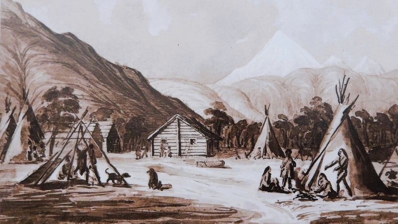
Excerpt: In 1813, the North West Company built Rocky Mountain Portage House on Brûlé Lake as a provision depot for brigades crossing the Athabasca Pass to the Pacific. When Jasper Haws took command of the post in 1815, it became known as “Jasper's House,”(Submitted on September 30, 2026, by Cosmos Mariner of Cape Canaveral, Florida.)to avoid confusion with Rocky Mountain House on the North Saskatchewan River. Under the trained eye of Jasper Haws, the post became the centre of a modest and diverse community responsible for meeting transportation and supply needs, caring for horses grazing in the valley, and trading goods for meat and furs with Aboriginal groups, including Iroquois and Métis peoples.Courtesy Royal Ontario Museum3. Marker detail: Settlement at Jasper House
by Sir James Warre, 1845Colonie de peuplement au poste de traite Jasper House, par Sir James Warre, 1845.Jasper married an Iroquois woman and fathered no less than five children - three boys and at least two girls. He remained at Jasper House until 1821. When the North West Company was forced to amalgamate with the Hudson's Bay Company, he was suddenly without work. Leaving his wife and daughters with family, Jasper returned with his sons to Québec.
2. Jasper House (Wikipedia).
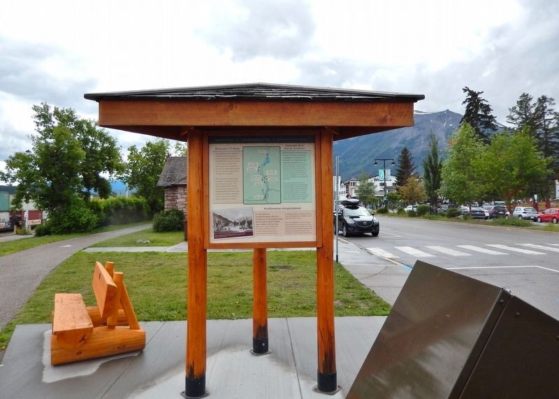
Excerpt: The site operated until 1853 and was occasionally used until 1858 when it was reopened seasonally by Henry John Moberly, who operated it into the 1860s. The post was officially closed in 1884 after years of inactivity. From 1891 or 1892 to 1894 the house was used by miner Lewis Swift. The(Submitted on September 30, 2026, by Cosmos Mariner of Cape Canaveral, Florida.)building was destroyed in 1909 when its lumber was used to make a raft by surveyors for the Grand Trunk Pacific Railway. Apart from a small cemetery, no significant ruins remain.Photographed by Cosmos Mariner, July 5, 20224. Memories of Home / Souvenirs d'un lieu de résidence / Weekiwawoo isitapatamook MarkerLooking south along Connaught Drive. This marker is the north-facing panel on a triangular sidewalk interpretive kiosk.
Credits. This page was last revised on October 1, 2026. It was originally submitted on September 29, 2026, by Cosmos Mariner of Cape Canaveral, Florida. This page has been viewed 5 times since then. Photos: 1, 2, 3, 4. submitted on September 30, 2026, by Cosmos Mariner of Cape Canaveral, Florida.
