Pascoag in Burrillville in Providence County, Rhode Island — The American Northeast (New England)
The White Mill
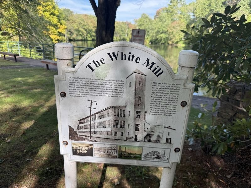
The first mill built near this site in 1834 for owner Arnold Hunt, operated on and off until 1892, when it burnt down. The water rights were originally purchased from Moses Taft, another mill owner, supposedly over a turkey dinner. (Hence the christening of the nearby neighborhood as "Turkeyville"). the mill was rebuilt and operated as the White or Prendergast Mill until it closed for good in the early 1970's. Ownership of the mill and the property itself passed through many hands throughout its lifetime. A textile mill, it employed nearly 100 workers at its height, and utilized first water, then steam, and finally electric power.
Mills such as this were vital to the town's economy. In the 19th century, Pascoag had the most mills and the largest population in Burrillville. Mills provided jobs for the citizens and profits for the town. Neighborhoods in Burrillville were built around the mills. However, in the mid 1960's, most mill markets moved South to cheaper labor, and the mill-based economy with it. The importance of mills and their effect on the history of our Town shows us how vital an industry it was towards
this page online
Topics. This historical marker is listed in these topic lists: Industry & Commerce • Settlements & Settlers • Waterways & Vessels. A significant historical year for this entry is 1834.
Location. 41° 57.902′ N, 71° 42.873′ W. Marker is in Burrillville, Rhode Island, in Providence County. It is in Pascoag. It is at the intersection of East Wallum Lake Road and Church Street (Rhode Island Route 100), on the right when traveling west on East Wallum Lake Road. Touch for map. Marker is at or near this postal address: 468 Church St, Pascoag RI 02859, United States of America. Touch for directions.

Regionally, this marker is in Greater Providence. It is also in the American Northeast, in New England, and on the Eastern Seaboard. Globally, it is in the North Atlantic Region, North America, the Western Hemisphere, the Western World, and the Anglosphere. Historically, it finds itself in what was once one of the original Thirteen Colonies.
Other nearby markers. At least 8 other markers are within 5 miles of this marker, measured as the crow flies: Burrillville Veterans Plaque (approx. 0.8 miles away);
Credits. This page was last revised on September 29, 2026. It was originally submitted on September 29, 2026, by Devry Becker Jones of Washington, District of Columbia. This page has been viewed 3 times since then. Photos: 1, 2. submitted on September 29, 2026, by Devry Becker Jones of Washington, District of Columbia.
