THE HISTORICAL
MARKER DATABASE
“Bite-Size Bits of Local, National, and Global History”
Cranston in Providence County, Rhode Island — The American Northeast (New England)
 

Spragueville

— Cranston Discovery Network —


Spragueville Marker image. Click for full size.
Photographed by Devry Becker Jones (CC0), September 19, 2026
1. Spragueville Marker
Inscription.
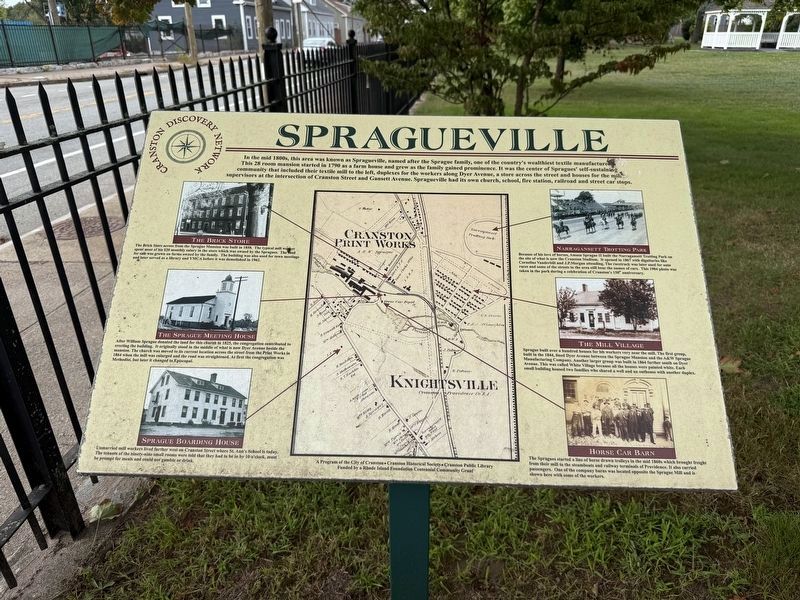
In the mid 1800s, this area was known as Spragueville, named after the Sprague family, one of the country's wealthiest textile manufacturers. This 28 room mansion started in 1790 as a farm house and grew as the family gained prominence. It was the center of Spragues' self-sustaining community that included their textile mill to the left, duplexes for the workers along Dyer Avenue, a store across the street and houses for the mill supervisors at the intersection of Cranston Street and Gansett Avenue. Spragueville had its own church, school, fire station, railroad and street car stops.

The Brick Store
The Brick Store across from the Sprague Mansion was built in 1858. The typical mill worker spent most of his $10 monthly salary in the store which was owned by the Spragues. The food he ate was grown on farms owned by the family. The building was also used for town meetings and later served as a library and YMCA before it was demolished in 1961.

The Sprague Meeting House
After William Sprague donated the land for this church in 1828, the congregation contributed to erecting the building. It originally stood in the
Paid Advertisement
Click or scan to see
this page online
middle of what is now Dyer Avenue inside the mansion. The church was moved to its current location across the street from the Print Works in 1864 when the mill was enlarged and the road was straightened. At first the congregation was Methodist, but later it changed to Episcopal.

Sprague Boarding House
Unmarried mill workers lived where today stands Cranston Street where St. Ann's School is today. The tenants of the ninety-nine small rooms were told that they had to be in by 10 o'clock, must be prompt for meals and could not gamble or drink.

Narragansett Trotting Park
Because of his love of horses, Amasa Sprague II built the Narragansett Trotting Park, on the site of what is now the Cranston Stadium. It opened in 1867 with dignitaries like Cornelius Vanderbilt and J.P. Morgan attending. The racetrack was later used for auto races and some of the streets in the area still bear the names of cars. This 1904 photo was taken in the park during a celebration of Cranston's 150th anniversary.

The Mill Village
Sprague built over a hundred houses for his workers very near the mill. The first group, built in the 1844, lined Dyer Avenue
Spragueville Marker image. Click for full size.
Photographed by Devry Becker Jones (CC0), September 19, 2026
2. Spragueville Marker
between the Sprague Mansion and the A&W Sprague Manufacturing Company. Another larger group was built in 1864 further south on Dyer Avenue. This was called White Village because all the houses were painted white. Each small building housed two families who shared a well and an outhouse with another duplex.

Horse Car Barn
The Spragues started a line of horse drawn trolleys in the mid 1860s which brought freight from their mill to the steamboats and railway terminals of Providence. It also carried passengers. One of the company barns was located opposite the Sprague Mill and is shown here with some of the workers.
 
Erected by Cranston Discovery Network.
 
Topics. This historical marker is listed in these topic lists: Industry & Commerce • Parks & Recreational Areas • Religion & Religious Structures • Settlements & Settlers. A significant historical year for this entry is 1790.
 
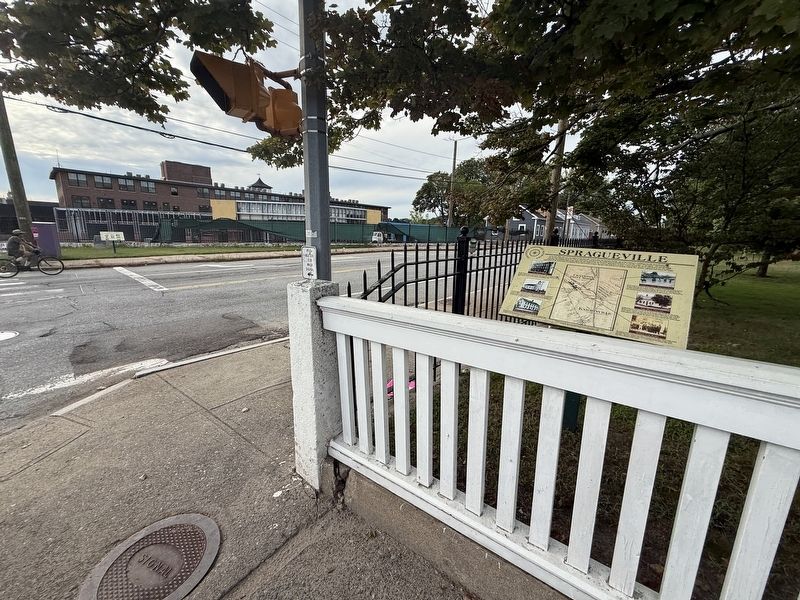
Location. 41° 47.432′ N, 71° 27.424′ W. Marker is in Cranston, Rhode Island, in Providence County. It is at the intersection of Cranston Street and Dyer Avenue, on the right when traveling west on Cranston Street. Touch for map. Marker is at
Paid Advertisement
or near this postal address: 1370 Cranston St, Cranston RI 02920, United States of America. Touch for directions.

Regionally, this marker is in Greater Providence. It is also in the American Northeast, in New England, and on the Eastern Seaboard. Globally, it is in the North Atlantic Region, North America, the Western Hemisphere, the Western World, and the Anglosphere. Historically, it finds itself in what was once one of the original Thirteen Colonies.

Other nearby markers. At least 8 other markers are within 2 miles of this marker, measured as the crow flies: Print Works (within shouting distance of this marker); Clarence Surprise Square (within shouting distance of this marker); Vietnam War (approx. 1.3 miles away); Viet Nam Memorial Quadrangle (approx. 1.3 miles away); Armed Forces Memorial (approx. 1.3 miles away); World War II, Korean Conflict and Vietnam War Memorial (approx. 1.4 miles away); Veterans Memorial (approx. 1.4 miles away); RI Freedom Monument (approx. 1.4 miles away). Touch for a list and map of all markers in Cranston.
 
 
Credits. This page was last revised on September 30, 2026. It was originally submitted on September 29, 2026, by Devry Becker Jones of Washington, District of Columbia. This page has been viewed 3 times since then. Photos:   1, 2. submitted on September 29, 2026, by Devry Becker Jones of Washington, District of Columbia.

m=312422

CeraNet Cloud Computing sponsors the Historical Marker Database.
This website earns income from purchases you make after using our links to Amazon.com. We appreciate your support.
Paid Advertisement
Oct. 1, 2026