Near Interior in Jackson County, South Dakota — The American Midwest (Upper Plains)
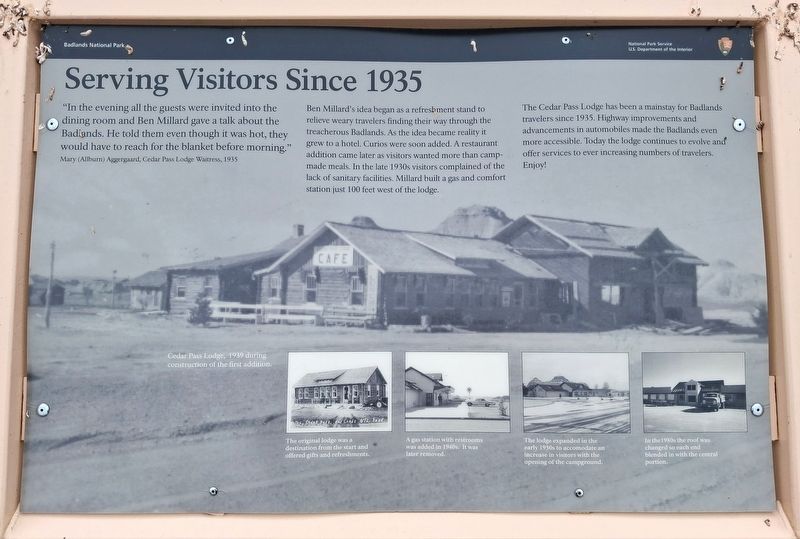
Serving Visitors Since 1935
Photographed by William Fischer, Jr., September 18, 2026
1. Serving Visitors Since 1935 Marker
"In the evening all the guests were invited into the dining room and Ben Millard gave a talk about the Badlands. He told them even though it was hot, they would have to reach for the blanket before morning."
Mary (Allburn) Aggergaard, Cedar Pass Lodge Waitress, 1935
Ben Millard's idea began as a refreshment stand to relieve weary travelers finding their way through the treacherous Badlands. As the idea became reality it grew to a hotel. Curios were soon added. A restaurant addition came later as visitors wanted more than camp-made meals. In the late 1930s visitors complained of the lack of sanitary facilities. Millard built a gas and comfort station just 100 feet west of the lodge.
The Cedar Pass Lodge has been a mainstay for Badlands travelers since 1935. Highway improvements and advancements in automobiles made the Badlands even more accessible. Today the lodge continues to evolve and offer services to ever increasing numbers of travelers. Enjoy!
[Photo captions, left to right, read]
• Cedar Pass Lodge, 1939 during construction of the first addition.
• The original lodge was a destination from
this page online
• A gas station with restrooms was added in 1940. It was later removed.
• The lodge expanded in the early 1950s to accom[m]odate an increase in visitors with the opening of the campground.
• In the 1980s the roof was blended in with the central portion.
Erected by National Park Service.
Topics. This historical marker is listed in these topic lists: Industry & Commerce • Parks & Recreational Areas. A significant historical year for this entry is 1935.
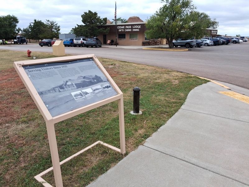
Location. 43° 44.898′ N, 101° 56.688′ W. Marker is near Interior, South Dakota, in Jackson County. It is on Badlands Loop Road (State Highway 240), on the right when traveling north. Marker is near Cedar Pass Lodge, in Badlands National Park. Touch for map. Marker is in this post office area: Interior SD 57750, United States of America. Touch for directions.

Regionally, this marker is on the Oglala Lakota Pine Ridge Reservation, in West River, and in the Badlands. It is also in the American Lewis & Clark Corridor, on the prairies, and on the Northern Plains. Globally, it is in North America, the Western Hemisphere, the
Photographed by William Fischer, Jr., September 18, 2026
2. Serving Visitors Since 1935 Marker
Other nearby markers. At least 8 other markers are within 4 miles of this marker, measured as the crow flies: Cliff Shelf Nature Trail (approx. 0.7 miles away); A Slump And A Bump (approx. ¾ mile away); Badlands Oasis (approx. 0.8 miles away); Anatomy of a Badland (approx. 1½ miles away); Mako sica (approx. 1½ miles away); Saddle Pass Trail (approx. 1.6 miles away); Town of Interior (approx. 2.4 miles away); Bands of Time (approx. 3.4 miles away). Touch for a list and map of all markers in Interior.
Also see . . . Badlands National Park. (Submitted on September 29, 2026, by William Fischer, Jr. of Reynoldsburg, Ohio.)
Credits. This page was last revised on September 29, 2026. It was originally submitted on September 29, 2026, by William Fischer, Jr. of Reynoldsburg, Ohio. This page has been viewed 5 times since then. Photos: 1, 2. submitted on September 29, 2026, by William Fischer, Jr. of Reynoldsburg, Ohio.
