Gouda, South Holland, Netherlands — Northwestern Europe
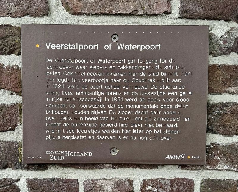
Veerstalpoort of Waterpoort
⎯⎯⎯
Veerstal Gate or Water Gate
Photographed by Andrew Ruppenstein, September 2, 2026
1. Veerstalpoort of Waterpoort Marker

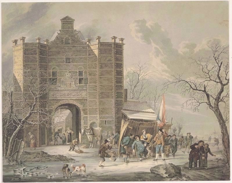
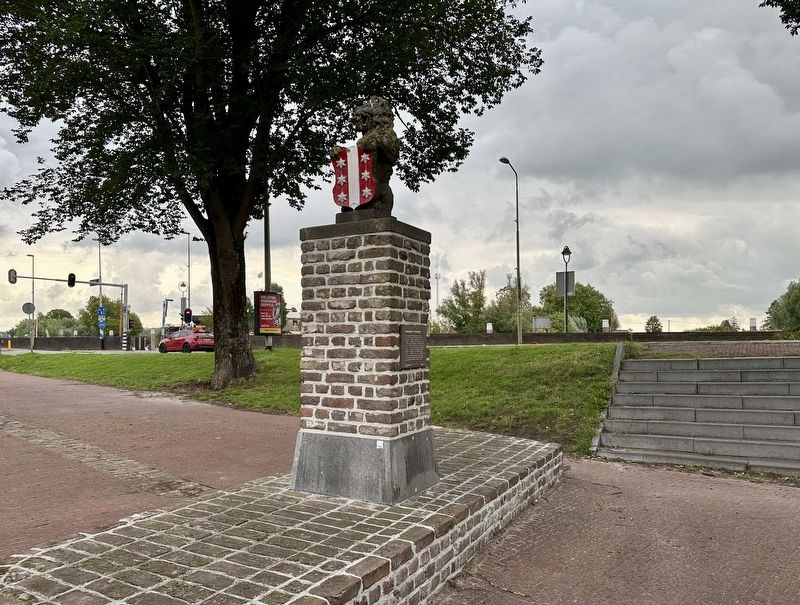
De Veerstal poort of Waterpoort gaf toegang tot de IJsseloever waar slepers en zakkendragers de schepen losten. Ook veel boeren kwamen hier de stad binnen, want hier legde het veerbootje naar de Gouderaksedijk aan. In 1624 werd de poort geheel vernieuwd. De stadszijde kreeg twee achikantige torens en de IJsselzijde een gevel in rijke renaissancestijl. In 1851 werd de poort voor sloop verkocht op voorwaarde dat de monumentale onderdelen behouden zouden blijven. De sloper dacht daar anders over. Zelfs een beeld van Hercules, dat as zinnebeeld an kracht de buitenzijde gesierd had, bleef niet bewaard. Aleen twee leeuwtjes werden hier later op bakstenen pijlers herplaatst en daarvan is er nu nog één over.
Veerstal Gate or Water Gate
The Veerstal Gate—also known as the Water Gate—provided access to the banks of the River IJssel, where haulers and sack-bearers unloaded ships. Many farmers also entered the city here, as the small ferry to the Gouderaksedijk docked at this location. The gate was completely rebuilt in 1624; the city-facing side was given two
this page online
Erected by Provincie Zuid Holland / ANWB. (Marker Number 35204/056.)
Topics. This historical marker is listed in these topic lists: Forts and Castles • Waterways & Vessels. A significant historical year for this entry is 1624.
Location. 52° 0.419′ N, 4° 42.765′ E. Marker is in Gouda, Zuid-Holland (South Holland). It is on Veerstal. Touch for map. Marker is at or near this postal address: Veerstal 2-18, Gouda, Zuid-Holland 2801 RD, Netherlands. Touch for directions.

Regionally, it is in Europe, the European Union, Atlantic Europe, the Benelux Low Countries, the Schengen Area, Western Europe, and the Western World. Historically, it finds itself in what
Cornelis Boorsteegh, courtesy Streekarchief Midden-Holland (Inventaris 0440. 71382), circa 1830
2. Veerstalpoort of Waterpoort in winter
Other nearby markers. At least 8 other markers are within walking distance of this marker: Pieter Hugesztoren / Pieter Hugesz Tower (a few steps from this marker); De Sterke Samsom (about 90 meters away, measured in a direct line); Nieuwe Veerstal en bolwerk de Punt / New Veerstal and the 'De Punt' Bastion (about 90 meters away); Mallegatsluis / Mallegat Lock (about 90 meters away); Kaaspakhuizen / Cheese Warehouses (about 180 meters away); Voormalig postkantoor / Former Post Office (about 180 meters away); Erasmus: Westhaven (about 210 meters away); Woonhuis van Arie Blanken / Residence of Arie Blanken (about 210 meters away). Touch for a list and map of all markers in Gouda.
Photographed by Andrew Ruppenstein, September 2, 2026
3. Veerstalpoort of Waterpoort / Veerstal Gate or Water Gate Marker - wide view
Credits. This page was last revised on September 30, 2026. It was originally submitted on September 30, 2026, by Andrew Ruppenstein of Lamorinda, California. This page has been viewed 2 times since then. Photos: 1, 2, 3. submitted on September 30, 2026, by Andrew Ruppenstein of Lamorinda, California.
