Near Morgantown in Monongalia County, West Virginia — The American South (Appalachia)
How the Reservoir Worked
The Story of the Tibbs Run Reservoir
| — | West Virginia Botanic Garden at Tibbs Run Preserve | — |
Photographed by Bradley Owen, September 27, 2026
1. How the Reservoir Worked Marker
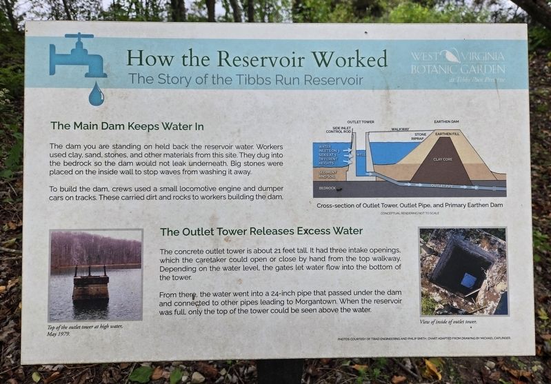
The Main Dam Keeps Water In
The dam you are standing on held back the reservoir water. Workers used clay, sand, stones, and other materials from this site. They dug into the bedrock so the dam would not leak underneath. Big stones were placed on the inside wall to stop waves from washing it away.
To build the dam, crews used a small locomotive engine and dumper cars on tracks. These carried dirt and rocks to workers building the dam.
The Outlet Tower Releases Excess Water
The concrete outlet tower is about 21 feet tall. It had three intake openings, which the caretaker could open or close by hand from the top walkway. Depending on the water level, the gates let water flow into the bottom of the tower.
From there, the water went into a 24-inch pipe that passed under the dam and connected to other pipes leading to Morgantown. When the reservoir was full, only the top of the tower could be seen above the water.
(Captions):
Cross-section of Outlet Tower, Outlet Pipe, and Primary Earthen Dam
Top of the outlet tower at high water, May 1979.
View of inside of outlet tower.
Erected 2026 by West
this page online
Topics. This historical marker is listed in these topic lists: Industry & Commerce • Waterways & Vessels. A significant historical month for this entry is May 1979.
Location. 39° 37.618′ N, 79° 52.125′ W. Marker is near Morgantown, West Virginia, in Monongalia County. It can be reached from Tyrone Road (County Route 75) 0.1 miles south of Quartz Drive, on the left when traveling south. The marker is located on the Reservoir Loop Trail at the West Virginia Botanic Garden. Touch for map. Marker is at or near this postal address: 1061 Tyrone Road, Morgantown WV 26508, United States of America. Touch for directions.

Regionally, this marker is in North Central West Virginia. It is also in the American South, specifically in the Upper South, in Appalachia, and specifically in Northern Appalachia. Globally, it is in North America, the Western Hemisphere, the Western World, and the Anglosphere. Historically, it finds itself in what was once the territory of the Mississippian Culture.
Other nearby markers. At least 8 other markers are within walking distance of this marker: Modernism and Mastery: Lazzell's Paris Influence & the White-Line Woodcut
Photographed by Bradley Owen, September 27, 2026
2. How the Reservoir Worked Marker
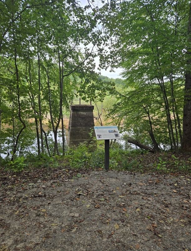
The outlet tower is in the background.
Other markers no longer nearby. Remnants of the Past: The Dam and Outlet Tower (was about 400 feet away, measured in a direct line but has been replaced with another marker now near it); "Clean Mountain Water" Not So Clean (was about 500 feet away but has been replaced with another marker now near it); Who Wants Clean Water? (was approx. 0.2 miles away but has been replaced with another marker now near it).
Related marker. Click here for another marker that is related to this marker. This marker has replaced the linked marker.
Credits. This page was last revised on September 30, 2026. It was originally submitted on September 30, 2026, by Bradley Owen of Morgantown, West Virginia. This page has been viewed 4 times since then. Photos: 1, 2. submitted on September 30, 2026, by Bradley Owen of Morgantown, West Virginia.
