Chattahoochee in Gadsden County, Florida — The American South (South Atlantic)
Confrontation with the United States
Photographed by James L.Whitman, September 26, 2026
1. Confrontation with the United States Marker
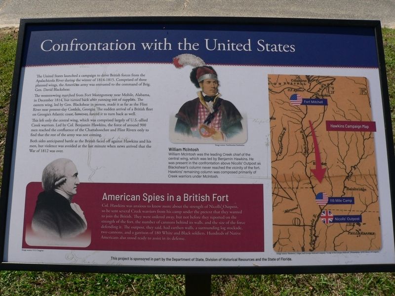
The United States launched a campaign to drive British forces from the Apalachicola River during the winter of 1814-1815. Comprised of three planned wings, the American army was entrusted to the command of Brig. Gen. David Blackshear.
The western wing marched from Fort Montgomery near Mobile, Alabama, in December 1814, but turned back after running out of supplies. The eastern wing, led by Gen. Blackshear in person, made it as far as the Flint River near present-day Cordele, Georgia. The sudden arrival of a British fleet on Georgia's Atlantic coast, however, forced it to turn back as well.
This left only the central wing, which was comprised largely of U.S.-allied Creek warriors. Led by Col. Benjamin Hawkins, the force of around 900 men reached the confluence of the Chattahoochee and Flint Rivers only to find that the rest of the army was not coming.
Both sides anticipated battle as the British faced off against Hawkins and his men, but violence was avoided at the last minute when news arrived that the War of 1812 was over.
American Spies in a British Fort
Col. Hawkins was anxious to know more about the strength
this page online
(captions)
William McIntosh
William McIntosh was the leading Creek chief of the central wing, which was led by Benjamin Hawkins. He was present in the confrontation above Nicolls' Outpost as Blackshear's column never reached the vicinity of the fort. Hawkins' remaining column was composed primarily of Creek warriors under McIntosh. Image source: Smithsonian Institution
Hawkins Campaign Map
This project is sponsored in part by the Department of State, Division of Historical Resources and the State of Florida.
Erected 2026 by Department of State, Division of Historical Resources and the State of Florida.
Topics. This historical marker is listed in these topic lists: Forts and Castles • Indigenous Peoples and Communities • Peace • War of 1812. A significant historical month for this entry is December 1814.
Location. 30° 42.037′ N, 84° 51.388′ W. Marker is in Chattahoochee, Florida, in Gadsden County. It is at the intersection of South River Landing Road and North River Landing Road, on the left when traveling south on South River Landing Road. Touch for map. Marker is at or near this postal address: 500 S River Landing Rd, Chattahoochee FL 32324, United States of America. Touch for directions.

Regionally, this marker is in Greater Tallahassee and on the Florida Panhandle. It is also in the American South and specifically in the Deep South. Globally, it is in the North Atlantic Region, North America, a Gulf of Mexico state, the Western Hemisphere, the Western World, and the Anglosphere. Historically, it finds itself in what was once New Spain, the territory of the Mississippian Culture, one of the Confederate States of America, and the Antebellum South.
Other nearby markers. At least 8 other markers are within walking distance of this marker: The British Evacuation (here, next to this marker); Archaeology of Nicolls' Outpost (here, next to this marker); The Treaty of Nicolls' Outpost (here, next to this marker); The Front Line of Freedom (here, next to this marker); Nicolls' Outpost (within shouting distance of this marker); Chattahoochee Landing Mound Group (within shouting distance of this marker); The Scott Massacre (within shouting distance of this marker); The Scott Battle of 1817 (within shouting distance of this marker). Touch for a list and map of all markers in Chattahoochee.
Credits. This page was last revised on October 15, 2026. It was originally submitted on October 1, 2026, by James L.Whitman of Eufaula, Alabama. This page has been viewed 10 times since then. Photo 1. submitted on October 1, 2026, by James L.Whitman of Eufaula, Alabama. • Bernard Fisher was the editor who published this page.
