Gouda, South Holland, Netherlands — Northwestern Europe
Nieuwe Veerstal en bolwerk de Punt
⎯⎯⎯
New Veerstal and the 'De Punt' Bastion
Photographed by Andrew Ruppenstein, September 2, 2026
1. Nieuwe Veerstal / New Veerstal Marker

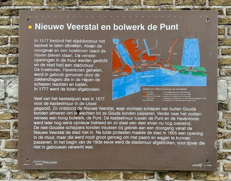
In 1577 besloot het stadsbestuur het kasteel te laten afbreken. Alleen de voorgevel en een hoektoren naast de Haven bleven staan. De venster- openingen in de muur werden gedicht en de stad had een stadsmuur. De hoektoren, Haventoren geheten, werd in gebruik genomen door de zakkendragers die in de Haven de schepen laadden en losten. In 1777 werd de toren afgebroken.
Veel van het kasteelpuin was in 1577 voor de kasteelmuur in de IJssel gegooid. Zo ontstond de Nieuwe Veerstal, waar voortaan schepen van buiten Gouda konden afmeren om te wachten tot ze Gouda konden passeren. Verder naar het oosten verrees een hoog bolwerk, de Punt. De kasteelmuur tussen de Punt en de Haventoren werd later nog eens opnieuw bekleed en zo staat een deel ervan nu nog overeind. De niet-Goudse schippers konden intussen bij gebrek aan een doorgang vanaf de Nieuwe Veerstal de stad niet in. Na luide protesten maakte de stad in 1605 een opening in de muur, maar die werd nooit groot genoeg om met paard en wagen te kunnen passeren. In het begin van de 19de eeuw werd de stadsmuur afgebroken, voor
this page online
New Veerstal and the 'De Punt' Bastion
In 1577, the city authorities decided to have the castle demolished. Only the front façade and a corner tower next to the Harbor remained standing. The window openings in the wall were walled up, effectively creating a city wall. The corner tower—known as the Harbor Tower—was put to use by the sack-bearers who loaded and unloaded ships at the Harbor. The tower was demolished in 1777.
In 1577, much of the castle rubble was dumped into the IJssel River in front of the castle wall. This created the Nieuwe Veerstal (“New Ferry Landing”), where ships from outside Gouda could moor and wait for their turn to pass through the city. Further east, a high bastion known as de Punt (“the Point”) was erected. The section of the castle wall between de Punt and the Haventoren (“Harbour Tower”) was later refaced, and a portion of it remains standing to this day. Meanwhile, because there was no passageway, skippers from outside Gouda could not enter the city from the Nieuwe Veerstal. Following loud protests, the city created an opening in
Photographed by Andrew Ruppenstein, September 2, 2026
2. Nieuwe Veerstal / New Veerstal Marker
Erected by Provincie Zuid Holland, ANWB. (Marker Number 35204/071.)
Topics. This historical marker is listed in these topic lists: Forts and Castles • Waterways & Vessels. A significant historical year for this entry is 1577.
Location. 52° 0.433′ N, 4° 42.842′ E. Marker is in Gouda, Zuid-Holland (South Holland). It is at the intersection of Nieuwe Veerstal and Oosthaven, on the left when traveling east on Nieuwe Veerstal. Touch for map. Marker is in this post office area: Gouda, Zuid-Holland 2801 RD, Netherlands. Touch for directions.

Regionally, it is in Europe, the European Union, Atlantic Europe, the Benelux Low Countries, the Schengen Area, Western Europe, and the Western World. Historically, it finds itself in what was once the Roman Empire and specifically also the Holy Roman Empire.
Other nearby markers. At least 8 other markers are within walking distance of this marker: De Sterke Samsom
Photographed by Andrew Ruppenstein, September 2, 2026
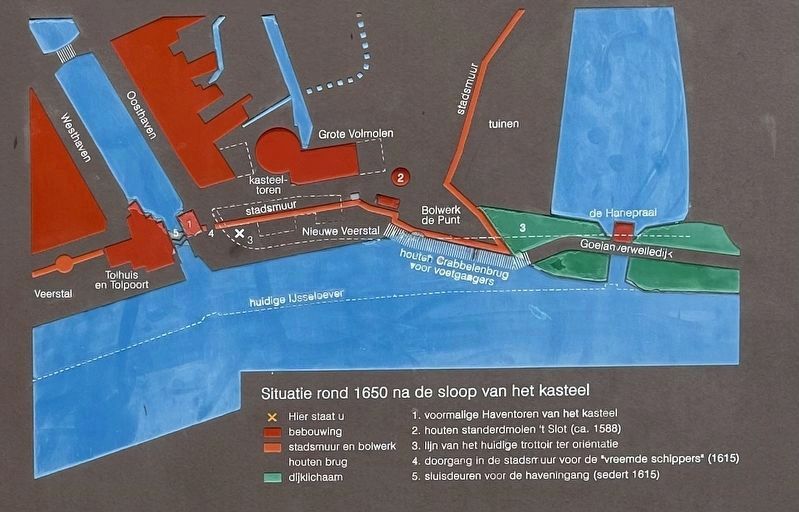
3. Marker inset map, showing the immediate vicinity after ca. 1650
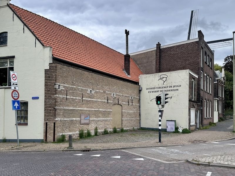
Of note is the you-are-here point (“x”, at the marker location), which shows a portion of the city wall running east from the marker site. And although the marker does not explicitly state it, it would seem that the marker itself is mounted to a remnant portion of the wall that has been incorporated into the building.
Credits. This page was last revised on October 2, 2026. It was originally submitted on October 1, 2026, by Andrew Ruppenstein of Lamorinda, California. This page has been viewed 7 times since then. Photos: 1, 2. submitted on October 1, 2026, by Andrew Ruppenstein of Lamorinda, California. 3. submitted on October 2, 2026, by Andrew Ruppenstein of Lamorinda, California.
