Munising Township near Shingleton in Alger County, Michigan — The American Midwest (Great Lakes)
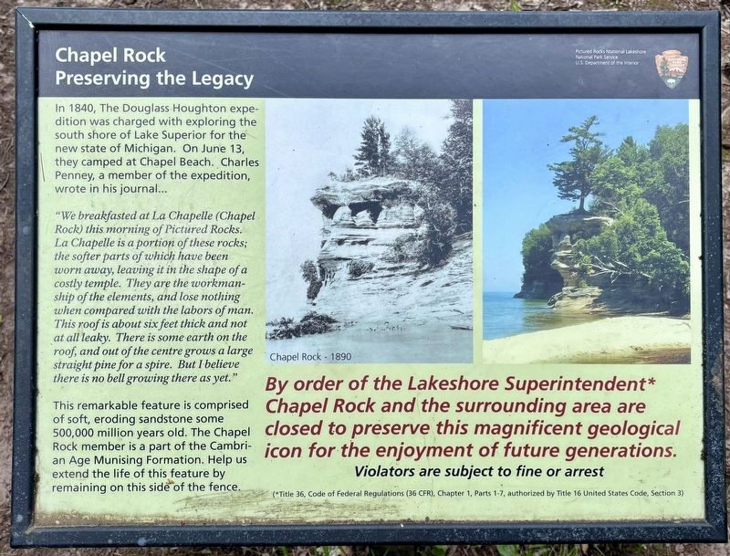
Chapel Rock
Preserving the Legacy
Photographed by Connor Olson, June 28, 2026
1. Chapel Rock Marker
"We breakfasted at La Chapelle (Chapel Rock) this morning of Pictured Rocks. La Chapelle is a portion of these rocks; the softer parts of which have been worn away, leaving it in the shape of a costly temple. They are the workmanship of the elements, and lose nothing when compared with the labors of man. This roof is about six feet thick and not at all leaky. There is some earth on the roof, and out of the centre grows a large straight pine for a spire. But I believe there is no bell growing there as yet."
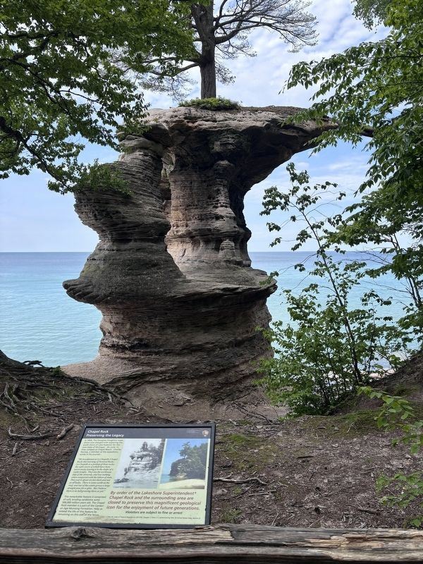
This remarkable feature is comprised of soft, eroding sandstone some 500,000 million years old. The Chapel Rock member is a part of the Cambrian Age Munising Formation. Help us extend the life of this feature by remaining on this side of the fence.
Erected by National Park Service, Department of the Interior.
Topics. This historical marker is listed in this topic
this page online
Location. 46° 32.915′ N, 86° 26.272′ W. Marker is near Shingleton, Michigan, in Alger County. It is in Munising Township. It can be reached from Chapel Road near Melstrand Road. On the Chapel Falls Trail. Touch for map. Marker is in this post office area: Shingleton MI 49884, United States of America. Touch for directions.

Regionally, this marker is on the Upper Peninsula. It is also in the American Midwest and on Lake Superior’s South Shore Region. Globally, it is in North America, in the Great North Woods, on the Great Lakes, in the Western Hemisphere, in the Western World, and in the Anglosphere. Historically, it finds itself in what was once the Northwest Territory.
Other nearby markers. At least 6 other markers are within 13 miles of this marker, measured as the crow flies: Crumbling Into Time (approx. 6½ miles away); Lake Superior Basin Geology (approx. 6.6 miles away); Different Perspectives (approx. 6.6 miles away); Grand Island View (approx. 6.6 miles away); U.S. Coast Guard (approx. 10½ miles away); Munising Falls (approx. 12.4 miles away).
Photographed by Connor Olson, June 28, 2026
2. Chapel Rock Marker
Credits. This page was last revised on October 5, 2026. It was originally submitted on October 1, 2026, by Connor Olson of Menomonee Falls, Wisconsin. This page has been viewed 5 times since then. Photos: 1, 2. submitted on October 1, 2026, by Connor Olson of Menomonee Falls, Wisconsin. • Andrew Ruppenstein was the editor who published this page.
