Kyneton in Macedon Ranges Shire, Victoria, Australia — Oceania
Kyneton Destinations
Photographed by Dean Barton-Ancliffe, August 31, 2026
1. Kyneton Destinations Marker
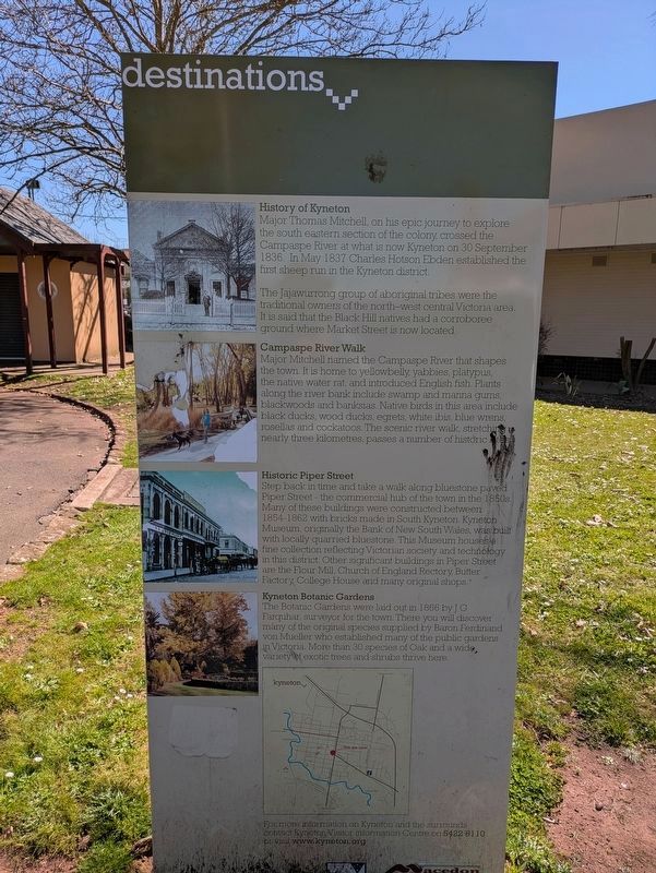
Major Thomas Mitchell, on his epic journey to explore the south eastern section of the colony, crossed the Campaspe River at what is now Kyneton on 30 September 1836. In May 1837 Charles Hotson Ebden established the first sheep run in the Kyneton district.
The Jajawurrong group of aboriginal tribes were the traditional owners of the north-west central Victoria area. It is said that the Black Hill natives had a corroboree ground where Market Street is now located.
Campaspe River Walk
Major Mitchell named the Campaspe River that shapes the town. It is home to yellowbelly, yabbies, platypus, the native water rat, and introduced English fish. Plants along the river bank include swamp and manna gums, blackwoods and banksias. Native birds in this area include black ducks, wood ducks, egrets, white ibis, blue wrens, rosellas and cockatoos. The scenic river walk, stretching nearly three kilometres, passes a number of historic sites.
Historic Piper Street
Step back in time and take a walk along bluestone paved Piper Street - the commercial hub of the town in the 1850s. Many of these buildings were
this page online
Kyneton Botanic Gardens
The Botanic Gardens were laid out in 1866 by J G Farquhar, surveyor for the town. There you will discover many of the original species supplied by Baron Ferdinand von Mueller who established many of the public gardens in Victoria. More than 30 species of Oak and a wide, variety of exotic trees and shrubs thrive here.
Erected by Macedon Ranges Shire.
Topics. This historical marker is listed in these topic lists: Colonial Era • Exploration • Notable Places • Settlements & Settlers. A significant historical year for this entry is 1836.
Location. 37° 14.948′ S, 144° 27.181′ E. Marker is in Kyneton, Victoria, in Macedon Ranges Shire. It is at the intersection of Baynton Street and Mollison Street
Photographed by Dean Barton-Ancliffe, August 31, 2026
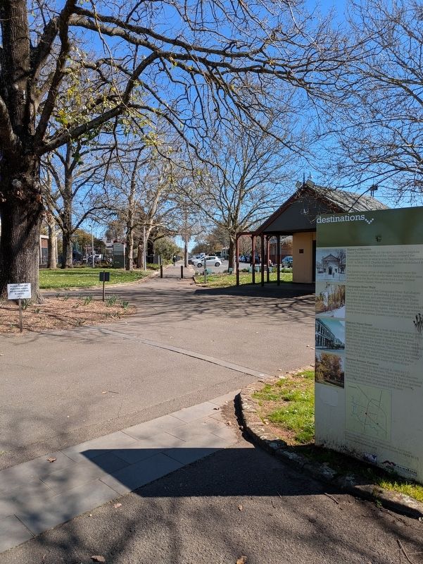
2. Kyneton Destinations Marker in the Town Park

Regionally, it is in Oceania, in Australasia, in the Pacific Ocean, in South Pacific, on the Pacific Rim, in the Western World, and in the Anglosphere. Historically, it finds itself in what was once a British colony.
Other nearby markers. At least 8 other markers are within walking distance of this marker: Kyneton War Memorial (a few steps from this marker); Kyneton Old Scholars War Memorial (about 150 meters away, measured in a direct line); Kyneton Community Mosaic Columns (about 210 meters away); Kyneton Town Hall (about 210 meters away); Kyneton Court House (about 240 meters away); 2009 Bushfires Memorial Mural Kyneton (about 240 meters away); Our Lady of the Rosary (approx. 0.4 kilometers away); Congregational or Independent Church (approx. 0.4 kilometers away). Touch for a list and map of all markers in Kyneton.
Also see . . . Kyneton. Wikipedia
Kyneton (/ˈkaɪntən/ KYNE-tən) is a town in the Macedon Ranges region of central Victoria, Australia. The Calder Freeway bypasses Kyneton to the north and east.(Submitted on October 1, 2026, by Dean Barton-Ancliffe of Rowville, Victoria.)
The town has three main streets: Mollison Street, Piper Street and High Street. Piper Street has the oldest streetscape of these, and still has many of its original buildings. The railway station, about 86 kilometres (53 mi) from Melbourne on the Deniliquin railway line, is a terminus for two weekday peak-hour trains. The town is the council seat of the Shire of Macedon Ranges. At the 2021 census, Kyneton recorded a population of 7,513.
Credits. This page was last revised on October 2, 2026. It was originally submitted on October 1, 2026, by Dean Barton-Ancliffe of Rowville, Victoria. This page has been viewed 10 times since then. Photos: 1, 2. submitted on October 1, 2026, by Dean Barton-Ancliffe of Rowville, Victoria. • Andrew Ruppenstein was the editor who published this page.
