South Elmwood in Providence in Providence County, Rhode Island — The American Northeast (New England)
Joseph Williams Field & Playground
Photographed by Devry Becker Jones (CC0), September 19, 2026
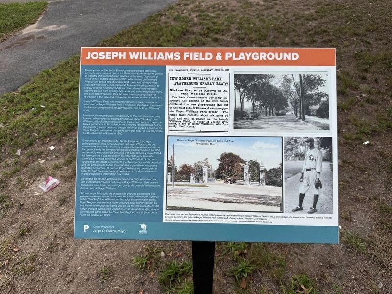
1. Joseph Williams Field & Playground Marker

Development of the South Elmwood neighborhood took place primarily in the second half of the 19th century, following the growth of industry and transportation services in the area. Operation of horse-drawn coaches began in 1855, with service on Elmwood Avenue and Broad Street, and by 1894 the horse railways were replaced with trolley lines. Elmwood Avenue linked downtown to rapidly growing neighborhoods, and the railroad and streetcar allowed people from all neighborhoods and income levels to enjoy the park. Roger Williams Park became the favorite location for recreation in the City, and remains an important public space today.
Joseph Williams Field was originally designed as a recreational extension of Roger Williams Park. The park is located on the site of the former homestead of Joseph Williams, one of Roger Williams' sons.
However, the more popular origin story of the park's name comes from an often-repeated neighborhood tale about "Smokey" Joe Williams, a Black American pitcher in the Negro Leagues, coming to play a game here in Providence. He is widely recognized as one of the game's greatest pitchers,
this page online
La cancha de Joseph Williams fue diseñada originalmente como una extensión recreativa del parque Roger Williams. El parque se encuentra en el lugar de la antigua granja de Joseph Williams, uno de los hijos de Roger Williams.
Sin embargo, la historia
Photographed by Devry Becker Jones (CC0), September 19, 2026
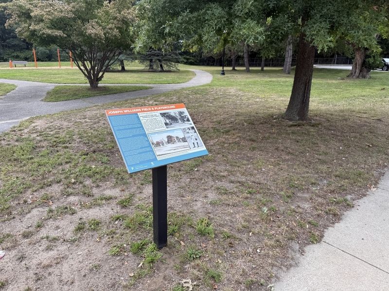
2. Joseph Williams Field & Playground Marker
Clockwise from top left: Providence Journal clipping announcing the opening of Joseph Williams Field in 1922; photograph of a streetcar on Elmwood Avenue in 1935; postcard depicting the gates at Roger Williams Park in 1915; and photograph of "Smokey" Joe Williams.
Erected by City of Providence, Rhode Island.
Topics. This historical marker is listed in these topic lists: African Americans • Parks & Recreational Areas • Settlements & Settlers • Sports. A significant historical year for this entry is 1855.
Location. 41° 47.145′ N, 71° 25.176′ W. Marker is in Providence, Rhode Island, in Providence County. It is in South Elmwood. It is on Elmwood Avenue (U.S. 1) south of Linden Avenue, on the right when traveling south. Touch for map. Marker is at or near this postal address: 3 Alger Ave, Providence RI 02907, United States of America. Touch for directions.

Regionally, this marker is on Narragansett Bay. It is also in the American Northeast, in New England, and on the Eastern Seaboard. Globally, it is in the North Atlantic Region, North America, the Western Hemisphere, the Western World, and the Anglosphere. Historically, it finds itself in what was once one of the original Thirteen Colonies.
Other nearby markers. At least 8 other markers are within walking distance of this marker: Saving Red Wolves (about 600 feet away, measured in a direct line); Purple Loosestrife Project (about 600 feet away); What is an SSP? (about 600 feet away); Karner Blue Butterfly Project (about 600 feet away); American Burying Beetle Project (about 600 feet away); Bactrian Camel (about 700 feet away); Follow your Food (about 700 feet away); Marco Polo's Adventure Trek (about 700 feet away). Touch for a list and map of all markers in Providence.
Credits. This page was last revised on October 1, 2026. It was originally submitted on October 1, 2026, by Devry Becker Jones of Washington, District of Columbia. This page has been viewed 13 times since then. Photos: 1, 2. submitted on October 1, 2026, by Devry Becker Jones of Washington, District of Columbia.
