Near Jasper in Jasper National Park, Alberta — Canada’s Prairie Region (North America)
David Thompson
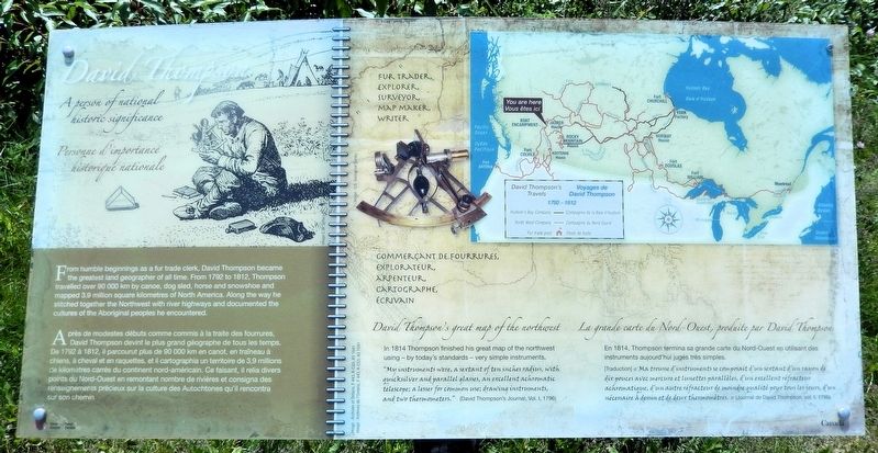
A person of national historic significance
⎯⎯⎯
Personne d'importance historic nationale
Photographed by Cosmos Mariner, July 6, 2022
1. David Thompson Marker

David Thompson’s great map of the northwest
In 1814 Thompson finished his great map of the northwest using — by today's standards — very simple instruments.
“My instruments were, a sextant of ten inches radius, with quicksilver and parallel glasses, an excellent achromatic telescope; a lesser for common use; drawing instruments, and two thermometers.” (David Thompson's Journal, Vol. 1, 1796)
this page online
La grande carte du Nord-Ouest, produite par David Thompson
En 1814, Thompson termina sa grande carte du Nord-Ouest en utilisant des instruments aujourd'hui jugés très simples.
[Traduction] « Ma trousse d’instruments se composait d’un sextant d’un rayon de dix pouces avec mercure et lunettes parallèles, d’un excellent réfracteur achromatique, d’un autre réfracteur de moindre qualité pour tous les jours, d’un nécessaire à dessin et de deux thermomètres. » (Journal de David Thompson. vol. 1, 1796)
Erected by Parks Canada / Parcs Canada.
Topics. This historical marker is listed in these topic lists: Exploration • Indigenous Peoples and Communities. A significant historical year for this entry is 1792.
Location. 52° 43.032′ N, 117° 52.498′ W. Marker is near Jasper, Alberta, in Jasper National Park. It is on Icefields
Archives of Ontario, F 443, R-C(U), A0 1541
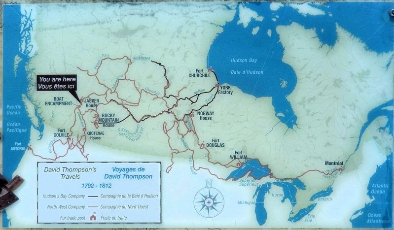
2. Marker detail: David Thompson’s Travels 1792-1812
Voyages de David Thompson
Voyages de David Thompson

Regionally, this marker is in the Canadian Rockies. It is also in the Prairies. Globally, it is in North America, the Rocky Mountains, the Western Hemisphere, the Western World, and the Anglosphere. Historically, it finds itself in what was once a British colony and also Rupert’s Land.
Other nearby markers. At least 8 other markers are within 23 kilometers of this marker, measured as the crow flies: A different marker also named David Thompson (here, next to this marker); Athabasca Pass National Historic Site / Lieu historique national du Col-Athabasca (here, next to this marker); New Trade Route Over the Rockies / Une nouvelle route de commerce à travers les Rocheuses (here, next to this marker); Passengers on the fur trade / Les passagers de la traite des fourrures (a few steps from this marker); Henry House (approx. 22.2 kilometers
Photographed by Cosmos Mariner, July 6, 2022
3. David Thompson Marker
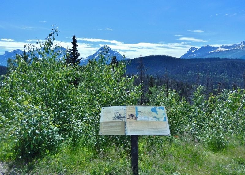
Looking southwest from the Athabasca Pass Lookout wayside.
Also see . . . David Thompson’s Surveying and Mapping of the Northwest of North America (ASCE.org).
Excerpt: David Thompson surveyed and mapped a vast region of the Northwest of North America, stretching from the 45th parallel to the 60th parallel and from the western shores of Hudson Bay and Lake Superior to the Pacific Ocean between 1790 and 1812. Often accompanied by his Métis wife, Charlotte Small, he travelled 50,000 miles by canoe, horseback and on foot, making hundreds of astronomical observations to accurately determine the geographical positions of fur-trading posts and major natural landmarks – while attending to the day-to-day business of fur trading for the Hudson’s Bay and North West Companies.(Submitted on October 4, 2026, by Cosmos Mariner of Cape Canaveral, Florida.)
Thompson’s legacies include his 1814 Great Map, compiled from his surveys and those of Alexander Mackenzie, Simon Fraser, George Vancouver, and his mentor, Philip Turnor, that laid the groundwork for development of the Northwest of North America. J.B. Tyrrell found, transcribed and edited his 702-page, handwritten manuscript describing his travels, publishing it in 1916 as David Thompson’s Narrative of his Travels in Western America 1784-1812. It included extensive original data on the geological, botanical, zoological, anthropological, and meteorological facets of the regions he had visited.
Credits. This page was last revised on October 4, 2026. It was originally submitted on October 2, 2026, by Cosmos Mariner of Cape Canaveral, Florida. This page has been viewed 4 times since then. Photos: 1, 2, 3. submitted on October 4, 2026, by Cosmos Mariner of Cape Canaveral, Florida.
