Kyneton in Macedon Ranges Shire, Victoria, Australia — Oceania
Kyneton Town Hall
| — | Discover Historic Kyneton | — |
Photographed by Dean Barton-Ancliffe, August 31, 2026
1. Kyneton Town Hall Markers
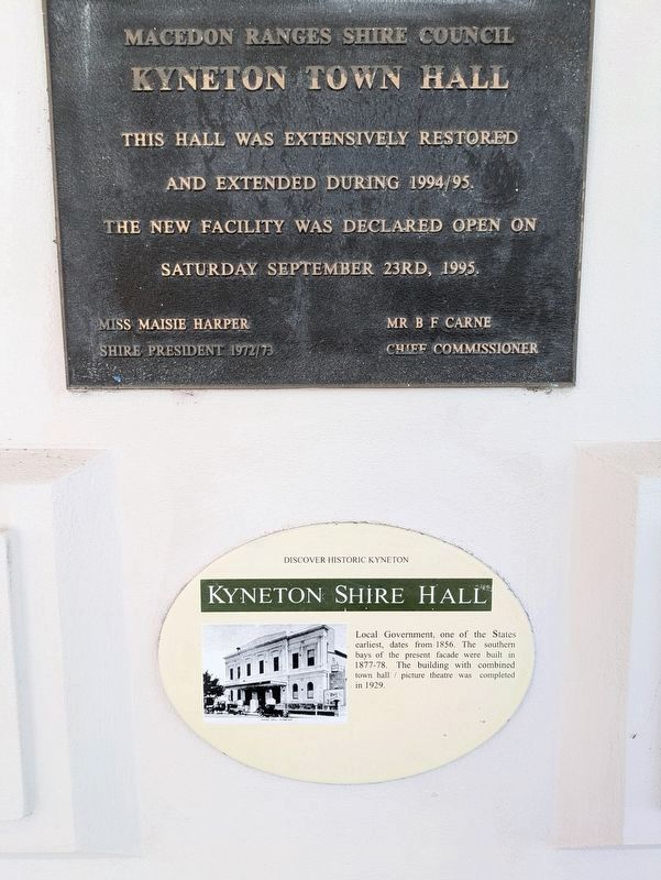
Macedon Ranges Shire Council
Kyneton Town Hall
This Hall was extensively restored
and extended during 1994/95.
The new facility was declared open on
Saturday September 23rd, 1995
Miss Maisie Harper
Shire President 1972/73
Mr B F Carne
Chief Commissioner
(Bottom Plaque) Kyneton Shire Hall
Local Government, one of the States earliest, dates from 1856. The southern bays of the present facade were built in 1877-78. The building with combined town hall / picture theatre was completed in 1929.
Erected by Macedon Ranges Shire Council.
Topics. This historical marker is listed in these topic lists: Architecture • Colonial Era. A significant historical year for this entry is 1856.
Location. 37° 14.831′ S, 144° 27.207′ E. Marker is in Kyneton, Victoria, in Macedon Ranges Shire. It is at the intersection of Mollison Street (Route C793) and Hutton Street, on the left when traveling north on Mollison Street. Touch for map. Marker is at or near this postal address: 129 Mollison Street, Kyneton VIC 3444, Australia. Touch for directions.

Regionally, it is in Oceania, in Australasia, in the Pacific
this page online
Other nearby markers. At least 8 other markers are within walking distance of this marker: Kyneton Community Mosaic Columns (a few steps from this marker); 2009 Bushfires Memorial Mural Kyneton (within shouting distance of this marker); Kyneton Court House (about 120 meters away, measured in a direct line); Kyneton Destinations (about 210 meters away); Kyneton War Memorial (about 210 meters away); Our Lady of the Rosary (approx. 0.2 kilometers away); Kyneton Old Scholars War Memorial (approx. 0.3 kilometers away); WT Jones & Son Stonemason (approx. 0.3 kilometers away). Touch for a list and map of all markers in Kyneton.
Also see . . . Kyneton Town Hall. Goldfields Guide
This beautiful hall is a striking feature along Kyneton's gorgeous streetscape. Kyneton is a beautiful place to explore if you are interested in 19th century architecture and stonework.(Submitted on October 2, 2026, by Dean Barton-Ancliffe of Rowville, Victoria.)
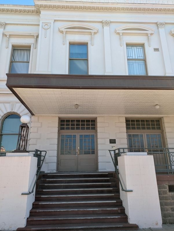
The Town Hall dates from 1856 and the southern bays of the present facade were constructed in 1877 to 78.The building with combined hall and theatre was completed in 1929.Photographed by Dean Barton-Ancliffe, August 31, 20262. Kyneton Town Hall Markers at the front of the Hall
The Town Hall was extensively restored and extended in 1994 and 199
Credits. This page was last revised on October 5, 2026. It was originally submitted on October 2, 2026, by Dean Barton-Ancliffe of Rowville, Victoria. This page has been viewed 11 times since then. Photos: 1, 2. submitted on October 2, 2026, by Dean Barton-Ancliffe of Rowville, Victoria. • Andrew Ruppenstein was the editor who published this page.
