Boston in Lincolnshire, England, United Kingdom — Northwestern Europe (the British Isles)
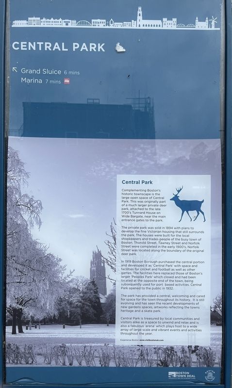
Central Park
Photographed by Ray Gurganus
1. Central Park Marker
The private park was sold in 1894 with plans to develop the fine Victorian housing that still surrounds the park. The houses were built for the local shopkeepers and trades people of the busy town of Boston. Thorold Street, Tawney Street and Norfolk Street were completed in the early 1900's, Norfolk Street was located along the boundary of the original deer park.
In 1919 Boston Borough purchased the central portion and developed it as 'Central Park' with space and facilities for cricket and football as well as other games. The facilities here replaced those of Boston's larger 'Peoples Park' which closed and had been located at the opposite end of the town, being subsequently used for port based activities Central Park opened to the public in 1932.
The park has provided a central, welcoming and cared for space for the town throughout its history. It is still evolving and has seen the recent developments of new gardens spaces, artworks reflecting the towns heritage and a skate park.
Central Park is treasured by local communities and visitors alike as a space to unwind and relax and is also a fabulous arena' which plays host to a wide array of large scale and vibrant events and activities throughout the year.
Erected by Boston Borough Council.
Topics. This historical marker is listed in this topic list: Parks & Recreational Areas.
Location. 52° 58.832′ N, 0° 1.355′ W. Marker is in Boston, England, in Lincolnshire. It can be reached from Park Gate. The marker is located within Central Park, just beyond
this page online

Regionally, this marker is in the Midlands. Globally, it is on the Atlantic Ocean, in the North Atlantic Region, in Europe, in Atlantic Europe, on one of the British Isles, in the Western World, and in the Anglosphere. Historically, it finds itself in what was once the Roman Empire.
Other nearby markers. At least 5 other markers are within walking distance of this marker: Strait Bargate (about 120 meters away, measured in a direct line); Wide Bargate (about 180 meters away); The Reverend John Cotton and Boston's American Legacy (about 210 meters away); The Puritan Vision (approx. 0.3 kilometers away); Boston: A Short Introduction (approx. 0.7 kilometers away).
Photographed by Valentine and Sons, Ltd., circa 1925
2. Views of Boston
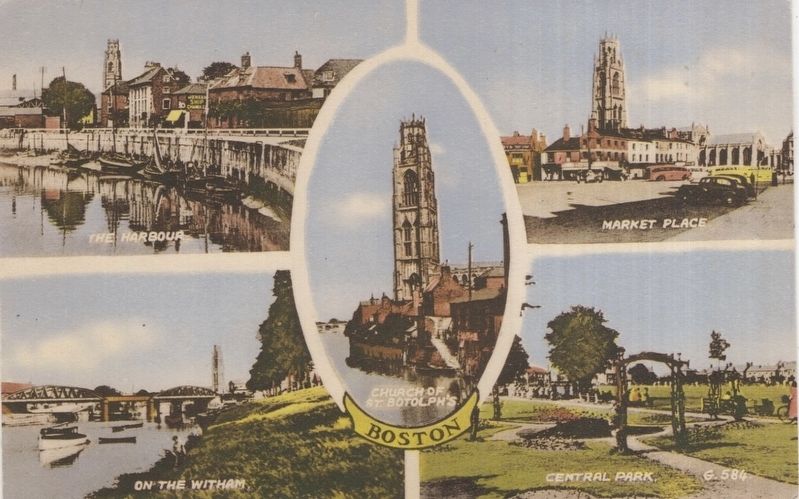
A glimpse of Boston’s Central Park îs seen here in the lower right quadrant óf this postcard.
Credits. This page was last revised on October 5, 2026. It was originally submitted on October 2, 2026, by Ray Gurganus of Washington, District of Columbia. This page has been viewed 3 times since then. Photos: 1. submitted on October 2, 2026, by Ray Gurganus of Washington, District of Columbia. 2. submitted on October 5, 2026. • Andrew Ruppenstein was the editor who published this page.
Editor’s want-list for this marker. photo of the marker within its surroundings • Can you help?
