Delphi in Carroll County, Indiana — The American Midwest (Great Lakes)
Monon High Bridge Trail
Photographed by Craig Doda, September 13, 2026
1. Monon High Bridge Trail Marker
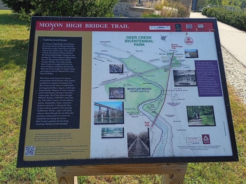
Exploring a Local Treasure
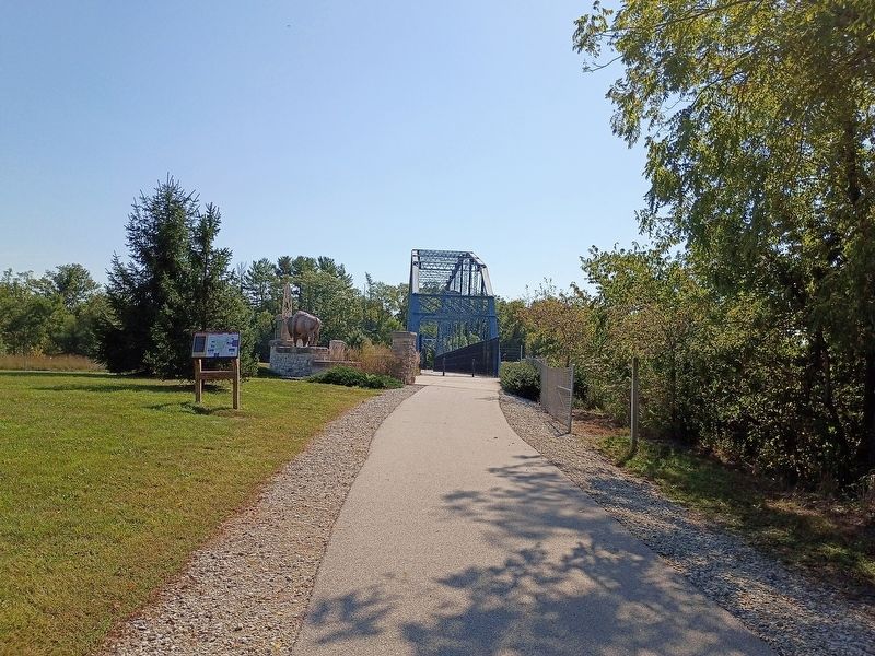
The Monon High Bridge Trail follows the former bed of the Monon Railroad. Referred to as the Louisville to Chicago route or the Airline route. The trail now extends from Samuel Milroy Road to the Monon High Bridge. Along the way passing the 1916 Centennial Monument, the new Bicentennial Plaza and the Freedom Bridge. The trestle crosses Deer Creek at a height of 65 feet, the second highest in Indiana. Deer Creek flows the entire length of Carroll County and empties into the Wabash River just beyond Delphi.
The Creek is the focus of an aquatic environment which harbors many insects in addition to damsel and dragon flies. The waters are the home of smallmouth and largemouth bass, saugers, catfish and many panfish. Mussels of many varieties anchor the bottom and help to keep the waters clear. The Creek flows through Whistler Woods, a NICHES Land Trust site, lush with a variety of trees such as: walnut, tulip poplar, maple, sycamore, hickory and beech. In Spring the floor of the woods is carpeted with stunning wildflowers. Hawks, eagles and turkey vultures wheel through the air while deer, raccoons,
this page online
[Caption:]
Noted sculptor, painter and cartoonist Harry Milroy was born in 1867 on a farm adjacent to the Monon line. He lived his entire life with the exception of 2 years he spent at the Art Students League in New York City. He helped design the 1916 Centennial stone.
Along the tracks just east of Veterans Plaza he created a grouping of sculptures in the dense compressed sand. They became a major attraction and the train would slow for passengers to see this unique series of artworks. He also created many other works some of which can be seen in the historical museum.
Erected by Tippecanoe Arts Federation; North Central Health Services, Inc.
Topics. This historical marker is listed in these topic lists: Arts, Letters, Music • Bridges & Viaducts • Parks & Recreational Areas • Railroads & Streetcars. A significant historical year for this entry is 1916.
Location. 40° 35.661′ N, 86° 39.339′ W. Marker is in Delphi, Indiana, in Carroll County. It is at the intersection of Old Camden
Photographed by Craig Doda, September 13, 2026
2. Monon High Bridge Trail Marker

Regionally, this marker is in Northern Indiana. It is also in the American Midwest and in the Corn Belt. Globally, it is in North America, the Western Hemisphere, the Western World, and the Anglosphere. Historically, it finds itself in what was once the territory of the Mississippian Culture and also the Northwest Territory.
Other nearby markers. At least 8 other markers are within walking distance of this marker: Welcome to Delphi (within shouting distance of this marker); Wabash & Erie Canal (within shouting distance of this marker); Retaining the Past & Forging the Future (about 400 feet away, measured in a direct line); Entombed Aboard the USS Arizona (about 500 feet away); a different marker also named Wabash & Erie Canal (about 500 feet away); Site of Cabin Home Gen. Samuel Milroy (about 600 feet away); Deer Creek Valley Rural Historic District (approx. half a mile away); Foreman-Case House (approx. one mile away). Touch for a list and map of all markers in Delphi.
Another marker is no longer nearby. Samuel Milroy (was about 600 feet away but has been confirmed missing).
Credits. This page was last revised on October 8, 2026. It was originally submitted on October 2, 2026, by Craig Doda of Napoleon, Ohio. This page has been viewed 11 times since then. Photos: 1, 2. submitted on October 2, 2026, by Craig Doda of Napoleon, Ohio. • Devry Becker Jones was the editor who published this page.
