Norwich in Norfolk, England, United Kingdom — Northwestern Europe (the British Isles)
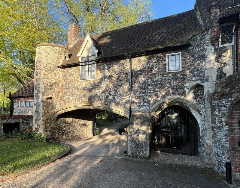
Pull's Ferry House
Photographed by Ray Gurganus, April 22, 2026
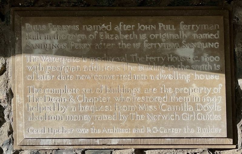
1. Pull's Ferry House Marker
The Watergate is medieval. The Ferry House c. 1600 with Georgian additions. The building to the south is of later date now converted into a dwelling house.
The complete set of buildings are the property of The Dean & Chapter, who restored them in 1947 helped by a bequest from Miss Camilla Doyle also from money raised by The Norwich Girl Guides.
Cecil Upcher was the Architect and RG-Carter the Builder.
Topics. This historical marker is listed in this topic list: Waterways & Vessels. A significant historical year for this entry is 1600.
Location. 52° 37.826′ N, 1° 18.42′ E. Marker is in Norwich, England, in Norfolk. It is on Ferry Lane. Touch for map. Marker is at or near this postal address: 29 Ferry Ln, Norwich, England NR1 1SR, United Kingdom. Touch for directions.

Regionally, this marker is in East Anglia. Globally, it is on the Atlantic Ocean, in the North Atlantic Region, in Europe, in Atlantic Europe, on one of the British Isles, in the Western World,
this page online
Other nearby markers. At least 8 other markers are within walking distance of this marker: Pull's Ferry (a few steps from this marker); Edith Cavell (approx. 0.6 kilometers away); Augustine Steward House (approx. 0.6 kilometers away); Elm Hill (approx. 0.7 kilometers away); Wrights Court (approx. 0.7 kilometers away); St Peter Hungate (approx. 0.7 kilometers away); United Reformed Church (approx. 0.7 kilometers away); Paston House (approx. 0.7 kilometers away). Touch for a list and map of all markers in Norwich.
Also see . . . Pulls Ferry, Norwich (Wikipedia). Excerpt:
Pulls Ferry is a former ferry house located on the River Wensum in Norwich, Norfolk, England. It is a flint building and was once a 15th-century watergate. It was the route for the stone used to build Norwich Cathedral. The stone came from Caen up the rivers Yare and Wensum. A canal, specifically built by the monks, used to run under the arch, where the Normans ferried the stone and building materials to be unloaded on the spot.(Submitted on October 5, 2026.)
The building is named after JohnPull, who ran the ferry across the Wensum from 1796 to 1841. It was previously known as Sandling's, after a seventeenth-century predecessor. The ferry operated until 1943.Photographed by Ray Gurganus, April 22, 20262. Pull's Ferry House
Additional keywords. plaque
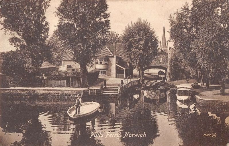
Photographed by John Valentine and Sons, Co., circa 1910
3. Pulls Ferry, Norwich
Credits. This page was last revised on October 5, 2026. It was originally submitted on October 2, 2026, by Ray Gurganus of Washington, District of Columbia. This page has been viewed 4 times since then. Photos: 1, 2. submitted on October 2, 2026, by Ray Gurganus of Washington, District of Columbia. 3. submitted on October 5, 2026. • Andrew Ruppenstein was the editor who published this page.
