Keystone in Pennington County, South Dakota — The American Midwest (Upper Plains)
Medical Office of Eugene B. Hultz, M.D.
Photographed by William Fischer, Jr., September 17, 2026
1. Medical Office of Eugene B. Hultz, M.D. Marker
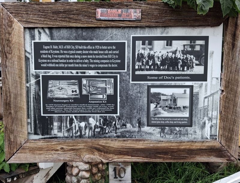
Eugene B. Hultz, M.D. of Hill City, SD built this office in 1928 to better serve the residents of Keystone. He was a typical country doctor who made house calls and carried a black bag. It was reported that once during a snow storm he traveled from Hill City to Keystone on a railroad handcar in order to deliver a baby. The mining companies in Keystone would withhold one dollar per month from the miner's wages to compensate the doctor.
[Photo captions, clockwise from top right, read]
• Some of Doc's patients.
• The office also has served as a wood and rock shop, stained glass shop, coffee shop, and living quarters.
• [Neurosurgery Kit (and) Amputation Kit (photos)]
In 1870 doctors began to sterilize medical instruments. After 1890 the handles of medical instruments were no longer made of ivory, wood, and other porous materials because they could not withstand the heat of sterilization. Thus the trend began to use all metal instruments. Shown are some medical instruments from that era.
Erected 2005 by Keystone Area Historical Society. (Marker Number 10.)
Topics. This historical marker is listed in these
this page online
Location. 43° 53.774′ N, 103° 25.133′ W. Marker is in Keystone, South Dakota, in Pennington County. It is at the intersection of 1st Street (State Highway 40) and Mitchell Street, on the right when traveling south on 1st Street. Touch for map. Marker is at or near this postal address: 417 1st Street, Keystone SD 57751, United States of America. Touch for directions.

Regionally, this marker is in West River, in the Badlands, and in Greater Rapid City. It is also in the American Black Hills, in the Lewis & Clark Corridor, on the prairies, and on the Northern Plains. Globally, it is in North America, the Western Hemisphere, the Western World, and the Anglosphere. Historically, it finds itself in what was once Rupert’s Land and also the Louisiana Purchase.
Other nearby markers. At least 8 other markers are within walking distance of this marker: Keystone Battle Creek Cultural Center (a few steps from this marker); Keystone Trading Company/Halley's Store (a few steps from this marker); US Forest Service Icehouse (within
Photographed by William Fischer, Jr., September 17, 2026
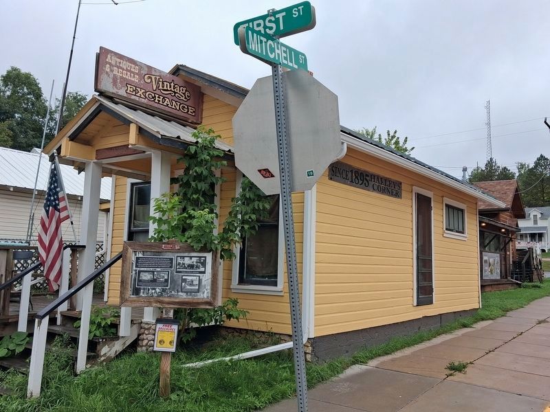
2. Medical Office of Eugene B. Hultz, M.D. and Marker
Also see . . . Historic Keystone Walking Tour. (Submitted on October 2, 2026, by William Fischer, Jr. of Reynoldsburg, Ohio.)
Credits. This page was last revised on October 2, 2026. It was originally submitted on October 2, 2026, by William Fischer, Jr. of Reynoldsburg, Ohio. This page has been viewed 6 times since then. Photos: 1, 2. submitted on October 2, 2026, by William Fischer, Jr. of Reynoldsburg, Ohio.
