Paola in Miami County, Kansas — The American Midwest (Upper Plains)
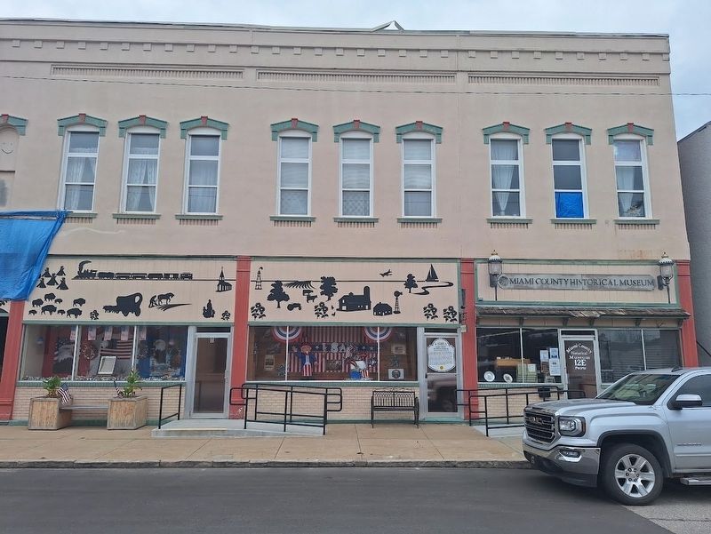
Miami County Historical Museum
Jefferson Highway Historic Site
Photographed by Jason Voigt, September 21, 2026
1. Miami County Historical Museum Marker
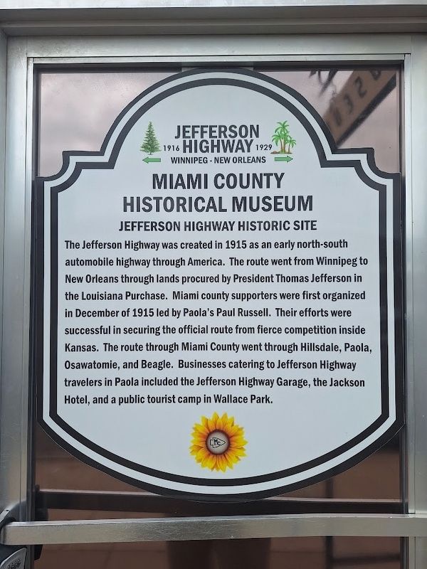
The Jefferson Highway was created in 1915 as an early north-south automobile highway through America. The route went from Winnipeg to New Orleans through lands procured by President Thomas Jefferson in the Louisiana Purchase. Miami County supporters were first organized in December of 1915 led by Paola's Paul Russell. Their efforts were successful in securing the official route from fierce competition inside Kansas. The route through Miami County went through Hillsdale, Paola, Osawatomie, and Beagle. Businesses catering to Jefferson Highway travelers in Paola included the Jefferson Highway Garage, the Jackson Hotel, and a public tourist camp in Wallace Park.
Erected by Jefferson Highway Association.
Topics and series. This historical marker is listed in these topic lists: Industry & Commerce • Roads & Vehicles. In addition, it is included in the Jefferson Highway series list. A significant historical month for this entry is December 1915.
Location. 38° 34.362′ N, 94° 52.634′ W. Marker is in Paola, Kansas, in Miami County. It is on East Peoria Street east of Pearl Street, on the right when traveling west. Touch for map.
this page online

Regionally, this marker is in Eastern Kansas, specifically in Bleeding Kansas Border War Country, and in Greater Kansas City. It is also in the American Midwest, in the Corn Belt, on the prairies, on the Southern Plains, and on the Santa Fe Trail Corridor. Globally, it is in North America, the Western Hemisphere, the Western World, and the Anglosphere. Historically, it finds itself in what was once the Louisiana Purchase.
Other nearby markers. At least 8 other markers are within walking distance of this marker: City Hall Fire Bell (within shouting distance of this marker); The Potawatomi Indians Trail of Death (about 300 feet away, measured in a direct line); History of the Park Square (about 400 feet away); Paola Veterans' Memorial (about 400 feet away); Baptiste & Mary Ann Peoria (about 400 feet away); Miami County History (about 800 feet away); Miami County Veterans Memorial (approx. ¾ mile away); Paola Pathways (approx. 0.8 miles away). Touch for a list and map of all markers in Paola.
Also see . . . Miami County Kansas Historical Museum (official website).
Photographed by Jason Voigt, September 21, 2026
2. Miami County Historical Museum Marker
Credits. This page was last revised on October 2, 2026. It was originally submitted on October 2, 2026, by Jason Voigt of Glen Carbon, Illinois. This page has been viewed 6 times since then. Photos: 1, 2. submitted on October 2, 2026, by Jason Voigt of Glen Carbon, Illinois.
