Near Massive in Banff National Park, Alberta — Canada’s Prairie Region (North America)
Past Visitors
⎯⎯⎯
Visiteurs du passé
Photographed by Cosmos Mariner, July 4, 2022
1. Past Visitors / Visiteurs du passé Marker

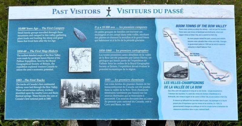
10,000 Years Ago ... The First Campers
Small family groups travelled through these mountains and camped in this valley, gathering plant foods and hunting the sheep and giant bison that lived here after the Ice Age.
1858-60 ... The First Map-Makers
The earliest detailed maps of the Bow Valley were made by geologist James Hector of the Palliser Expedition. Sent by the Royal Geographical Society of Britain, the expedition explored western Canada to assess the area's economic potential.
1883 ... The First Tracks
The tracks of Canada's first continental railway were laid through the Bow Valley. Three adventurous railway workers stumbled upon the nearby Cave and Basin thermal springs. These became the core of Canada's first national park in 1885.
Boom Towns of the Bow Valley
Towns soon sprang up along the railway — and not just for tourists. There were coal mines at Bankhead and Anthracite, silver and copper mines at Silver City, and a sawmill at Holt City.
As more people visited the park, scenery and wildlife became more valuable than mines and mills. Changes in government policy in 1930 put an end to resource extraction
this page online
Il y a 10 000 ans ... les premiers campeurs
De petits groupes de familles ont traversé ces montagnes et ont campé dans cette vallée, récoltant des plantes et chassant le mouflon et le grand bison qui habitaient ici à la fin de la période glaciaire.
1858-1860 ... les premiers cartographes
Les toutes premières cartes détaillées de la vallée de la Bow ont été préparées par James Hector, un géologue qui faisait partie de l'expédition de Palliser. Sous les ordres de la Royal Geographic Society of Britain, l'expédition devait évaluer le potentiel économique de la région.
1883 ... les premiers cheminots
Les voies ferrées du premier chemin de fer transcontinental du Canada ont été posées dans la vallée de la Bow. Trois cheminots téméraires tombèrent par hasard sur les sources thermales qui se trouvaient à proximité. Ces sources devaient être au cœur du premier parc national du Canada, créé à Cave and Basin, en 1885.
Les villes-champignons de la Vallée de la Bow
Des villes sont vite apparues le long de la voie ferrée — et pas seulement à l'intention des touristes. Il y avait des mines de charbon à Bankhead et à Anthracite,
Photographed by Cosmos Mariner, July 4, 2022
2. Past Visitors / Visiteurs du passé Marker
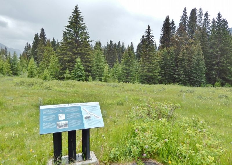
Looking south from Bow Valley Parkway.
À mesure qu'affluaient les touristes dans le parc, les paysages et la faune prirent plus d'importance que les mines et les scieries. En 1930, le gouvernement changea sa politique et mit fin à toute forme d'extraction de ressources premières dans le parc national Banff.
Erected by Parks Canada / Parcs Canada.
Topics. This historical marker is listed in these topic lists: Anthropology & Archaeology • Exploration • Railroads & Streetcars • Settlements & Settlers.
Location. 51° 13.388′ N, 115° 47.008′ W. Marker is near Massive, Alberta, in Banff National Park. It is on Bow Valley Parkway (Provincial Highway 1A) 11.3 kilometers east of Banff-Windermere Highway (Provincial Highway 93), on the right when traveling east. The marker is beside a pull-out on the south side of Bow Valley Parkway. Touch for map. Marker is in this post office area: Massive AB T0L 1E0, Canada. Touch for directions.

Regionally, this marker is in the Canadian Rockies. It is also in the Prairies. Globally, it is in North America, the Rocky Mountains, the Western Hemisphere, the Western World, and the Anglosphere. Historically, it finds itself in what was once a British colony and also Rupert’s Land.
Other nearby markers. At least 8 other markers are within 16 kilometers of this marker, measured as the crow flies: Era of the Automobile / L'ère de l'automobile (here, next to this marker); Sawback (approx. 1.3 kilometers away); The Bigger Picture / La situation dans son ensemble (approx. 1.3 kilometers away); Pilot Pond / Étang Pilot (approx. 2.2 kilometers away); Prescribed Burn / Brûlage dirigé (approx. 4.7 kilometers away); Flames of Life / Flammes de la vie (approx. 4.7 kilometers away); Storm Mountain (approx. 13 kilometers away); The Cave and Basin (approx. 14.8 kilometers away). Touch for a list and map of all markers in Massive.
Also see . . . Palliser Expedition (Wikipedia).
Excerpt: The Palliser expedition, officially the British North American Exploring Expedition, explored and surveyed the open prairies and rugged wilderness of western Canada from 1857 to 1860. The expedition was led by Irish-born explorer John Palliser and accompanied by a party of four other men: James Hector, Eugène Bourgeau, Thomas Blakiston and John W. Sullivan. With the support of the British government and the Royal Geographical Society it became an official expedition with the stated purpose of gathering scientific information about the landscapes of British-claimed north-western North America (today's western Canada), in particular the territory of Rupert's Land, including information on the geography, climate, soil, flora and fauna, in order to discover its capabilities for settlement and transportation. As well, local guides and interpreters traveled with the party and assisted with its work.(Submitted on October 5, 2026, by Cosmos Mariner of Cape Canaveral, Florida.)
The expedition was the first detailed and scientific survey of the region between Lake Superior and the southern passes of the Rocky Mountains in British North America. The expedition provided a better understanding of the remote western frontier, and the new observations and knowledge were significant for the expansion into and development of the western prairies by European settlers. The expedition's reports impacted changes in the economy, settlement, transportation, Indigenous communities and the campaign for expansionism in Canada.
Credits. This page was last revised on October 7, 2026. It was originally submitted on October 3, 2026, by Cosmos Mariner of Cape Canaveral, Florida. This page has been viewed 10 times since then. Photos: 1, 2. submitted on October 5, 2026, by Cosmos Mariner of Cape Canaveral, Florida.
