St Katharine's & Wapping in Tower Hamlets in Greater London, England, United Kingdom — Northwestern Europe (the British Isles)
Controlling the River
Discover the Fortress Story
Photographed by Ian Lefkowitz, September 11, 2026
1. Controlling the River Marker

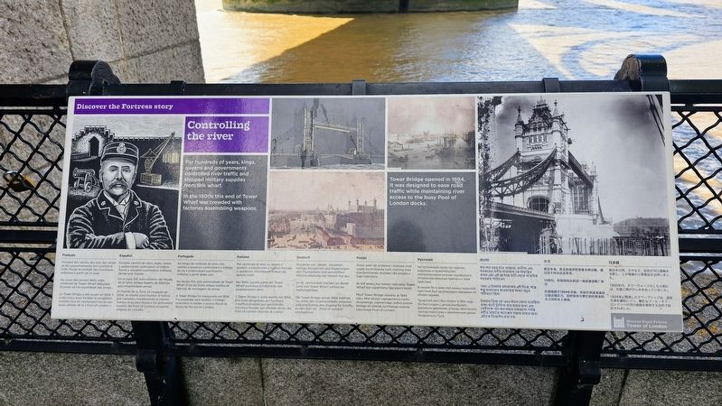
For hundreds of years, kings, queens and governments controlled river traffic and shipped military supplies from this wharf.
In the 1800s this end of Tower Wharf was crowded with factories assembling weapons.
Tower Bridge opened in 1894. It was designed to ease road traffic while maintaining river access to the busy Pool of London docks.
Pendant des siècles, des rois, des reines et des gouvernements ont contrôlé le trafic fluvial et expédié des fournitures militaires à partir de ce quai.
Au cours des années 1800, cette extrémité de Tower Wharf débordait d’usines ou l’on assemblait des armes.
Le Tower Bridge a été ouvert en 1894. Il a été conçu pour faciliter la circulation routière tout en maintenant l’accès aux bateaux de la « Pool of London », le quartier original de Londres.
Durante cientos de años, reyes, reinas y gobernantes controlaron el tráfico fluvial y enviaron suministros militares desde este muelle.
En el siglo XIX, este extremo del Muelle de la Torre estaba repleto de fábricas que ensamblaban armas.
El Puente de la Torre se inauguró en 1894. Se diseñó para facilitar el tráfico
this page online
Ao longo de centenas de anos, reis, rainhas e governos controlaram o tráfego do rio e embarcaram suprimentos militares a partir deste cais.
No século XIX, este extremo de Tower Wharf (Cais da Torre) estava repleto de fábricas de montagem de armas.
A Tower Bridge foi inaugurada em 1894. Foi projetada para facilitar o tráfego rodoviário e manter o acesso fluvial às docas da Piscina de Londres.
Per centinaia di anni, re, regine e governi controllavano il traffico fluviale e spedirono rifornimenti militari da questo molo.
Nel 1800, questa parte del Tower Wharf pullulava di fabbriche che assemblavano armi.
Il Tower Bridge è stato aperto nel 1894. Era stato progettato per facilitare il traffico stradale pur garantendo l’accesso fluviale agli affollati docks del Pool of London (bacino di Londra).
Hunderte von Jahren steuerten Könige, Königinnen und Regierungen den Flussverkehr und verschifften Militärausrüstung von diesem Kai aus.
Im 19. Jahrhundert standen an dieser Seite von Tower
Photographed by Ian Lefkowitz, September 11, 2026
2. Controlling the River Marker
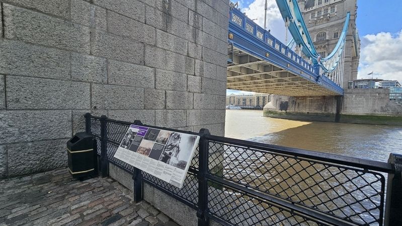
The marker is located directly beneath the Tower Bridge entrance.
Die Tower Bridge wurde 1894 eröffnet. Sie sollte den Straßenverkehr entlasten und gleichzeitig den Zugang für Schiffe zu den Kais im “Pool of London” ermöglichen.
Przez setki lat, królowie i królowe oraz rządy kontrolowały ruch rzeczny oraz transportowały dostawy dla wojska z tego nabrzeża.
W XIX wieku ten koniec nabrzeża Tower Wharf był zapełniony fabrykami broni.
Most Tower Bridge otwarto w 1894 roku. Miał służyć usprawnieniu ruchu drogowego, zapewniając jednocześnie dostęp do doków ruchliwego basenu rzecznego Pool of London.
На протяжении сотен лет короли, королевы и правительство контролировали речные
Photographed by Ian Lefkowitz, September 11, 2026
3. The Tower Bridge
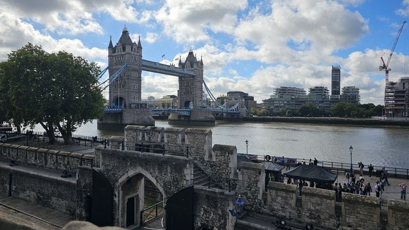
This icon of London spans the River Thames and is located next to the Tower of London.
В начале 19-го века этот конец тауэрской пристани был загромождён заводами по сборке оружия.
Тауэрский мост был открыт в 1894 году. Он был создан
Photographed by John Valentine and Sons, Co., circa 1910
4. Tower Bridge, London
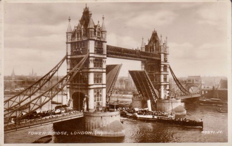
This is a view from the south side of the Thames, with a tiny bit of the Tower of London visible through the raised part óf the bridge.
শত-শত বছর ধরে, রাজারা, রানীরা এবং সরকারা নদীর যাতায়াত কে নিয়ন্ত্রিত করত এবং এ জাহাজ ঘাটা থেকে সামরিক সরবরাহ পাঠাতো।
1800-এ টাওয়ার ওয়ার্ফের এই দিকে, অস্ত্র-শস্ত্র বানানোর কারখানার সংখ্যা প্রচুর পরিমাণে ছিলো।
টাওয়ার ব্রিজ কে 1894 সালে খোলা হয়েছিলো রাস্তা-ঘাটে ট্রাফিক কম করার জন্য এবং সেইসঙ্গে পুল অব লন্ডন ডকগুলো পর্যন্ত নদীর মাধ্যমে অ্যাক্সেস বজায় রাখার জন্য এটাকে ডিজাইন করা হয়।
数百年来,君主和政府控制着水路运输,通过这个码头运送军资。
19世纪,伦敦塔码头的这一端武器装配厂林立。
伦敦塔桥于1894年开放。其设计用途是减轻公路运输压力,同时保持与繁忙的伦敦池码头之间的水上通道。
数百年の間、王や女王、政府が河川運輸を支配し、この埠頭から軍需品を出荷しました。
1800年代、タワーウォーフのこちら側には、兵器工場がひしめき合っていました。
1894年に開通したタワーブリッジは、道路交通を緩和しつつ、繁忙なプール・オブ・ロンドンへの河川経路を維持する目的で設計されました。
Erected by Historic Royal Palaces.
Topics. This historical marker is listed in these topic lists: Bridges & Viaducts • Waterways & Vessels. A significant historical year for this entry is 1894.
Location. 51° 30.404′ N, 0° 4.486′ W. Marker is in Tower Hamlets, England, in Greater London. It is in St Katharine's & Wapping. It can be reached from the intersection of Saint Katharine's Way and Tower Hill, on the left when traveling north. Touch for map. Marker is in this post office area: Tower Hamlets, England E1W 1UR, United Kingdom. Touch for directions.

Regionally, this marker is in London and in the Greater South East. Globally, it is on the Atlantic Ocean, in the North Atlantic Region, in Europe, in Atlantic Europe, on one of the British Isles, in the Western World, and in the Anglosphere. Historically, it finds itself in what was once the Roman Empire.
Other nearby markers. At least 8 other markers are within walking distance of this marker: An Ancient Right (here, next to this marker); Tower Bridge (here, next to this marker); Corporation of London Tower Bridge (a few steps from this marker); City of London Tower Bridge (a few steps from this marker); a different marker also named City of London Tower Bridge (a few steps from this marker); Cast iron 12-pounder Gun (a few steps from this marker); Memorial Stone (a few steps from this marker); The Poet and the Wharf (within shouting distance of this marker). Touch for a list and map of all markers in Tower Hamlets.
Also see . . . Tower Bridge. (Submitted on October 3, 2026, by Ian Lefkowitz of New York, New York.)
Credits. This page was last revised on October 3, 2026. It was originally submitted on October 3, 2026, by Ian Lefkowitz of New York, New York. This page has been viewed 5 times since then. Photos: 1, 2, 3. submitted on October 3, 2026, by Ian Lefkowitz of New York, New York. 4. submitted on October 3, 2026. • Andrew Ruppenstein was the editor who published this page.
