North Scituate in Providence County, Rhode Island — The American Northeast (New England)
Scituate, Rhode Island
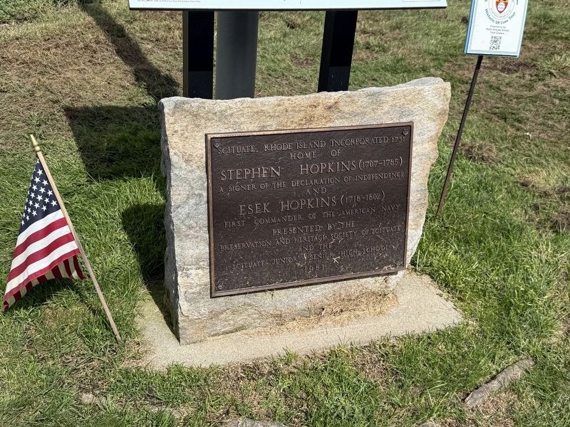
Home of
Stephen Hopkins (1707-1785)
a signer of the Decalration of Independence
and
Esek Hopkins (1718-1802)
First Commander of the American Navy
Erected 1981 by Preservation and Heritage Society of Scituate and the Scituate Junior-Senior High School.
Topics. This historical marker is listed in these topic lists: Colonial Era • Settlements & Settlers • War, US Revolutionary. A significant historical year for this entry is 1731.
Location. 41° 49.973′ N, 71° 35.478′ W. Marker is in Scituate, Rhode Island, in Providence County. It is in North Scituate. It is on Danielson Pike west of Silk Lane, on the right when traveling west. Touch for map. Marker is at or near this postal address: 195 Danielson Pike, North Scituate RI 02857, United States of America. Touch for directions.

Regionally, this marker is in the Quiet Corner and in Greater Providence. It is also in the American Northeast, in New England, and on the Eastern Seaboard. Globally, it is in the North Atlantic Region, North America, the Western Hemisphere, the Western World, and the Anglosphere.
this page online
Other nearby markers. At least 8 other markers are within walking distance of this marker: Stephen Hopkins • 1707-1785 (here, next to this marker); Owen Soldiers' Monument (approx. ¼ mile away); Old Congregational Church (approx. ¼ mile away); Scituate Honor Roll (approx. ¼ mile away); Korea Memorial (approx. ¼ mile away); Revolutionary War Memorial (approx. ¼ mile away); a different marker also named Scituate Honor Roll (approx. ¼ mile away); The Richmond Mill Bell (approx. ¼ mile away). Touch for a list and map of all markers in Scituate.
Credits. This page was last revised on October 3, 2026. It was originally submitted on October 3, 2026, by Devry Becker Jones of Washington, District of Columbia. This page has been viewed 6 times since then. Photos: 1, 2. submitted on October 3, 2026, by Devry Becker Jones of Washington, District of Columbia.
