Greenville in Smithfield in Providence County, Rhode Island — The American Northeast (New England)
Crossroads of Greenville
Town of Smithfield Rhode Island
| — | est. 1730-1731 | — |
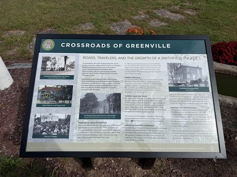
For generations, the roads crossing Greenville carried farmers, merchants, stagecoaches, livestock, and travelers between Providence and the rural communities of western Rhode Island and Connecticut. What began as Native trails and colonial roads gradually grew into one of northern Rhode Island's most active crossroads villages.
Long before modern highways, Greenville's location along important transportation routes helped shape the community's growth. Taverns, mills, churches, businesses, and public gathering places developed here to serve both local residents and the steady flow of travelers through the region.
From Native Trails to Turnpikes
Many of Smithfield's earliest roads followed long-established. Native American trails. By the early 1700s, routes through the region linked Providence with western Rhode Island and Connecticut. In 1733, the Great Country Road — later known as the Providence-Woodstock Pike — became one of the area's most important east-west travel routes.
In 1788, the road was improved as one of Smithfield's first toll roads and later
this page online
Naming Greenville
In 1797, the growing village was named for Revolutionary War General Nathanael Greene, Rhode Island's most celebrated military leader. Greene's success during the Southern Campaign of the American Revolution made him a hero throughout the young United States, and communities across the country adopted his name in recognition of his service.
Taverns, Trade, and Travel
Throughout the the 1700s and early 1800s, taverns flourished along Smithfield's busy roads. These taverns served as gathering places for local residents and resting places for weary travelers moving goods and livestock through the region. Road construction itself relied upon local labor, with able-bodied Smithfield men assigned days each year to improve and maintain public highways.
The opening of the Glocester Turnpike in 1804 further strengthened Greenville's role as a transportation center, imrpoving travel west toward Chepachet and
Greenville's Historic Landmarks
As traffic and commerce increased, Greenville developed into a thriving village center. In 1822, the Smithfield Exchange Bank opened along Putnam Pike, reflecting the growing importance of trade and business in the community. The historic brick bank building still stands today at 598 Putnam Pike.
Nearby, the Episcopal Church opened in 1851 at 1 Smith Avenue and became an important religious and civic landmark for the growing village. Together, these buildings reflect Greenville's transformation from a rural crossroads into a busy nineteenth-century community.
Railroads and Modern Roads
Transportation continued to shape Greenville and Smithfield into the twentieth century. In 1873, the Providence and Springfield Railroad connected nearby mill villages and improved the movement of people and goods across the region. By 1933, the construction of the George Washington Highway reflected the gowing importance of the automobile and modern road travel in northern Rhode Island.
Today, Greenville remains connected to this long history of movement and community — a village shaped by the roads, travelers, and local landmarks that helped define Smithfield for generations.
Erected 2026 by Town of Smithfield, Rhode Island, supported in part by a grant from the Rhode Island Semiquincentennial Commission (RI250).
Topics and series. This historical marker is listed in these topic lists: Industry & Commerce • Railroads & Streetcars • Religion & Religious Structures • Roads & Vehicles. In addition, it is included in the America 250 series list. A significant historical year for this entry is 1733.
Location. 41° 52.295′ N, 71° 33.2′ W. Marker is in Smithfield, Rhode Island, in Providence County. It is in Greenville. It is on Putnam Pike (U.S. 44) near Church Street, on the right when traveling east. Touch for map. Marker is at or near this postal address: 607 Putnam Pike, Greenville RI 02828, United States of America. Touch for directions.

Regionally, this marker is in the Blackstone Valley and in Greater Providence. It is also in the American Northeast, in New England, and on the Eastern Seaboard. Globally, it is in the North Atlantic Region, North America, the Western Hemisphere, the Western World, and the Anglosphere. Historically, it finds itself in what was once one of the original Thirteen Colonies.
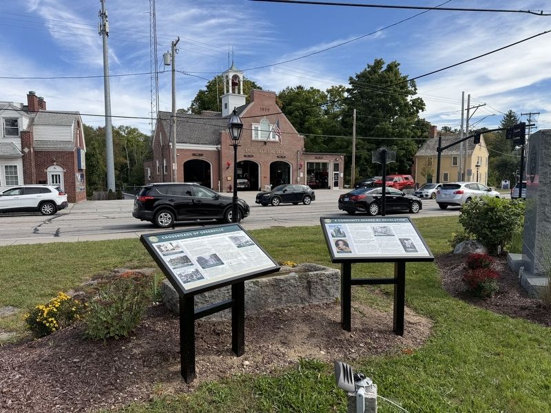
Other nearby markers. At least 8 other markers are within 3 miles of this marker, measured as the crow flies: A Community Shaped by Revolution (here, next to this marker); World War Memorial (here, next to this marker); Aircraft Accident Memorial (approx. 1.9 miles away); Scituate Schools (approx. 3.1 miles away); The Bell Garden (approx. 3.1 miles away); The Richmond Mill Bell (approx. 3.1 miles away); Vietnam Veterans Memorial (approx. 3.1 miles away); Scituate Honor Roll (approx. 3.1 miles away). Touch for a list and map of all markers in Smithfield.
Credits. This page was last revised on October 9, 2026. It was originally submitted on October 3, 2026, by Devry Becker Jones of Washington, District of Columbia. This page has been viewed 3 times since then. Photos: 1, 2. submitted on October 3, 2026, by Devry Becker Jones of Washington, District of Columbia.
