Keystone in Pennington County, South Dakota — The American Midwest (Upper Plains)
Charles Upham and the Upham Saloon
Photographed by William Fischer, Jr., September 21, 2026
1. Charles Upham and the Upham Saloon Marker
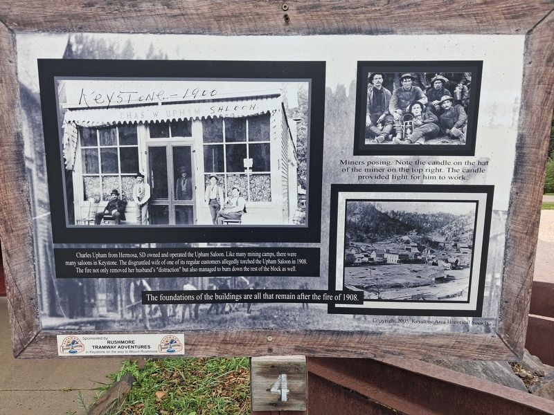
Charles Upham from Hermosa, SD owned and operated the Upham Saloon. Like many mining camps, there were many saloons in Keystone. The disgruntled wife of one of its regular customers allegedly torched the Upham Saloon in 1908. The fire not only removed her husband's "distraction" but also managed to burn down the rest of the block as well.
The foundations of the buildings are all that remain after the fire of 1908.
[Photo captions, clockwise from top left, read]
• Chas. W Upham Saloon, Keystone - 1900
• Miners posing. Note the candle on the hat of the miner on the top right. The candle provided light for him to work.
• [Period bird's eye view of Keystone SD]
Erected 2005 by Keystone Area Historical Society. (Marker Number 4.)
Topics. This historical marker is listed in these topic lists: Disasters • Industry & Commerce • Settlements & Settlers • Women. A significant historical year for this entry is 1908.
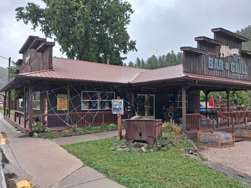
Location. 43° 53.693′ N, 103° 25.099′ W. Marker is in Keystone, South Dakota, in Pennington County. It is at the intersection of 1st Street (State Highway 40) and Blair Street, on the right when
this page online

Regionally, this marker is in West River, in the Badlands, and in Greater Rapid City. It is also in the American Black Hills, in the Lewis & Clark Corridor, on the prairies, and on the Northern Plains. Globally, it is in North America, the Western Hemisphere, the Western World, and the Anglosphere. Historically, it finds itself in what was once Rupert’s Land and also the Louisiana Purchase.
Other nearby markers. At least 8 other markers are within walking distance of this marker: Big Thunder Gold Mine (within shouting distance of this marker); Hayes-Hopkins Supply Company (within shouting distance of this marker); William and Jennie Franklin (about 300 feet away, measured in a direct line); Henry Loomis House (about 300 feet away); Site of the McDonald Hotel (about 300 feet away); Tom Hoy and the Hoy Drug Store (about 300 feet away); First Congregational Church (about 300 feet away); Bill Durst (about 400 feet away). Touch for a list and map of
Photographed by William Fischer, Jr., September 21, 2026
2. Charles Upham and the Upham Saloon Marker
Also see . . . Historic Keystone Walking Tour. (Submitted on October 3, 2026, by William Fischer, Jr. of Reynoldsburg, Ohio.)
Credits. This page was last revised on October 3, 2026. It was originally submitted on October 3, 2026, by William Fischer, Jr. of Reynoldsburg, Ohio. This page has been viewed 5 times since then. Photos: 1, 2. submitted on October 3, 2026, by William Fischer, Jr. of Reynoldsburg, Ohio.
