Richmond in Washington County, Rhode Island — The American Northeast (New England)
Early Town of Richmond
| — | Richmond Heritage Trail | — |
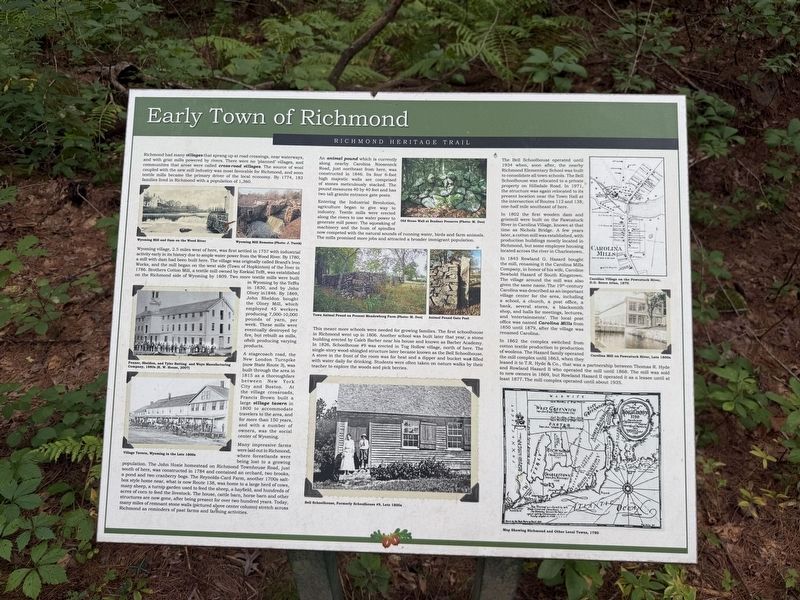
Richmond had many villages that sprang up at road crossings, near waterways, and with grist mills powered by rivers. There were no 'planned' villages, and communities that arose were called cross-road villages. The source of wool coupled with the new mill industry was most favorable for Richmond, and soon textile mills became the primary driver of the local economy. By 1774, 183 families lived in Richmond with a population of 1,360.
Wyoming village, 2.5 miles west of here, was first settled in 1757 with industrial activity early in its history due to ample water power from the Wood River. By 1780, a mill with dam had been built here. The village was originally called Brand’s Iron Works, and the mill began on the west side (Town of Hopkinton) of the river in 1786. Brothers Cotton Mill, a textile mill owned by Ezekial Tefft, was established on the Richmond side of Wyoming by 1809. Two more textile mills were built in Wyoming by the Teffts in 1830, and by John Olney in 1846. By 1869, John Sheldon bought the Olney Mill, which employed 45 workers producing 7,000-10,000 pounds of yarn, per week. These mills were eventually
this page online
A stagecoach road, the New London Turnpike (now State Route 3), was built through the area in 1815 as a thoroughfare between New York City and Boston. At the village crossroads, Francis Brown built a large village tavern in 1800 to accommodate travelers to the area, and for more than 150 years, and with a number of owners, was the social center of Wyoming.
Many impressive farms were laid out in Richmond, where forestlands were being lost to a growing population. The John Hoxie homestead on Richmond Townhouse Road, just south of here, was constructed in 1784 and contained an orchard, two brooks, a pond and two cranberry bogs. The Reynolds-Card Farm, another 1700s salt-box style home near, what is now Route 138, was home to a large herd of cows, many sheep, a turnip garden used to feed the sheep, a hayfield, and hundreds of acres of corn to feed the livestock. The house, cattle barn, horse barn and other structures are now gone, after being present for over two hundred years. Today, many miles of remnant stone walls stretch across Richmond as reminders of
An animal pound which is currently along nearby Carolina Nooseneck Road, just northeast from here, was constructed in 1846. Its four 6-foot high majestic walls are comprised of stones meticulously stacked. The pound measures 40 by 40 feet and has two tall granite entrance gate posts.
Entering the Industrial Revolution, agriculture began to give way to industry. Textile mills were erected along the rivers to use water power to generate mill power. The squeaking of machinery and the hum of spindles now competed with the natural sounds of running water, birds and farm animals. The mills promised more jobs and attracted a broader immigrant population.
This meant more schools were needed for growing families. The first schoolhouse in Richmond went up in 1806. Another school was built later that year, a stone building erected by Caleb Barber near his house and known as Barber Academy. In 1826, Schoolhouse #9 was erected in Tug Hollow village, north of here. The single-story wood-shingled structure later became known as the Bell Schoolhouse. A stove in the front of the room was for heat and a dipper and bucket was filled with water daily for drinking. Students were often taken on nature walks by their teacher to explore the woods and pick berries.
The Bell Schoolhouse operated until 1934 when, soon after, the nearby Richmond Elementary School was built to consolidate all town schools. The Bell Schoolhouse was relocated to a private property on Hillsdale Road. In 1971, the structure was again relocated to its present location near the Town Hall at the intersection of Routes 112 and 138, one-half mile southeast of here.
In 1802 the first wooden dam and gristmill were built on the Pawcatuck River in Carolina Village, known at that time as Nichols Bridge. A few years later, a cotton mill was established, with production buildings mostly located in Richmond, but some employee housing located across the river in Charlestown.
In 1843 Rowland G. Hazard bought the mill, renaming it the Carolina Mills Company, in honor of his wife, Caroline Newbold Hazard of South Kingstown. The village around the mill was also given the same name. The 19th-century Carolina was described as an important village center for the area, including a school, a church, a post office, a bank, several stores, a blacksmith shop, and halls for meetings, lectures, and 'entertainments'. The local post office was named Carolina Mills from 1850 until 1879, after the village was renamed Carolina.
In 1862 the complex switched from cotton textile production to production of woolens. The Hazard family operated the mill complex until 1863, when they leased it to T.R. Hyde & Co., that was a partnership between Thomas R. Hyde and Rowland Hazard II who operated the mill until 1868. The mill was sold to new owners in 1869, but Rowland Hazard II operated it as a lessee until at least 1877. The mill complex operated until about 1935.
Erected by Town of Richmond, Rhode Island.
Topics. This historical marker is listed in these topic lists: Colonial Era • Education • Industry & Commerce • Settlements & Settlers. A significant historical year for this entry is 1774.
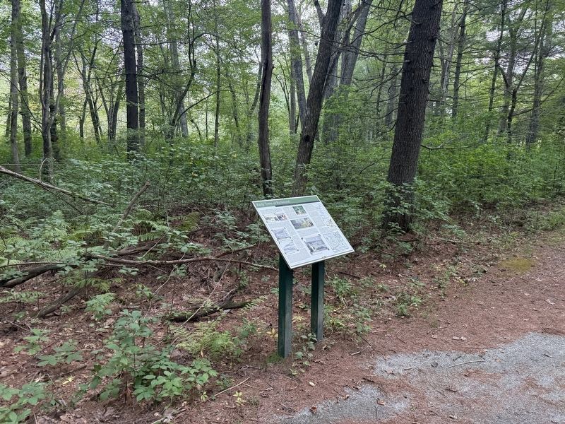
Location. 41° 30.33′ N, 71° 39.971′ W. Marker is in Richmond, Rhode Island, in Washington County. It is on Richmond Heritage Trail north of Country Acres Road, on the right when traveling south. Touch for map. Marker is at or near this postal address: 5 Country Acrs Rd, Wyoming RI 02898, United States of America. Touch for directions.

Regionally, this marker is on Narragansett Bay and in South County. It is also in the American Northeast, in New England, and on the Eastern Seaboard. Globally, it is in the North Atlantic Region, North America, the Western Hemisphere, the Western World, and the Anglosphere. Historically, it finds itself in what was once one of the original Thirteen Colonies.
Other nearby markers. At least 8 other markers are within 3 miles of this marker, measured as the crow flies: Early European Settlement (within shouting distance of this marker); A Maturing Town (about 300 feet away, measured in a direct line); Post-Glaciation and Native Peoples (about 400 feet away); Recent Times and the Future of Richmond (about 600 feet away); Richmond: A Town with Vision of Its Heritage and History (approx. 0.2 miles away); World War I, World War II and the Korean Campaign Memorial (approx. half a mile away); Vietnam and Desert Storm Memorial (approx. half a mile away); Depot Square Park (approx. 2.6 miles away). Touch for a list and map of all markers in Richmond.
Credits. This page was last revised on October 3, 2026. It was originally submitted on October 3, 2026, by Devry Becker Jones of Washington, District of Columbia. This page has been viewed 3 times since then. Photos: 1, 2. submitted on October 3, 2026, by Devry Becker Jones of Washington, District of Columbia.
