Warner in Merrimack County, New Hampshire — The American Northeast (New England)
Warner
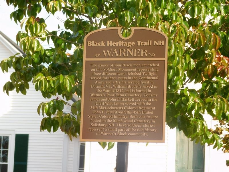
| — | Black Heritage Trail NH | — |
Photographed by Jimmy Emerson, October 2, 2026
1. Warner Marker
Erected 2021 by Black Heritage Trail NH.
Topics. This historical marker is listed in these topic lists: African Americans • War of 1812 • War, US Civil • War, US Revolutionary.
Location. 43° 16.883′ N, 71° 48.983′ W. Marker is in Warner, New Hampshire, in Merrimack County. It is at the intersection of Church Street and Kearsarge Mountain Road, on the left when traveling north on Church Street. Touch for map. Marker is at
this page online

Regionally, this marker is in the American Northeast and in New England. Globally, it is in North America, the Western Hemisphere, the Western World, and the Anglosphere. Historically, it finds itself in what was once one of the original Thirteen Colonies.
Other nearby markers. At least 8 other markers are within 9 miles of this marker, measured as the crow flies: Mount Kearsarge and the U.S.S. Kearsarge (a few steps from this marker); Lafayette's Tour (within shouting distance of this marker); Waterloo Historical District (approx. 2 miles away); John Sargent Pillsbury (approx. 6½ miles away); Contoocook Railroad Bridge and Depot (approx. 6½ miles away); New England College Covered Bridge (approx. 7.2 miles away); Woodwell's Garrison 1744 (approx. 7.2 miles away); Hotels and Camps (approx. 8½ miles away). Touch for a list and map of all markers in Warner.
Photographed by Jimmy Emerson, October 2, 2026
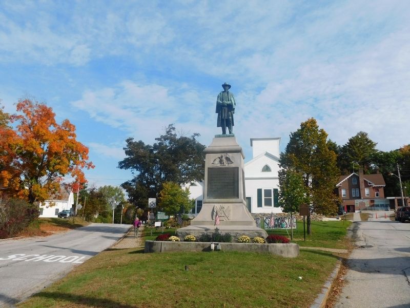
2. Warner Soldiers Monument and Black Heritage Marker
Credits. This page was last revised on October 6, 2026. It was originally submitted on October 4, 2026, by Jimmy Emerson of Dalton, Georgia. This page has been viewed 6 times since then. Photos: 1, 2. submitted on October 4, 2026, by Jimmy Emerson of Dalton, Georgia. • Bernard Fisher was the editor who published this page.
