Vermilion Pass in East Kootenay, British Columbia — Canada’s West Coast (North America)
Drawing the line: 1913
⎯⎯⎯
1913: La frontière est tracée
Photographed by Cosmos Mariner, July 2, 2022
1. Drawing the line: 1913 / 1913: La frontière est tracée Marker

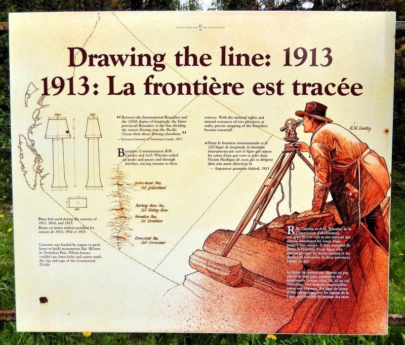
“Between the International Boundary and the 120th degree of longitude, the Inter-provincial Boundary is the line dividing the waters flowing into the Pacific Ocean from those flowing elsewhere.”
— Surveyor General of Dominion Lands, 1913
Boundary Commissioners R.W. Cautley and A.O. Wheeler toiled up peaks and passes and through marshes, tracing streams to their sources. With the mineral rights and natural resources of two provinces at stake, precise mapping of the boundary became essential!
Concrete was hauled by wagon or packhorse to build monuments like 1B here in Vermilion Pass. Where horses couldn’t go, brass bolts and cairns mark the zigs and zags of the Continental Divide.
[image captions]
• Brass bolt used during the seasons of 1913, 1914 and 1915.
• Yellowhead Pass, Kicking Horse Pass, Vermilion Pass, Crowsnest Pass
• R. W. Cautley
« Entre la frontière internationale et le 120e degré de longitude, la frontière inter-provinciale suit la ligne qui sépare les cours d'eau qui vont se jeter dans l'océan Pacifique de ceux qui se dirigent dans une autre direction. »
— Arpenteur géomètre fédéral, 1913
this page online
R.W. Cautley et A.O. Wheeler, de la Commission d’abornement, ont gravi pics et cols et ont traversé des marais, remontant les cours d’eau jusqu’à leur source. Il était essentiel de tracer la frontière d’une façon très précise puisque les droits miniers et les ressources naturelles de deux provinces étaient en jeu!
Le béton fut amené par chariot ou par cheval de trait pour construire des monuments comme celui 1B, ici au col Vermilion. Aux endroits inaccessibles même aux chevaux, des tiges de laiton de des cairns marquent les zigzags de la Ligne continentale de partage des eaux.
[légendes d'images]
• Borne en laiton utilisée pendant les saisons de 1913, 1914 et 1915.
• Col Yellowhead, Col Kicking Horse, Col Vermilion, Col Crowsnest
• R. W. Cautley
Topics. This historical marker is listed in these topic lists: Natural Features • Political Subdivisions. A significant historical year for this entry is 1913.
Location. 51° 13.676′ N, 116° 2.999′ W. Marker is in Vermilion Pass, British Columbia, in East Kootenay. It is on Banff-Windermere Highway (Provincial Highway 93), on the right when traveling north. The marker is in the wayside on the
Photographed by Cosmos Mariner, July 2, 2022
2. Drawing the line: 1913 / 1913: La frontière est tracée Marker
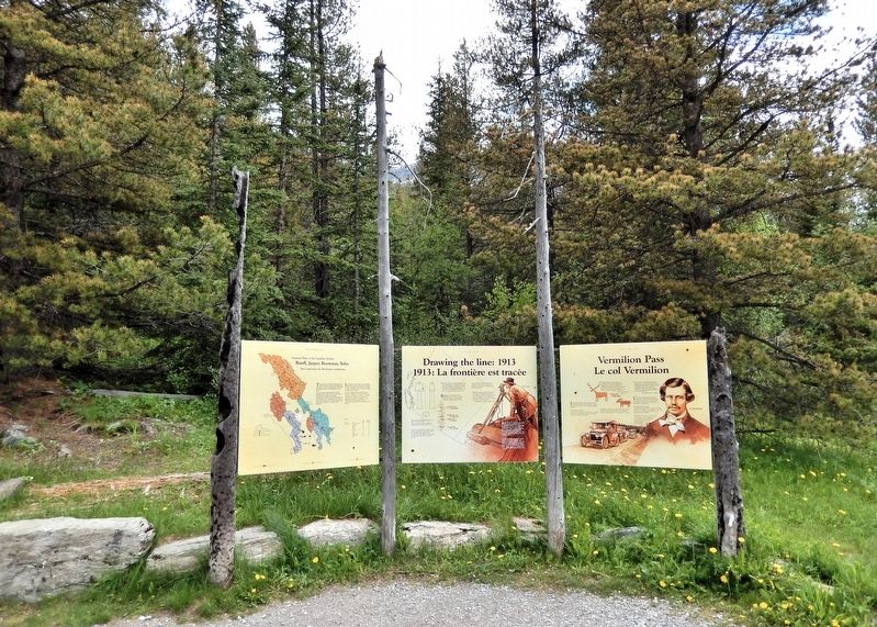
Looking east from the Vermilion Pass wayside. This marker is the center one of three interpretive panels at this location.

Regionally, this marker is in the BC Interior and in the Kootenay Rockies. Globally, it is in North America, in the Rocky Mountains, on the Ring of Fire, on the Pacific Rim, in the Western Hemisphere, in the Western World, and in the Anglosphere. Historically, it finds itself in what was once a British colony.
Other nearby markers. At least 8 other markers are within 24 kilometers of this marker, measured as the crow flies: Banff, Jasper, Kootenay, Yoho (here, next to this marker); Vermilion Pass / Le col Vermilion (here, next to this marker); Castle Camp (approx. 9.1 kilometers away in Alberta); Castle Mountain Internment Camp (approx. 9.1 kilometers away in Alberta); Internment Camp / Camp d'internement (approx. 9.1 kilometers away in Alberta); Storm Mountain (approx. 9.5 kilometers away in Alberta); Lake Louise-Welcome (approx. 23.8 kilometers away in Alberta); Canadian Rocky Mountain Parks (approx. 24 kilometers away in Alberta). Touch for a list and map
Photographed by Cosmos Mariner, July 2, 2022
3. British Columbia — Alberta Boundary
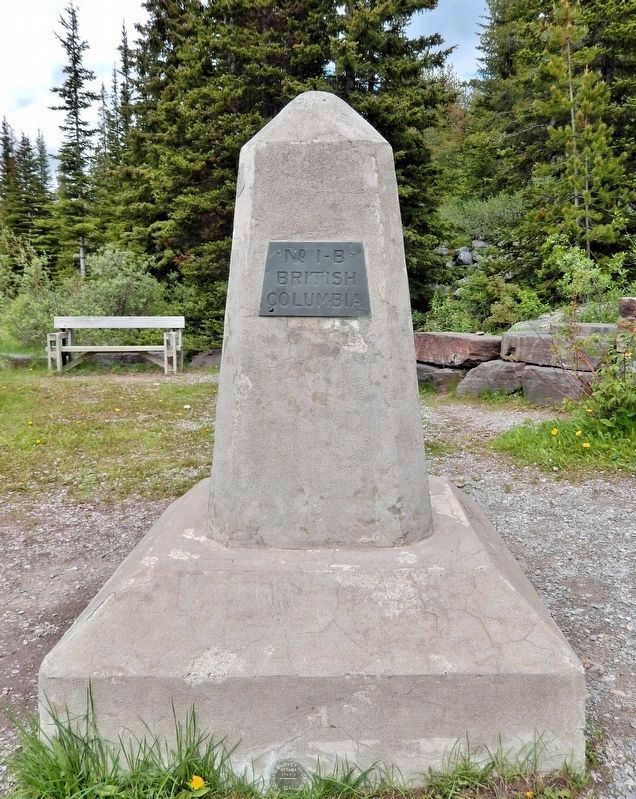
Cairn No. 1-B
Cairn No. 1-B
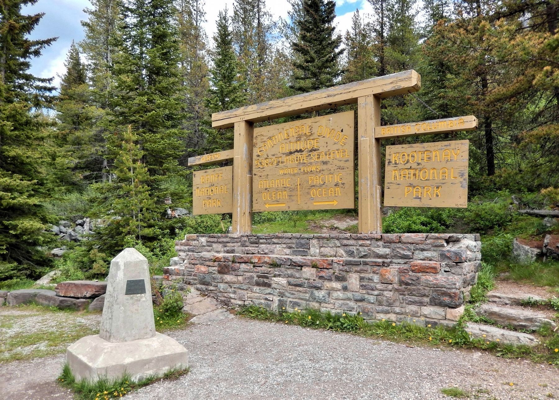
It is a few steps north of this historical marker on the Continental Divide and provincial boundary.
Other markers no longer nearby. Canadian Pacific Railway Stone Monument (was approx. 23.6 kilometers away in Alberta but has been confirmed missing); Defining the Boundary of the Great Divide (was approx. 23.6 kilometers away in Alberta but has been confirmed missing).
Also see . . . Alberta-British Columbia Boundary Survey 1913-1924 (Alberta Geomatics Historical Society).
(Posted on May 14, 2024 by Gordon Olsson) Excerpt: It was only natural as the west developed that the Rocky Mountains would become a boundary for administrative and political areas. When Alberta and British Columbia were set aside as provinces, it followed that the Rocky Mountains would form part of the common boundary. In the early 1900’s, with the discovery of valuable deposits of coal and timber and the construction of roads and railways in the mountains, the need to know the exact location of the boundary became more important. As a result, in 1913, the governments of British Columbia, Alberta and Canada established the Alberta-British Columbia Boundary Commission to survey and map the boundary.(Submitted on October 8, 2026, by Cosmos Mariner of Cape Canaveral, Florida.)Three Boundary Commissioners were appointed: Arthur O. Wheeler, DLS, OLS, MLS, ALS, BCLS representing the government of British Columbia; Richard W. Cautley, DLS, BCLS, ALS representing the government of Alberta; and John N. Wallace, DLS, OLS, ALS representing the government of Canada.Photographed by Cosmos Mariner, July 2, 20224. Continental Divide/Provincial Boundary Sign and Cairn No. 1-B at Vermilion Pass
By mutual consent of the three governments, it was arranged that the work of the boundary Commissioners be carried out under the instruction of Dr. Edouard Deville. Dr. Deville, who was Surveyor General of Dominion Lands from 1885 to 1924, introduced the method of photo-topographical surveying that was applied by the Boundary Commission surveyors in mapping the watershed. Dr. Deville’s instructions described the boundary to be mapped and surveyed as the line dividing the waters flowing into the Pacific Ocean from those flowing elsewhere.
The mapping of the watershed, where it was well defined, was the responsibility of the British Columbia Commissioner, Arthur O. Wheeler. The work was tailor made for Wheeler. He had over thirty years’ experience as a land surveyor and was one of a handful of surveyors proficient in the photo-topographical method of surveying introduced by Deville.
The Alberta boundary commissioner, Richard W. Cautley, was responsible for surveying the boundary in the passes. Cautley was an experienced surveyor, having obtained his first commission in 1896. Although Cautley was responsible for the surveys in the passes, the location of the monument positions was decided collectively by the Commission.
The diaries and reports of the Survey contained numerous accounts of adventure, hardship and danger. Occasionally, there were encounters with grizzly bears. Days were long: six hours of climbing to the camera station, three or four hours observing, and about three hours descending was a normal day’s work. Pack horses often lost their footings in rivers or on steep mountain slopes, resulting in injury or loss of equipment.
Credits. This page was last revised on October 9, 2026. It was originally submitted on October 5, 2026, by Cosmos Mariner of Cape Canaveral, Florida. This page has been viewed 6 times since then. Photos: 1, 2, 3, 4. submitted on October 8, 2026, by Cosmos Mariner of Cape Canaveral, Florida.
